Part I
Part I
Part I

Create successful ePaper yourself
Turn your PDF publications into a flip-book with our unique Google optimized e-Paper software.
Draft Black Sea Regional Transmission Project ESIA<br />
Table 4.2-7 Distances of the proposed line from national monuments and the direction of<br />
nearest approach<br />
Table 5.1-1 Land use sensitivity to change<br />
Table 5.1-2 Land uses affected by the transmission line route<br />
Table 5.1.3 Land affected in protected areas<br />
Table 5.1-4 Summary of Significance of Potential Impacts to Land Use<br />
Table 5.1-5 Air Quality Sensitivity to Change<br />
Table 5.1-6 Summary of Significance of Potential Impacts to Land Use<br />
Table 5.1-7 Mitigation of potential air quality impacts<br />
Table 5.1-8 Impacted Soil Types and the Areal Extent of Impact<br />
Table 5.1-9 Significance of Potential Impacts on Soils<br />
Table 5.1-10 Examples of General Sensitivity of the Water Environment<br />
Table 5.1-11 Significance of Environmental Impact: Surface Water and Groundwater<br />
Quality<br />
Table 5-1-12 Sensitivity of Ecological Receptors<br />
Table 5.1-13 Ecosystem impacts<br />
Table 5.1-14 Magnitude of Change – Ecosystems<br />
Table 5.1-15 Significance of potential impacts to ecosystems, flora, and fauna<br />
Table 5.1-17 Lands within protected areas from which project may be seen<br />
Table 5.1-18 Significance of potential effects on landscape appearance<br />
Table 5.1-19. Types of soil and area that could be affected<br />
Table 5.1-20 Significance of Potential Impact: Soils<br />
Table 5.2-1 Buildings within 100 Meters of the Transmission Line<br />
Table 5.2-2 Comparative cost evaluation of project alternatives<br />
Table 5-3-1 Summary of Potential Impacts<br />
Table 6-1 Environmental Management Plan: Mitigation and Enhancement Measures to<br />
Prevent or Reduce Potential Impacts<br />
Table 6-2 Social Management Plan: Mitigation and Enhancement Measures to Prevent<br />
or Reduce Potential Impacts<br />
Table 6-3. Environmental and Social Monitoring Program for Black Sea Regional<br />
Transmission Project<br />
LIST OF FIGURES<br />
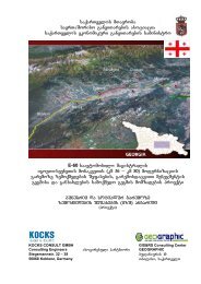
Figure 1-1 Black Sea Regional Transmission Project: Project Overview<br />
Figure 1-2 ESIA Process<br />
Figure 1-3 Leaders and citizens in village Ilmazlo receiving and giving information during<br />
a visit by the ESIA social team<br />
Figure 2-1 Alternative 1: Black Sea Regional Transmission Project - Original<br />
Transmission Line Route and Regional Grid Connection<br />
Figure 2-2 Vegetation clearing of a narrow corridor<br />
Figure 2-3 Typical installation of foundations and setting towers<br />
Figure 2-4 Raising tower in mountainous terrain<br />
Figure 2-5 Types of towers<br />
Figure 2-6 Ground-based conductoring<br />
Figure 2-7 Example of vegetation clearing for corridor maintenance in forested terrain<br />
Figure 2-8 Alternative 2: Black Sea Regional Transmission Project - Modified route near<br />
Ktsia-Tabatskuri Managed Reserve and through Borjomi-Kharagauli National<br />
Park<br />
Figure 2-9 Alternative 3: Black Sea Regional Transmission Project - Modified route near<br />
Ktsia-Tabatskuri Managed Reserve and around Borjomi-Kharagauli National<br />
Park<br />
Figure 4.1-1. Air Temperature Profile along Transmission Line<br />
Figure 4.1-2 Multiyear Average Annual Soil Temperature<br />
Figure 4.1-3. Precipitation Profile along Transmission Line<br />
Figure 4.1-4 Average Annual and Maximum Wind Speed<br />
iv