Part I
Part I
Part I

Create successful ePaper yourself
Turn your PDF publications into a flip-book with our unique Google optimized e-Paper software.
Draft Black Sea Regional Transmission Project ESIA<br />
4.1.2.1 Overview of the transmission line route<br />
The principle landscapes and ecosystems of the Gardabani district, are dry subtropical and<br />
relatively low zone, which are characteristic of subtropical plains, moderately dry plateaus,<br />
and moderately humid mountainous forests. Among them are landscapes of:<br />
<br />
<br />
<br />
<br />
Semi-deserts and dry steppes spread over plains (including Gardabani plain) and<br />
plateaus. They are sparsely covered by xerophytes (plants that can tolerate dry<br />
periods).<br />
Foothills mainly covered by shrubs and sparse woods.<br />
Sparse mountain forests characterized by oak (Quercus spp.), oak-hornbeam<br />
(Quercus- Carpinus), and hornbeam (Carpinus) communities that grow on<br />
hillsides. Also present are beech (Fagus spp.), ash (Fraxinus spp.), maples (Acer<br />
spp.), and other hardwoods. In addition, the Mtkvari valley accommodates<br />
riparian (tugai) forest.<br />
Mountain meadows containing marshes around lakes where grow wetland maple,<br />
lime-tree, and oak with shrub substory.<br />
The easternmost part of the route begins at the edge of Gardabani Managed Reserve in the<br />
floodplain of the Kura River. The Reserve is known for its riparian forests that provides<br />
habitat to many floral and faunal<br />
species with conservation value. As<br />
the line runs west, it passes to semidesert<br />
and arid steppes landscapes,<br />
which at higher elevations<br />
interchange with mountainous-forest<br />
and mountainous meadows, covered<br />
with shrubby, sparse woods and<br />
other arid and semi-arid natural<br />
landscapes.<br />
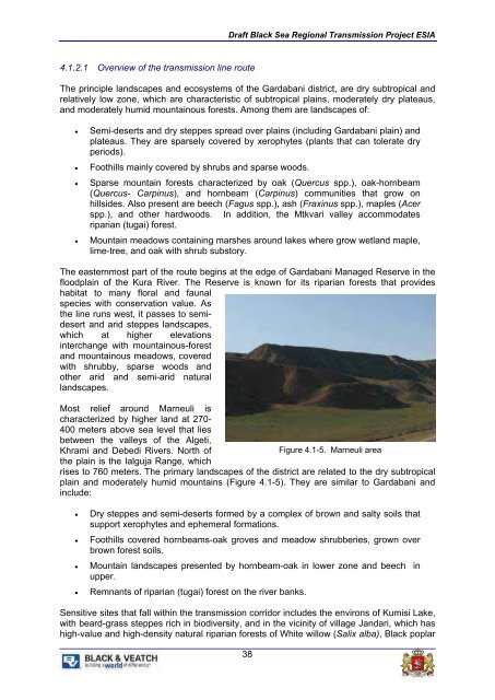
Most relief around Marneuli is<br />
characterized by higher land at 270-<br />
400 meters above sea level that lies<br />
between the valleys of the Algeti,<br />
Khrami and Debedi Rivers. North of<br />
Figure 4.1-5. Marneuli area<br />
the plain is the Ialguja Range, which<br />
rises to 760 meters. The primary landscapes of the district are related to the dry subtropical<br />
plain and moderately humid mountains (Figure 4.1-5). They are similar to Gardabani and<br />
include:<br />
<br />
<br />
<br />
<br />
Dry steppes and semi-deserts formed by a complex of brown and salty soils that<br />
support xerophytes and ephemeral formations.<br />
Foothills covered hornbeams-oak groves and meadow shrubberies, grown over<br />
brown forest soils.<br />
Mountain landscapes presented by hornbeam-oak in lower zone and beech in<br />
upper.<br />
Remnants of riparian (tugai) forest on the river banks.<br />
Sensitive sites that fall within the transmission corridor includes the environs of Kumisi Lake,<br />
with beard-grass steppes rich in biodiversity, and in the vicinity of village Jandari, which has<br />
high-value and high-density natural riparian forests of White willow (Salix alba), Black poplar<br />
38