Minimum Aviation System Performance Standards for Aircraft ...
Minimum Aviation System Performance Standards for Aircraft ...
Minimum Aviation System Performance Standards for Aircraft ...

You also want an ePaper? Increase the reach of your titles
YUMPU automatically turns print PDFs into web optimized ePapers that Google loves.
Appendix A<br />
Page A-14<br />
Extended Display Range – Extended display range is the capability of the CDTI to depict traffic at<br />
ranges beyond the standard display range maximum of 40 NM.<br />
Note: An extended display range capability of at least 90 NM from own-ship is desirable <strong>for</strong> the<br />
ACM application.<br />
Extended Runway Center Line – An extension outwards of the center line of a runway, from one or<br />
both ends of that runway.<br />
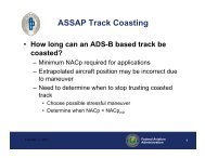
Extrapolation – The process of predicting a track’s state <strong>for</strong>ward in time based on the track’s last<br />
kinematic state.<br />
Field of View – The field of view of a CDTI is the geographical region within which the CDTI shows<br />
traffic targets. (Some other documents call this the field of regard.)<br />
Flight Crew – One or more cockpit crew members required <strong>for</strong> the operation of the aircraft.<br />
Foreground Application – An ASA application that the crew can activate and/or deactivate, the<br />
<strong>for</strong>eground applications is not intended to run full-time or activate automatically without crew<br />
interaction.<br />
Garble – Garble is either nonsynchronous, in which reply pulses are received from a transponder being<br />
interrogated by some other source (see FRUIT), or synchronous, in which an overlap of reply<br />
pulses occurs when two or more transponders reply to the same interrogation.<br />
Generic Conflict – A violation of parameterized minimum separation criteria <strong>for</strong> adverse weather,<br />
aircraft traffic, special use airspace, other airspace, turbulence, noise sensitive areas, terrain and<br />
obstacles, etc. There can be different levels or types of conflict based on how the parameters are<br />
defined. Criteria can be either geometry based or time-based.<br />
Geometric height – The minimum altitude above or below a plane tangent to the earth’s ellipsoid as<br />
defined by WGS-84.<br />
Geometric height error – Geometric height error is the error between the true geometric height and the<br />
transmitted geometric height.<br />
Geometric Vertical Accuracy (GVA) – The GVA parameter is a quantized 95% bound of the error of<br />
the reported geometric altitude, specifically the Height Above the WGS-84 Ellipsoid (HAE).<br />
This parameter is derived from the Vertical Figure of Merit (VFOM) output by the position<br />
source.<br />
GNSS sensor integrity risk – The probability of an undetected failure that results in NSE (navigation<br />
system error) that significantly jeopardizes the total system error (TSE) exceeding the<br />
containment limit. [DO-247, §5.2.2.1]<br />
Global Positioning <strong>System</strong> (GPS) – A space-based positioning, velocity and time system composed of<br />
space, control and user segments. The space segment, when fully operational, will be composed<br />
of 24 satellites in six orbital planes. The control segment consists of five monitor stations, three<br />
ground antennas and a master control station. The user segment consists of antennas and<br />
receiver-processors that provide positioning, velocity, and precise timing to the user.<br />
Ground Speed – The magnitude of the horizontal velocity vector (see velocity). In these MASPS it is<br />
always expressed relative to a frame of reference that is fixed with respect to the earth’s surface<br />
such as the WGS-84 ellipsoid.<br />
©20xx, RTCA, Inc.