Shire of Roebourne Local Planning Strategy
Shire of Roebourne Local Planning Strategy
Shire of Roebourne Local Planning Strategy

Create successful ePaper yourself
Turn your PDF publications into a flip-book with our unique Google optimized e-Paper software.
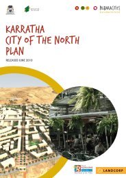
<strong>Shire</strong> <strong>of</strong> <strong>Roebourne</strong> <strong>Local</strong> <strong>Planning</strong> <strong>Strategy</strong>Technical Report A1: Economic Development <strong>Strategy</strong>1 Introduction1.1 This paperThis Technical report 1: Economic Development <strong>Strategy</strong> is a preliminary paper in a suite <strong>of</strong> five reportsto inform the preparation <strong>of</strong> the <strong>Local</strong> <strong>Planning</strong> <strong>Strategy</strong> (LPS) for the <strong>Shire</strong> <strong>of</strong> <strong>Roebourne</strong>. There isplanned to be a series <strong>of</strong> consultations and further information gathering through the course <strong>of</strong> theformulation <strong>of</strong> the LPS.The Economic Development <strong>Strategy</strong>, as a component <strong>of</strong> the LPS and as a <strong>Strategy</strong> in its own right, willbe refined and finalised in the course <strong>of</strong> this process.The scope for the five technical reports was identified through an Information Gap Analysis prepared byMike Allen <strong>Planning</strong> in June 2012. This means that the Technical Reports do not comprehensivelyaddress all <strong>of</strong> the issues that will affect the <strong>Shire</strong>’s future; instead they are designed to complement thewide body <strong>of</strong> research and planning that has already been undertaken.1.2 History and overviewThe <strong>Shire</strong> <strong>of</strong> <strong>Roebourne</strong> is located in the Pilbara region <strong>of</strong> northern Western Australia, about 1,200kilometres north <strong>of</strong> Perth. The <strong>Shire</strong> <strong>of</strong> <strong>Roebourne</strong> is bounded by the Indian Ocean in the north and west,the Town <strong>of</strong> Port Hedland in the east, and the <strong>Shire</strong> <strong>of</strong> Ashburton in the south.The original inhabitants <strong>of</strong> the <strong>Roebourne</strong> area were the Ngaluma and Yindibarndi Aboriginal people.European settlement dates from the 1860s, with land used mainly for pastoral purposes (sheep grazing).Some growth took place in the late 1800s and early 1900s, particularly in Cossack and Point Samson.The population then declined. Significant development did not occur until the late 1960s when iron oredeposits and <strong>of</strong>fshore natural gas fields were discovered. The townships <strong>of</strong> Dampier, Karratha andWickham were established to house mining and transport workers, with Dampier established as a port.Growth took place from the 1970s, with the population <strong>of</strong> the <strong>Shire</strong> increasing from about 10,000 in 1971to 17,000 in 1991. This growth was driven by the North-West Shelf Gas joint venture, with Karrathafunctioning as a service centre for on and <strong>of</strong>f-shore oil and gas facilities. The population declined slightlyduring the early 1990s, falling to about 15,000 in 1996. From the late 1990s the population increasedsubstantially, rising to about 19,000 in 2006. By 2011 the resident population <strong>of</strong> the <strong>Shire</strong> had grown to23,900. Population growth is expected to continue, particularly in and around Karratha, largely a result<strong>of</strong> investment in new mining operations and continued global demand for iron ore and natural gas.The <strong>Shire</strong> <strong>of</strong> <strong>Roebourne</strong> encompasses a total land area <strong>of</strong> over 15,000 square kilometres. The <strong>Shire</strong> ispredominantly rural, with growing population centres in the township <strong>of</strong> Karratha and the smallertownships <strong>of</strong> Dampier, <strong>Roebourne</strong> and Wickham/Point Samson. The main industries in the <strong>Shire</strong> aremining (iron ore and gas extraction), salt production, and cattle and sheep grazing, with some fishing andtourism. The key employment sectors are currently mining and construction, and to a lesser extent, retail,transport, education, tourism and property and business services. The major industrial areas are theDampier and Cape Lambert Ports, with an industrial estate to the south <strong>of</strong> Karratha. The <strong>Shire</strong>'s mainretail area is the Karratha CBD, with a smaller centre at Wickham. <strong>Roebourne</strong> features one tertiaryinstitution (Pilbara Institute) and a number <strong>of</strong> primary and secondary schools.6