

Interim Geologic Map of the West Part of - Utah Geological Survey
Interim Geologic Map of the West Part of - Utah Geological Survey
Interim Geologic Map of the West Part of - Utah Geological Survey

Create successful ePaper yourself
Turn your PDF publications into a flip-book with our unique Google optimized e-Paper software.
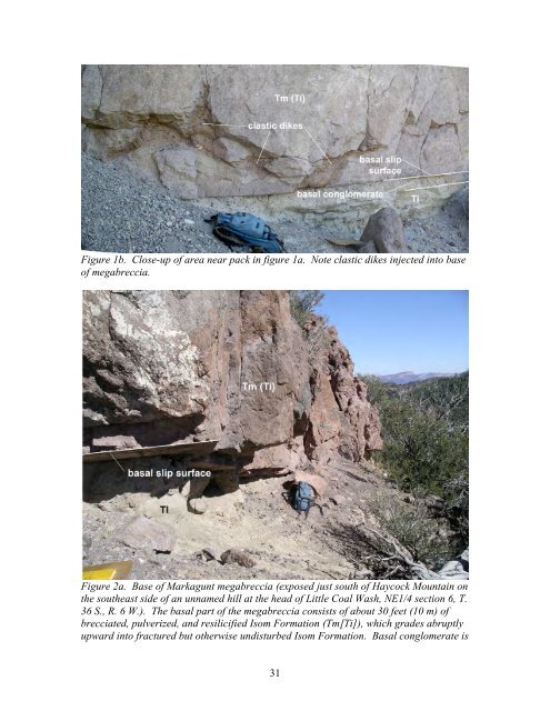
Figure 1b. Close-up <strong>of</strong> area near pack in figure 1a. Note clastic dikes injected into base<strong>of</strong> megabreccia.Figure 2a. Base <strong>of</strong> Markagunt megabreccia (exposed just south <strong>of</strong> Haycock Mountain on<strong>the</strong> sou<strong>the</strong>ast side <strong>of</strong> an unnamed hill at <strong>the</strong> head <strong>of</strong> Little Coal Wash, NE1/4 section 6, T.36 S., R. 6 W.). The basal part <strong>of</strong> <strong>the</strong> megabreccia consists <strong>of</strong> about 30 feet (10 m) <strong>of</strong>brecciated, pulverized, and resilicified Isom Formation (Tm[Ti]), which grades abruptlyupward into fractured but o<strong>the</strong>rwise undisturbed Isom Formation. Basal conglomerate is31


