Appendix L - Federal Emergency Management Agency
Appendix L - Federal Emergency Management Agency
Appendix L - Federal Emergency Management Agency
You also want an ePaper? Increase the reach of your titles
YUMPU automatically turns print PDFs into web optimized ePapers that Google loves.
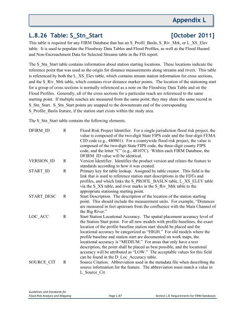
<strong>Appendix</strong> LL.8.26 Table: S_Stn_Start [October 2011]This table is required for any FIRM Database that has an S_Profil_Basln, S_Riv_Mrk, or L_XS_Elevtable. It is used to populate the Floodway Data Tables and Flood Profiles, as well as the Flood Hazardand Non-Encroachment Data for Selected Streams table in the FIS report.The S_Stn_Start table contains information about station starting locations. These locations indicate thereference point that was used as the origin for distance measurements along streams and rivers. This tableis referenced by both the L_XS_Elev table, which contains stream station information for cross sections,and the S_Riv_Mrk table, which contains river distance marker points. The location of the stationing startfor a group of cross sections is normally referenced as a note on the Floodway Data Table and on theFlood Profiles. Generally, all of the cross sections for a particular reach are referenced to the samestarting point. If multiple reaches are measured from the same point, they may share the same record inS_Stn_Start. S_Stn_Start points are snapped to the downstream end of the correspondingS_Profile_Basln feature, if the station start exists within the study area.The S_Stn_Start table contains the following elements.DFIRM_ID R Flood Risk Project Identifier. For a single-jurisdiction flood risk project, thevalue is composed of the two-digit State FIPS code and the four-digit FEMACID code (e.g., 480001). For a countywide flood risk project, the value iscomposed of the two-digit State FIPS code, the three-digit county FIPScode, and the letter “C” (e.g., 48107C). Within each FIRM Database, theDFIRM_ID value will be identical.VERSION_ID R Version Identifier. Identifies the product version and relates the feature tostandards according to how it was created.START_ID R Primary key for table lookup. Assigned by table creator. This field is thelink that is used to reference station start descriptions in the FDTs andprofiles, and which links the S_PROFIL_BASLN table, L_XS_ELEV tablevia the S_XS table, and river marks in the S_Riv_Mrk table to theappropriate stationing starting point.START_DESC R Start Description. The description of the location of the station startingpoint. This should include the measurement units. For example, “Distancesare measured in feet upstream from the confluence with the Main Channel ofthe Big River.”LOC_ACC R Start Station Locational Accuracy. The spatial placement accuracy level ofthe Station Start point. For all new models with profile baselines, the exactlocation of the profile baseline station start should be placed and thelocational accuracy be categorized as “HIGH.” For old models where theprofile baseline and station start are documented on work maps, thelocational accuracy is “MEDIUM.” For areas that only have a textdescription, the point shall be placed as best possible, and the locationalaccuracy will be attributed as “LOW.” The acceptable values for this fieldcan be found in the D_Loc_Accuracy table.SOURCE_CIT R Source Citation. Abbreviation used in the metadata file when describing thesource information for the feature. The abbreviation must match a value inL_Source_Cit.Guidelines and Standards forFlood Risk Analysis and Mapping Page L-87 Section L.8 Requirements for FIRM Databases


