Appendix L - Federal Emergency Management Agency
Appendix L - Federal Emergency Management Agency
Appendix L - Federal Emergency Management Agency
You also want an ePaper? Increase the reach of your titles
YUMPU automatically turns print PDFs into web optimized ePapers that Google loves.
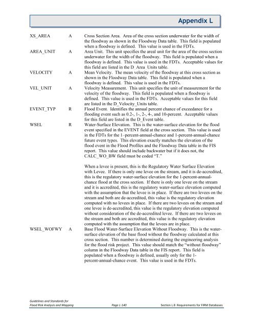
<strong>Appendix</strong> LXS_AREA A Cross Section Area. Area of the cross section underwater for the width ofthe floodway as shown in the Floodway Data table. This field is populatedwhen a floodway is defined. This value is used in the FDTs.AREA_UNIT A Area Unit. This unit specifies the areal unit for the area of the cross sectionunderwater for the width of the floodway. This field is populated when afloodway is defined. This value is used in the FDTs. Acceptable values forthis field are listed in the D_Area_Units table.VELOCITY A Mean Velocity. The mean velocity of the floodway at this cross section asshown in the Floodway Data table. This field is populated when afloodway is defined. This value is used in the FDTs.VEL_UNIT A Velocity Measurement. This unit specifies the unit of measurement for thevelocity of the floodway. This field is populated when a floodway isdefined. This value is used in the FDTs. Acceptable values for this fieldare listed in the D_Velocity_Units table.EVENT_TYP R Flood Event. Identifies the annual percent chance of exceedance for aflooding event such as 0.2-, 1-, 2-, 4-, and 10-percent. Acceptable valuesfor this field are listed in the D_Event table.WSEL R Water-Surface Elevation. This is the water-surface elevation for the floodevent specified in the EVENT field at the cross section. This value is usedin the FDTs for the 1–percent-annual-chance and 1-percent-annual-chancefuture event types. This elevation exactly matches the elevation of theflood event in the Flood Profiles and the Floodway Data table in the FISreport. This value should include backwater but if it does not, theCALC_WO_BW field must be coded “T.”When a levee is present, this is the Regulatory Water Surface Elevationwith Levee. If there is only one levee on the stream, and it is de-accredited,this is the regulatory water-surface elevation for the 1-percent-annualchanceflood at the cross section. If there is only one levee on the streamand it is accredited, this is the regulatory water-surface elevation computedwith the assumption that the levee is in place. If there are two levees on thestream and both are de-accredited, this value is the regulatory elevationcomputed with no levees in place. If there are two levees on the stream andone levee is de-accredited, this value is the regulatory elevation computedwithout consideration of the de-accredited levee. If there are two levees onthe stream and both are accredited, this value is the regulatory elevationcomputed with the assumption that the levees are in place.WSEL_WOFWY A Base Flood Water-Surface Elevation Without Floodway. This is the watersurfaceelevation of the base flood without the floodway calculated at thiscross section. This number is determined during the engineering analysisfor the flood risk project. This value should match the “without floodway”column in the Floodway Data table in the FIS report. This field ispopulated when a floodway is defined, usually only for the 1-percent-annual-chance event. This value is used in the FDTs.Guidelines and Standards forFlood Risk Analysis and Mapping Page L-140 Section L.8 Requirements for FIRM Databases


