Appendix L - Federal Emergency Management Agency
Appendix L - Federal Emergency Management Agency
Appendix L - Federal Emergency Management Agency
You also want an ePaper? Increase the reach of your titles
YUMPU automatically turns print PDFs into web optimized ePapers that Google loves.
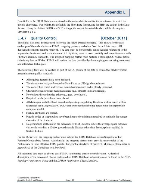
<strong>Appendix</strong> LDate fields in the FIRM Database are stored in the native date format for the data format in which thetable is distributed. For PGDB, the default is the Short Date format, and for SHP, the default is the Dateformat. Using the default PGDB and SHP settings, the output format of the date will be the requiredMM/DD/YYYY.L.4.7 Quality Control [October 2011]The digital files must be structured following the FIRM Database schema. This allows for the easyexchange of these data between FEMA, mapping partners, and other flood hazard data users. Allduplicated elements must be removed. The data must be horizontally controlled and referenced to theappropriate horizontal and vertical datum. All digitizing must be done carefully and in conformance withFEMA’s accuracy standards. The assigned mapping partner must perform a thorough QC review beforesubmitting data to FEMA. FEMA will review the data provided by the mapping partner using automatedand interactive techniques.The following items will be verified as part of the QC review of the data to ensure that all deliverablesmeet minimum quality standards:• All required features have been included.• The data are correctly referenced to State Plane or UTM grid coordinates.• The correct horizontal and vertical datum has been used and is clearly indicated.• Character of features has been maintained (e.g., straight lines are straight).• No obvious discontinuities exist (e.g., gaps, overshoots).• Required labels (text) have been placed.• All data agree with the flood hazard analyses (e.g., regulatory floodway widths match withintolerances set in Appendices C and J) and cross-section labeling agrees with the appropriatecomputer model.• Feature attributes are correct.• Pseudo-nodes or shape points have been kept to the minimum required to maintain the correctcharacter of the features.• No geometries shall exist in the deliverable FIRM Database where the average space betweenvertices is less than a 10-foot ground sample distance other than the exception specified inSection L-4.6.5.For the QC review, the mapping partner must submit the FIRM Database in Esri Shapefile or EsriPersonal Geodatabase format. Additionally, the mapping partner must provide raster copies of thePreliminary or Final effective FIRM panels. For graphic standards of raster FIRM panels, please refer to<strong>Appendix</strong> K of the Guidelines and Standards.All submitted data must be able to pass FEMA’s automated quality control system. A detaileddescription of the automated checks performed on FIRM Database submissions can be found in the DVT -Topology Verification Guide and the DFIRM Verification Check Standard.Guidelines and Standards forFlood Risk Analysis and Mapping Page L-28 Section L.4 Preliminary and Final Databases


