

Appendix L - Federal Emergency Management Agency
Appendix L - Federal Emergency Management Agency
Appendix L - Federal Emergency Management Agency

Create successful ePaper yourself
Turn your PDF publications into a flip-book with our unique Google optimized e-Paper software.
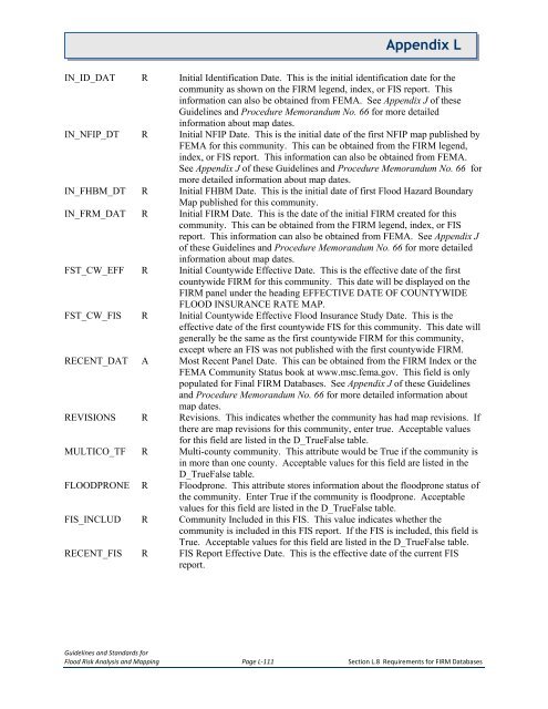
<strong>Appendix</strong> LIN_ID_DAT R Initial Identification Date. This is the initial identification date for thecommunity as shown on the FIRM legend, index, or FIS report. Thisinformation can also be obtained from FEMA. See <strong>Appendix</strong> J of theseGuidelines and Procedure Memorandum No. 66 for more detailedinformation about map dates.IN_NFIP_DT R Initial NFIP Date. This is the initial date of the first NFIP map published byFEMA for this community. This can be obtained from the FIRM legend,index, or FIS report. This information can also be obtained from FEMA.See <strong>Appendix</strong> J of these Guidelines and Procedure Memorandum No. 66 formore detailed information about map dates.IN_FHBM_DT R Initial FHBM Date. This is the initial date of first Flood Hazard BoundaryMap published for this community.IN_FRM_DAT R Initial FIRM Date. This is the date of the initial FIRM created for thiscommunity. This can be obtained from the FIRM legend, index, or FISreport. This information can also be obtained from FEMA. See <strong>Appendix</strong> Jof these Guidelines and Procedure Memorandum No. 66 for more detailedinformation about map dates.FST_CW_EFF R Initial Countywide Effective Date. This is the effective date of the firstcountywide FIRM for this community. This date will be displayed on theFIRM panel under the heading EFFECTIVE DATE OF COUNTYWIDEFLOOD INSURANCE RATE MAP.FST_CW_FIS R Initial Countywide Effective Flood Insurance Study Date. This is theeffective date of the first countywide FIS for this community. This date willgenerally be the same as the first countywide FIRM for this community,except where an FIS was not published with the first countywide FIRM.RECENT_DAT A Most Recent Panel Date. This can be obtained from the FIRM Index or theFEMA Community Status book at www.msc.fema.gov. This field is onlypopulated for Final FIRM Databases. See <strong>Appendix</strong> J of these Guidelinesand Procedure Memorandum No. 66 for more detailed information aboutmap dates.REVISIONS R Revisions. This indicates whether the community has had map revisions. Ifthere are map revisions for this community, enter true. Acceptable valuesfor this field are listed in the D_TrueFalse table.MULTICO_TF R Multi-county community. This attribute would be True if the community isin more than one county. Acceptable values for this field are listed in theD_TrueFalse table.FLOODPRONE R Floodprone. This attribute stores information about the floodprone status ofthe community. Enter True if the community is floodprone. Acceptablevalues for this field are listed in the D_TrueFalse table.FIS_INCLUD R Community Included in this FIS. This value indicates whether thecommunity is included in this FIS report. If the FIS is included, this field isTrue. Acceptable values for this field are listed in the D_TrueFalse table.RECENT_FIS R FIS Report Effective Date. This is the effective date of the current FISreport.Guidelines and Standards forFlood Risk Analysis and Mapping Page L-111 Section L.8 Requirements for FIRM Databases


