Annual Report 2008 - Office National des Hydrocarbures et des Mines
Annual Report 2008 - Office National des Hydrocarbures et des Mines
Annual Report 2008 - Office National des Hydrocarbures et des Mines

Create successful ePaper yourself
Turn your PDF publications into a flip-book with our unique Google optimized e-Paper software.
Tselfat permit (TransAtlantic)<br />
This American company acquired 175 sq km of<br />
3D seismic data in early <strong>2008</strong>. The conclusive<br />
results of geological and geophysical studies<br />
have led to the positioning of 4 wells HR 33-34-<br />
35 and 36, with a depth of about 1000 m each<br />
on Haricha zone. The drillings are expected to<br />
be implemented in 2009.<br />
Tendrara permits (MPE)<br />
MPE works on these permits focused on long<br />
term tests of TE-5 well and on the interpr<strong>et</strong>ation<br />
of reprocessed 2D seismic data. New play<br />
concepts and Triassic p<strong>et</strong>roleum prospects<br />
have been delineated on the north western<br />
zones.<br />
Ounara Est and Ouest permits (MPE)<br />
Following the reprocessing and interpr<strong>et</strong>ation<br />
of older seismic data, new play concepts have<br />
been developed and new Triassic and Jurassic<br />
prospects have been identified. A work program<br />
is under negotiation in view of concluding a new<br />
agreement.<br />
Missour Est reconnaissance zone (MPE)<br />
In this zone, MPE Company carried on seismic<br />
processing to compl<strong>et</strong>e the p<strong>et</strong>roleum potential<br />
evaluation.<br />
Missour Ouest reconnaissance zone (MND)<br />
MND started the first field surveys bearing on<br />
sedimentological studies and geochemical<br />
analyses and is now reprocessing the older<br />
seismic data.<br />
Activity <strong>Report</strong> <strong>2008</strong><br />
Boudenib permit and Ouarzazate<br />
reconnaissance zone (MND)<br />
MND acquired 45 562 km of airborne magn<strong>et</strong>ic/<br />
gravity lines followed by the implementation<br />
of a d<strong>et</strong>ailed land gravim<strong>et</strong>ric survey of 2 578<br />
stations.<br />
On the other hand, MND undertook the<br />
processing of 2 443 km of 2D seismic lines<br />
covering Boudenib and Ouarzazate basins.<br />
The interpr<strong>et</strong>ation of magn<strong>et</strong>ic, gravim<strong>et</strong>ric and<br />
seismic data is under way.<br />
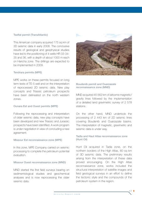
Tadla and Haut Atlas reconnaissance zone<br />
(Hunt Oil)<br />
Hunt Oil acquired in Tadla zone, on the<br />
northern borders of the High Atlas, 60 sq km<br />
of 3D seismic data. The preliminary results<br />
arising from the interpr<strong>et</strong>ation of these data<br />
proved encouraging. On the High Atlas<br />
reconnaissance zone, works included the<br />
structural interpr<strong>et</strong>ation of satellite images and<br />
field geological surveys in an effort to define<br />
the tectonic style and the compounds of the<br />
p<strong>et</strong>roleum system in the region.<br />
17