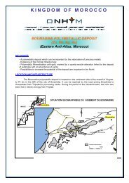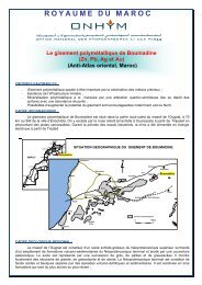
Annual Report 2008 - Office National des Hydrocarbures et des Mines
Annual Report 2008 - Office National des Hydrocarbures et des Mines
Annual Report 2008 - Office National des Hydrocarbures et des Mines

Create successful ePaper yourself
Turn your PDF publications into a flip-book with our unique Google optimized e-Paper software.
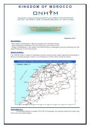
Doukkala-Abda reconnaissance zone (ENI)<br />
ENI acquired, in early <strong>2008</strong>, a 2D seismic<br />
campaign totaling 484 km.The processing of<br />
these data and the reprocessing of 1 000 km<br />
of old seismic lines is underway. Geochemical<br />
analyses, based on fluid inclusion technology,<br />
confirmed the hydrocarbon impregnation<br />
of Paleozoic reservoirs. Other additional<br />
geochemical works, relating to Triassic reservoirs<br />
have been implemented.<br />
Ouest Souss onshore reconnaissance zone<br />
(GBP)<br />
The reprocessing and interpr<strong>et</strong>ation of 2D<br />
seismic data, integrated with geological and<br />
geochemical surveys permitted to highlight the<br />
p<strong>et</strong>roleum potential in this frontier zone. These<br />
positive results encouraged GBP to undertake<br />
negotiations for a minimum work program to<br />
carry on the exploration of this region.<br />
Bas Draa permit (P<strong>et</strong>rocanada/ RWE)<br />
Following the encouraging results of geological,<br />
geochemical and magn<strong>et</strong>ic/gravity surveys, this<br />
reconnaissance zone was converted into an<br />
exploration permit. The acquisition of 1 400 km<br />
of 2D seismics was scheduled and preparations<br />
for the undertaking of this survey started at the<br />
end of <strong>2008</strong>.<br />
Zag basin reconnaissance zone (San Leon<br />
Energy / Island Oil & Gas / GB Oil & Gas)<br />
San Leon Energy and its partners carried out<br />
airborne magn<strong>et</strong>ic surveys totaling 18 789 km.<br />
The processing and interpr<strong>et</strong>ation of these<br />
data highlighted the hydrocarbon potential of<br />
18<br />
<strong>Office</strong> <strong>National</strong> <strong>des</strong> <strong>Hydrocarbures</strong> <strong>et</strong> <strong>des</strong> <strong>Mines</strong><br />
Paleozoic structures in this frontier zone. These<br />
partners expressed their interest in carrying on<br />
exploration works in these regions within the<br />
framework of a new work program.<br />
Tarfaya onshore permits (Island Oil & Gas /<br />
San Leon Energy / Longreach)<br />
The first evaluation works of the p<strong>et</strong>roleum<br />
potential on these permits concentrated on<br />
the reprocessing of old seismic data and the<br />
synthesis of former works and existing studies.<br />
Haha permits (PEL)<br />
The field studies conducted, tog<strong>et</strong>her with<br />
seismic and gravity reprocessing works, showed<br />
play concepts at the level of the Paleozoic and<br />
Triassic. A 2D or 3D seismic campaign is under<br />
negotiation and will be carried out in 2009.<br />
Bouanane permit (Dana / T<strong>et</strong>hys / Eastern)<br />
Gravity and magn<strong>et</strong>ic modelling and<br />
interpr<strong>et</strong>ation of reprocessed PSTM seismic<br />
data confirmed and specified the closures of<br />
Tafejjart structure. TAJ-1 well was spudded on<br />
this prospect and preparations of the platform<br />
and access roads are underway. The well is<br />
scheduled for February 2009.<br />
Guercif Est and Ouest permits (TransAtlantic /<br />
Stratic / Longe)<br />
Works carried out on these permits mainly<br />
concentrated on the re-entry of MSD-1 well.<br />
Log operations and tests on potential zones,<br />
at the Jurassic level, were carried out by the<br />
end of <strong>2008</strong>. No inflow of hydrocarbons, in the<br />
tested levels, was established.