

Bogue Banks Beach - Carteret County Shore Protection Office
Bogue Banks Beach - Carteret County Shore Protection Office
Bogue Banks Beach - Carteret County Shore Protection Office

Create successful ePaper yourself
Turn your PDF publications into a flip-book with our unique Google optimized e-Paper software.
Final Report <strong>Bogue</strong> <strong>Banks</strong> <strong>Beach</strong> & Nearshore Mapping Program<br />
Periodic Survey Evaluation<br />
profiles was conducted in order to determine sound speed variations in different parts of the<br />
survey area.<br />
RTK-based tidal measurements were continuously recorded throughout the survey by HYPACK<br />
Survey. The GPS height determined by the POS/MV was integrated into the raw singlebeam<br />
sonar data in the HYPACK data acquisition software by integrating the post-processed POSPac<br />
Smoothed Best Estimate of Trajectory (SBET) file. After importing the raw singlebeam data in<br />
HYPACK, the GPS tide was merged with the heave such to provide accurate tidal corrections<br />
and remove heave.<br />
3.2. Topographic Data Acquisition and Processing<br />
The following sections discuss the equipment, quality controls, sounding corrections, and data<br />
processing associated with the topographic data acquisition.<br />
3.2.1. Topographic Survey Equipment, Hardware, and Software<br />
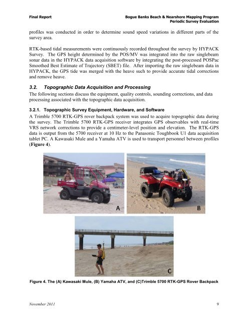
A Trimble 5700 RTK-GPS rover backpack system was used to acquire topographic data during<br />
the survey. The Trimble 5700 RTK-GPS receiver integrates GPS observables with real-time<br />
VRS network corrections to provide a centimeter-level position and elevation. The RTK-GPS<br />
data is output from the 5700 receiver at 10 Hz to the Panasonic Toughbook U1 data acquisition<br />
tablet PC. A Kawasaki Mule and a Yamaha ATV is used to transport personnel between profiles<br />
(Figure 4).<br />
Figure 4. The (A) Kawasaki Mule, (B) Yamaha ATV, and (C)Trimble 5700 RTK-GPS Rover Backpack<br />
November 2011 9