

Bogue Banks Beach - Carteret County Shore Protection Office
Bogue Banks Beach - Carteret County Shore Protection Office
Bogue Banks Beach - Carteret County Shore Protection Office

You also want an ePaper? Increase the reach of your titles
YUMPU automatically turns print PDFs into web optimized ePapers that Google loves.
Final Report <strong>Bogue</strong> <strong>Banks</strong> <strong>Beach</strong> & Nearshore Mapping Program<br />
Periodic Survey Evaluation<br />
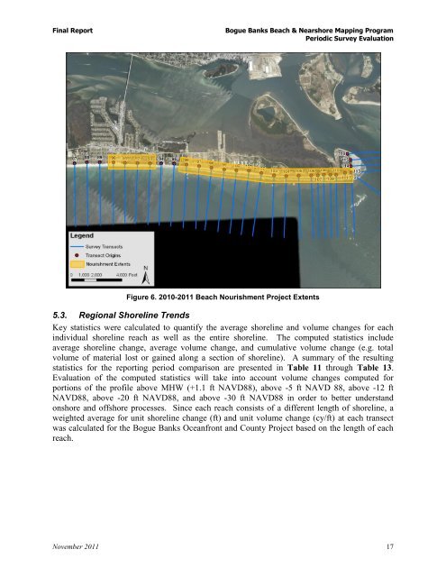
Figure 6. 2010-2011 <strong>Beach</strong> Nourishment Project Extents<br />
5.3. Regional <strong>Shore</strong>line Trends<br />
Key statistics were calculated to quantify the average shoreline and volume changes for each<br />
individual shoreline reach as well as the entire shoreline. The computed statistics include<br />
average shoreline change, average volume change, and cumulative volume change (e.g. total<br />
volume of material lost or gained along a section of shoreline). A summary of the resulting<br />
statistics for the reporting period comparison are presented in Table 11 through Table 13.<br />
Evaluation of the computed statistics will take into account volume changes computed for<br />
portions of the profile above MHW (+1.1 ft NAVD88), above -5 ft NAVD 88, above -12 ft<br />
NAVD88, above -20 ft NAVD88, and above -30 ft NAVD88 in order to better understand<br />
onshore and offshore processes. Since each reach consists of a different length of shoreline, a<br />
weighted average for unit shoreline change (ft) and unit volume change (cy/ft) at each transect<br />
was calculated for the <strong>Bogue</strong> <strong>Banks</strong> Oceanfront and <strong>County</strong> Project based on the length of each<br />
reach.<br />
November 2011 17