

Bogue Banks Beach - Carteret County Shore Protection Office
Bogue Banks Beach - Carteret County Shore Protection Office
Bogue Banks Beach - Carteret County Shore Protection Office

Create successful ePaper yourself
Turn your PDF publications into a flip-book with our unique Google optimized e-Paper software.
Final Report <strong>Bogue</strong> <strong>Banks</strong> <strong>Beach</strong> & Nearshore Mapping Program<br />
Periodic Survey Evaluation<br />
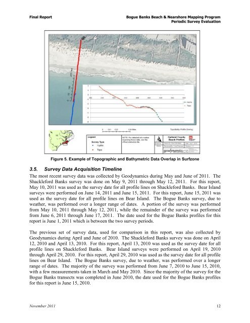
Figure 5. Example of Topographic and Bathymetric Data Overlap in Surfzone<br />
3.5. Survey Data Acquisition Timeline<br />
The most recent survey data was collected by Geodynamics during May and June of 2011. The<br />
Shackleford <strong>Banks</strong> survey was done on May 9, 2011 through May 12, 2011. For this report,<br />
May 10, 2011 was used as the survey date for all profile lines on Shackleford <strong>Banks</strong>. Bear Island<br />
surveys were performed on June 14, 2011 and June 15, 2011. For this report, June 15, 2011 was<br />
used as the survey date for all profile lines on Bear Island. The <strong>Bogue</strong> <strong>Banks</strong> survey, due to<br />
weather, was performed over a longer range of dates. A portion of the survey was performed<br />
from May 10, 2011 through May 12, 2011, while the remainder of the survey was performed<br />
from June 6, 2011 through June 17, 2011. The date used for the <strong>Bogue</strong> <strong>Banks</strong> profiles for this<br />
report is June 1, 2011 which is between the two survey periods.<br />
The previous set of survey data, used for comparison in this report, was also collected by<br />
Geodynamics during April and June of 2010. The Shackleford <strong>Banks</strong> survey was done on April<br />
12, 2010 and April 13, 2010. For this report, April 13, 2010 was used as the survey date for all<br />
profile lines on Shackleford <strong>Banks</strong>. Bear Island surveys were performed on April 19, 2010<br />
through April 29, 2010. For this report, April 29, 2010 was used as the survey date for all profile<br />
lines on Bear Island. The <strong>Bogue</strong> <strong>Banks</strong> survey, due to weather, was performed over a longer<br />
range of dates. The majority of the survey was performed from June 7, 2010 to June 15, 2010,<br />
with a few measurements taken in March and May 2010. Since the majority of the survey for the<br />
<strong>Bogue</strong> <strong>Banks</strong> transects was completed in June 2010, the date used for the <strong>Bogue</strong> <strong>Banks</strong> profiles<br />
for this report is June 15, 2010.<br />
November 2011 12