Descargue esta publicació en formato pdf haciendo ... - INSUGEO
Descargue esta publicació en formato pdf haciendo ... - INSUGEO
Descargue esta publicació en formato pdf haciendo ... - INSUGEO
Create successful ePaper yourself
Turn your PDF publications into a flip-book with our unique Google optimized e-Paper software.
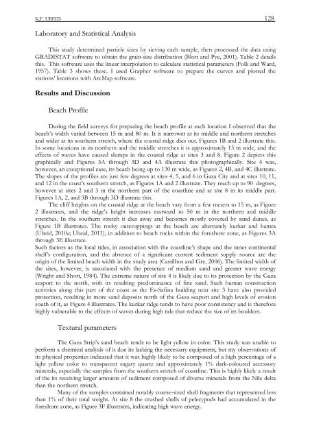
K.F. UBEID 128Laboratory and Statistical AnalysisThis study determined particle sizes by sieving each sample, th<strong>en</strong> processed the data usingGRADISTAT software to obtain the grain-size distribution (Blott and Pye, 2001). Table 2 detailsthis. This software uses the linear interpolation to calculate statistical parameters (Folk and Ward,1957). Table 3 shows these. I used Grapher software to prepare the curves and plotted th<strong>esta</strong>tions’ locations with ArcMap software.Results and DiscussionBeach ProfileDuring the field surveys for preparing the beach profile at each location I observed that thebeach’s width varied betwe<strong>en</strong> 15 m and 80 m. It is narrower at its middle and northern stretchesand wider at its southern stretch, where the coastal ridge dies out. Figures 1B and 2 illustrate this.In some locations in its northern and the middle stretches it is approximately 15 m wide, and theeffects of waves have caused slumps in the coastal ridge at sites 3 and 8. Figure 2 depicts thisgraphically and Figures 3A through 3D and 4A illustrate this photographically. Site 4 was,however, an exceptional case, its beach being up to 130 m wide, as Figures 2, 4B, and 4C illustrate.The slopes of the profiles are just few degrees at sites 4, 5, and 6 in Gaza City and at sites 10, 11,and 12 in the coast’s southern stretch, as Figures 1A and 2 illustrate. They reach up to 90 degrees,however at sites 2 and 3 in the northern part of the coastline and at site 8 in its middle part.Figures 1A, 2, and 3B through 3D illustrate this.The cliff heights on the coastal ridge at the beach vary from a few meters to 15 m, as Figure2 illustrates, and the ridge’s height increases eastward to 50 m in the northern and middlestretches. In the southern stretch it dies away and becomes mostly covered by sand dunes, asFigure 1B illustrates. The rocky outcroppings at the beach are alternately kurkar and hamra(Ubeid, 2010a; Ubeid, 2011), in addition to beach rocks within the foreshore zone, as Figures 3Athrough 3E illustrate.Such factors as the local tides, in association with the coastline’s shape and the inner contin<strong>en</strong>talshelf’s configuration, and the abs<strong>en</strong>ce of a significant curr<strong>en</strong>t sedim<strong>en</strong>t supply source are theorigin of the limited beach width in the study area (Castilhos and Gre, 2006). The limited width ofthe sites, however, is associated with the pres<strong>en</strong>ce of medium sand and greater wave <strong>en</strong>ergy(Wright and Short, 1984). The extreme nature of site 4 is likely due to its protection by the Gazaseaport to the north, with its resulting predominance of fine sand. Such human constructionactivities along this part of the coast as the Es-Safina building near site 3 have also providedprotection, resulting in more sand deposits north of the Gaza seaport and high levels of erosionsouth of it, as Figure 4 illustrates. The kurkar ridge t<strong>en</strong>ds to have poor consist<strong>en</strong>cy and is thereforehighly vulnerable to the effects of waves during high tide that reduce the size of its boulders.Textural parametersThe Gaza Strip’s sand beach t<strong>en</strong>ds to be light yellow in color. This study was unable toperform a chemical analysis of it due its lacking the necessary equipm<strong>en</strong>t, but my observations ofits physical properties indicated that it was highly likely to be composed of a high perc<strong>en</strong>tage of alight yellow color to transpar<strong>en</strong>t sugary quartz and approximately 1% dark-coloured accessoryminerals, especially the samples from the southern stretch of coastline. This is highly likely a resultof the its receiving larger amounts of sedim<strong>en</strong>t composed of diverse minerals from the Nile deltathan the northern stretch.Many of the samples contained notably coarse-sized shell fragm<strong>en</strong>ts that repres<strong>en</strong>ted lessthan 1% of their total weight. At site 8 the crushed shells of pelecypods had accumulated in theforeshore zone, as Figure 3F illustrates, indicating high wave <strong>en</strong>ergy.



![Descargar El Libro Completo [5.631 Kb] - INSUGEO](https://img.yumpu.com/40710231/1/177x260/descargar-el-libro-completo-5631-kb-insugeo.jpg?quality=85)
