1923%20Memoir%20on%20Maps%20of%20Chinese%20Turkistan%20by%20Stein%20s
1923%20Memoir%20on%20Maps%20of%20Chinese%20Turkistan%20by%20Stein%20s
1923%20Memoir%20on%20Maps%20of%20Chinese%20Turkistan%20by%20Stein%20s
Create successful ePaper yourself
Turn your PDF publications into a flip-book with our unique Google optimized e-Paper software.
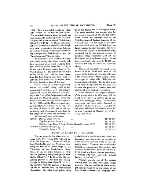
66 NOTES ON INDIVIDUAL MAY SllEETS [Chap. IV<br />
1913. Two triangulated points on either tween the FIunxo and Tish-kurghin rivers.<br />
aide confirm its position as here shown. The same snow-line was adopted also for<br />
The plane-table traverse along the route has tl~e range to the east of the Sarikol valley<br />
bee11 ndjustd to tire fixed I~osition of Tirsh- whicl~ divides tlle drainage areas of the<br />
kurghin and to the positiorl of Toile-bulung Tish-kurgh~n and Rsskam brancl~es of the<br />
(Sheet No. 2. D. 4). For this an astroi~omi- Yirkand river. On the range to the north<br />
cal value of latitude is a~ailable and a longi- and west whiel~ separates Sarikol from the<br />
tutlc value representi~lg the mean between Pimirs proper the snow-line seemed to me to<br />
two vahles obtained by interpolation between lie distinctly higher, a circumstance fully<br />
(a) Kisllgar and Tirsh-kurghsn, and (b) accounted for by the reduced amount of<br />
Yangi-hissir and Tish-kurghin.<br />
moisture whicl~ penetrates north of the<br />
An alternative route towards Kishgar Hindukosh and Kara-koram ranges. It has<br />
used chiefly during the winter months fol- been conjecturally shown on the 17,000 conlows<br />
the narrow gorge which descends from tour I~ue, but ntay in really be somewhat<br />
the Chichiklik-maidin (Sheet No. 2. C. 4) to higher.<br />
Shindi below the sharp eastern bend of the Grazing of the scanty sort usual on the<br />
Tish-kurghin R. The portion of this route Pimirs is to be found over most of the<br />
falliug witl~in this sheet has been s11own ground at the bottom of the main valley and<br />
from Rai Rim Singh's plane-table work of in the lower portion of those joining it from<br />
1901; and from notes kept by myself when the ranges on either side. This has not<br />
following it early in June of that year. been specially indicated. But in a few areas<br />
The snow-line on the high ranges nvllich (as at Hang; C. 2) yellow tint has been used<br />
enclose the Sarikol valley could be but to mark the presence of riverine loess soil<br />
approsin~stcl!~ i~ltlicated, as it was actually allowing of more luxuriant vegetation.<br />
apl~roached o ~~ly on the IVakhjir p:~zs lead-<br />
- -<br />
ing to the Osus (Bb-i-Pauja) source and on<br />
Some account of the physical features<br />
of the ground shown in this sheet will be<br />
the Kilik and Aling-taka passes. From my found in my Ilirilzs of Khotalz, pp. 57 sqq.<br />
observations when crossing the Wakhjir pass and Desert Catiay, pp. 83 rqq. Its historical<br />
in July, 1900, and the &ling-taka pass early topography has been fully discussed in<br />
in September, 1913, I was led to take the Chapter 11 of A7zciel~t Khotax ( i. pp. 22-40)<br />
elevation of about 16,500 feet as the ap- and some additional information about its<br />
proximate limit of permanent snow-beds on old sites furnished in Chapter 1x1 of Serthe<br />
range which forms the watershed be- izdia, i. pp. 72-76.<br />
Astronoit~ically obsercerl lafihdes.<br />
1000-01. Dafdir, Camp 1 (C. 2j . Tiighlak-gumbaz, Camp 2 (C. 1) ...<br />
...<br />
. . .<br />
37O 22' 26"<br />
37O 34' 38"<br />
Tish-kl~rgliin, Camp 3 (near British Ak-sakil's house ; C. 1)<br />
1906-08. CI~ushm:in, Camp 1 (C. 1) . . .<br />
ITdurghuk, Camp 5 (D. 1) ... . . .<br />
NOTES ON SHEET No. 4 (YAI-DOZE)<br />
37O 46' 58"<br />
37' 51' 28"<br />
:37O 50' 38"<br />
The area s1lon.n in this sheet was sur-<br />
veyed from two routes, both followed by<br />
R. 13. LB1 Singh only. The one of 1907 led<br />
from Uch-Turfin and the Taushkan river<br />
along the foot of an outer range of the<br />
T'ien-shan to the Terek-dawan (Sheet<br />
No. 1. D. 4); the other, followed in 1915,<br />
lay over previously unexplored ground from<br />
Kelpin (Sheet No. 7. B. 4) cia the Kirghiz<br />
grazing grounds of Yai-dobe and Chong-<br />
kara-jol to Kalta-yailak (Sheet No. 5. B. 1).<br />
On the latter route the position of Tunguz-<br />
luk had ito latitude fixed by astronomical<br />
observation. No other fixed points being<br />
available within the limits of this sheet, its<br />
delineation was determined by adjustment<br />
of the details to the fixed places of tlie ad-<br />
joining sheets. The result was satisfactorily<br />
checked by comparison of t,he position thus<br />
obtained for the Biloti-dawin (Sheet No. 4.<br />
D. 3) u~hich was found to agree very closely<br />
in latitude with that observed by Colonel<br />
Trotter, viz. 40' 40' YO".<br />
Though scarcely any of the streams<br />
coming from the outer T'ien-shan ranges<br />
shown in this sheet ordinarily carry water,<br />
yet springs found in various places at the<br />
foot of the northern one, combined with


