2013 VACATION PLANNER - Travel Yukon
2013 VACATION PLANNER - Travel Yukon
2013 VACATION PLANNER - Travel Yukon

Create successful ePaper yourself
Turn your PDF publications into a flip-book with our unique Google optimized e-Paper software.
32<br />
Watson Lake<br />
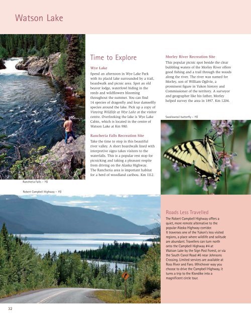
Rancheria Falls – YG<br />
Robert Campbell Highway – YG<br />
Time to Explore<br />
Wye Lake<br />
Spend an afternoon in Wye Lake Park<br />
with its placid lake surrounded by a trail,<br />
boardwalk and picnic area. Spot an old<br />
beaver lodge, waterfowl hiding in the<br />
reeds and wildflowers blooming<br />
throughout the summer. You can find<br />
14 species of dragonfly and four damselfly<br />
species around the lake. Pick up a copy of<br />
Viewing Wildlife at Wye Lake at the visitor<br />
centre. Overlooking the lake is Wye Lake<br />
Cabin, which is located in the centre of<br />
Watson Lake at Km 980.<br />
Rancheria Falls Recreation Site<br />
Take the time to stop in this beautiful<br />
river valley. A short boardwalk lined with<br />
interpretive signs takes visitors to the<br />
waterfalls. This is a popular rest stop for<br />
picnicking and taking a pleasant respite<br />
from driving on the Alaska Highway.<br />
The Rancheria area is important habitat<br />
for a herd of woodland caribou. Km 1112.<br />
Morley River Recreation Site<br />
This popular picnic spot beside the clear<br />
bubbling waters of the Morley River offers<br />
good fishing and a trail through the woods<br />
along the river. The river was named for<br />
Morley, son of William Ogilvie, a<br />
prominent figure in <strong>Yukon</strong> history and<br />
Commissioner of the territory. A surveyor<br />
and geographer like his father, Morley<br />
helped survey the area in 1897. Km 1204.<br />
Swallowtail butterfly – YG<br />
Roads Less <strong>Travel</strong>led<br />
The Robert Campbell Highway offers a<br />
quiet, more remote alternative to the<br />
popular Alaska Highway corridor.<br />
It traverses one of the <strong>Yukon</strong>’s less visited<br />
regions, a place where wildlife and solitude<br />
are abundant. <strong>Travel</strong>lers can turn north<br />
onto the Campbell Highway #4 at<br />
Watson Lake by the Sign Post Forest, or via<br />
the South Canol Road #6 near Johnsons<br />
Crossing. Limited services are available at<br />
Ross River and Faro. Whichever way you<br />
choose to drive the Campbell Highway, it<br />
turns a trip to the Klondike into a<br />
magnificent circle tour.