2013 VACATION PLANNER - Travel Yukon
2013 VACATION PLANNER - Travel Yukon
2013 VACATION PLANNER - Travel Yukon

You also want an ePaper? Increase the reach of your titles
YUMPU automatically turns print PDFs into web optimized ePapers that Google loves.
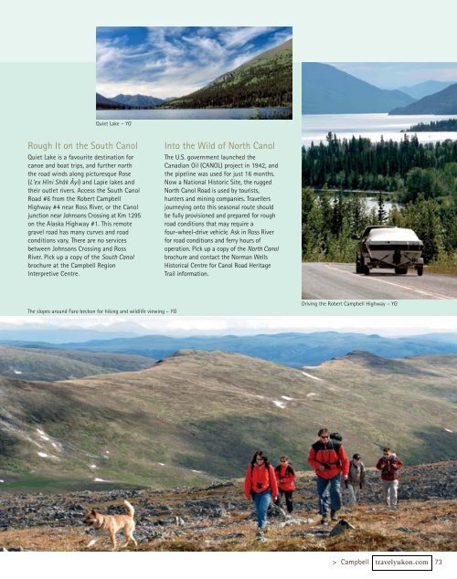
Quiet Lake – YG<br />
Rough It on the South Canol<br />
Quiet Lake is a favourite destination for<br />
canoe and boat trips, and further north<br />
the road winds along picturesque Rose<br />
(L’ex Hîni Shâk Âyi) and Lapie lakes and<br />
their outlet rivers. Access the South Canol<br />
Road #6 from the Robert Campbell<br />
Highway #4 near Ross River, or the Canol<br />
junction near Johnsons Crossing at Km 1295<br />
on the Alaska Highway #1. This remote<br />
gravel road has many curves and road<br />
conditions vary. There are no services<br />
between Johnsons Crossing and Ross<br />
River. Pick up a copy of the South Canol<br />
brochure at the Campbell Region<br />
Interpretive Centre.<br />
The slopes around Faro beckon for hiking and wildlife viewing – YG<br />
Into the Wild of North Canol<br />
The U.S. government launched the<br />
Canadian Oil (CANOL) project in 1942, and<br />
the pipeline was used for just 16 months.<br />
Now a National Historic Site, the rugged<br />
North Canol Road is used by tourists,<br />
hunters and mining companies. <strong>Travel</strong>lers<br />
journeying onto this seasonal route should<br />
be fully provisioned and prepared for rough<br />
road conditions that may require a<br />
four-wheel-drive vehicle. Ask in Ross River<br />
for road conditions and ferry hours of<br />
operation. Pick up a copy of the North Canol<br />
brochure and contact the Norman Wells<br />
Historical Centre for Canol Road Heritage<br />
Trail information.<br />
Driving the Robert Campbell Highway – YG<br />
> Campbell travelyukon.com 73