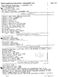
Final Second Five-Year Review Report Fort Ord Superfund Site ...
Final Second Five-Year Review Report Fort Ord Superfund Site ...
Final Second Five-Year Review Report Fort Ord Superfund Site ...

Create successful ePaper yourself
Turn your PDF publications into a flip-book with our unique Google optimized e-Paper software.
and 0.098 ppbv). Both the indoor and outdoor samples collected at Lexington Court were within the<br />
range of background concentrations 0.067 ppbv and 0.13 ppbv measured in outdoor air during the <strong>Fort</strong><br />
<strong>Ord</strong> outdoor air monitoring. These results then support the conclusion that groundwater contamination<br />
appears to be an insignificant contributing source of VOCs to indoor air in the source area<br />
(MACTEC, 2006b).<br />
11.1.2 Groundwater<br />
The upper three aquifers at the former <strong>Fort</strong> <strong>Ord</strong>, none of which are currently used as a drinking water<br />
source within the OUCTP, have been found to contain concentrations above MCLs for CT and other<br />
VOCs within the OUCTP. The aquifer cleanup levels are listed in Table 7. The presence of CT in these<br />
three aquifers is described below.<br />
A-Aquifer Groundwater<br />
The length of the CT plume in the A-Aquifer is approximately 1.6 miles, and ranges from 500 to 750 feet<br />
in width along the length of the plume (see Plate 3). The State MCL for CT in groundwater is 0.5 μg/L,<br />
and the maximum historic detected concentration in the A-Aquifer since groundwater monitoring was<br />
initiated in 1992 was 19 μg/L. The most recent maximum concentration of CT detected in the A-Aquifer<br />
was 15 μg/L. Low levels of PCE and TCE have also been identified in the A-Aquifer within the OUCTP.<br />
Hydraulic communication between this A-Aquifer and underlying aquifers is limited to those areas west<br />
of the OUCTP where the <strong>Fort</strong> <strong>Ord</strong>-Salinas Valley Aquiclude clay unit pinches out, or where it has been<br />
penetrated by wells without adequate sanitary seals. Two such vertical conduits have been identified and<br />
have resulted in the migration of CT from the A-Aquifer to the underlying Upper and Lower 180-Foot<br />
Aquifers. All identified vertical conduits have been destroyed (grouted and sealed) eliminating hydraulic<br />
communication between the A-Aquifer and the underlying aquifers.<br />
Upper 180-Foot Aquifer<br />
There are two narrow, parallel plumes in this aquifer as shown on Plate 3. The western CT plume in the<br />
Upper 180-Foot Aquifer is approximately 0.7 miles in length and 400 feet in width. The eastern CT<br />
plume in the Upper 180-Foot Aquifer is approximately 0.9 miles in length and ranges from 200 to 600<br />
feet in width. The maximum historic detected concentration in the Upper 180-Foot Aquifer since<br />
groundwater monitoring was initiated was 9.8 μg/L. The most recent maximum concentration of CT<br />
detected in the Upper 180-Foot Aquifer was 3.5 μg/L.<br />
Lower 180-Foot Aquifer<br />
There are two separate plumes in this aquifer. The northern CT plume in the Lower 180-Foot Aquifer is<br />
approximately 0.75 miles in length and 1,000 feet in width. The maximum historic detected<br />
concentration in the Lower 180-Foot Aquifer since groundwater monitoring was initiated was 6.95 μg/L.<br />
The most recent maximum concentration of CT detected in the Lower 180-Foot Aquifer was 3.6 μg/L.<br />
Low levels of 1,2-DCA have also been detected in the Lower 180-Foot Aquifer.<br />
11.2 Remedial Actions<br />
11.2.1 Remedy Selection<br />
The following four alternatives were evaluated in the FS (MACTEC, 2006b).<br />
<strong>Final</strong><br />
11-2<br />
FORMER FT ORD 5YR REVIEW 2007_FINAL United States Department of the Army