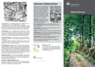
Macroalgae and phytoplankton as indicators of ... - Naturstyrelsen
Macroalgae and phytoplankton as indicators of ... - Naturstyrelsen
Macroalgae and phytoplankton as indicators of ... - Naturstyrelsen

You also want an ePaper? Increase the reach of your titles
YUMPU automatically turns print PDFs into web optimized ePapers that Google loves.
inputs (Figures 3.9 <strong>and</strong> 3.10) where<strong>as</strong> they are much broader in Limfjorden<br />
west <strong>of</strong> Mors <strong>and</strong> Roskilde Fjord – are<strong>as</strong> with a strong response <strong>of</strong><br />
TN concentration to TN inputs (Figures 3.11 <strong>and</strong> 3.12). All cover <strong>indicators</strong><br />
have been estimated to a st<strong>and</strong>ard depth <strong>of</strong> 7 m for comparison<br />
across are<strong>as</strong>. This depth st<strong>and</strong>ardisation will reduce the indicator precision<br />
for those sites with few data around 7 m, <strong>and</strong> in such c<strong>as</strong>es it will be<br />
more appropriate to choose a st<strong>and</strong>ardisation depth representing an average<br />
depth for the area.<br />
The figures also illustrate that along the open co<strong>as</strong>ts <strong>of</strong> the Sound <strong>and</strong><br />
Nivå Bay, status cl<strong>as</strong>s b<strong>and</strong>s <strong>of</strong> total cover were close to 100% <strong>and</strong> all<br />
very narrow. This is because total cover levels are potentially high in the<br />
open are<strong>as</strong> <strong>and</strong> <strong>of</strong>ten reach the upper boundary <strong>of</strong> 100%. Therefore, future<br />
modelling <strong>of</strong> total cover levels <strong>and</strong> cl<strong>as</strong>s boundaries for open co<strong>as</strong>tal<br />
are<strong>as</strong> should represent a water depth <strong>of</strong> 9 m where light limitation is<br />
more intense <strong>and</strong> where cover levels consequently are lower than at a<br />
depth <strong>of</strong> 7 m.<br />
In Limfjorden west <strong>of</strong> Mors status cl<strong>as</strong>s boundaries were well separated<br />
for all variables except for the fraction <strong>of</strong> opportunists (Figure 3.11). The<br />
narrow status cl<strong>as</strong>s b<strong>and</strong>s for the fraction <strong>of</strong> opportunists in this area are<br />
due to the high salinities which weaken the response <strong>of</strong> the fraction <strong>of</strong><br />
opportunists to TN (Figure 3.8).<br />
For the Sound <strong>and</strong> Nivå Bay, the mean levels <strong>of</strong> the algal <strong>indicators</strong> for<br />
the years 2001-2005 typically fell within the status cl<strong>as</strong>s 'bad'. The relatively<br />
low TN levels <strong>of</strong> the Sound thus give expectations <strong>of</strong> higher levels<br />
<strong>of</strong> algal cover <strong>and</strong> numbers <strong>of</strong> perennial species <strong>and</strong> lower fractions <strong>of</strong><br />
opportunists than found. B<strong>as</strong>ed on the Swedish macrophyte index, the<br />
ecological status <strong>of</strong> the northern Sound is <strong>as</strong>sessed <strong>as</strong> moderate<br />
(http://www.viss.lst.se/; district= Södra Östersjön, vattenkategori=Kust; Öresund).<br />
45