Rural Development Policies and Sustainable Land Use in the ...
Rural Development Policies and Sustainable Land Use in the ...
Rural Development Policies and Sustainable Land Use in the ...

You also want an ePaper? Increase the reach of your titles
YUMPU automatically turns print PDFs into web optimized ePapers that Google loves.
METHODS AND MODELS 33<br />
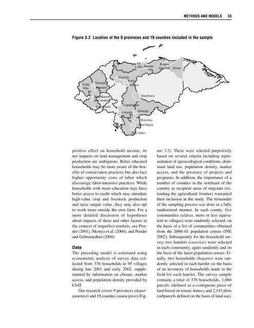
Figure 3.2 Location of <strong>the</strong> 9 prov<strong>in</strong>ces <strong>and</strong> 19 counties <strong>in</strong>cluded <strong>in</strong> <strong>the</strong> sample<br />
La<br />
Ceiba Jutiapa<br />
Bonito<br />
Oriental<br />
Iriona<br />
Santa<br />
Rita<br />
Naranjito<br />
Lepaera<br />
San Manuel<br />
de Colohete<br />
C<strong>and</strong>elaria<br />
Victoria<br />
Yorito<br />
Sulaco<br />
Lepaterique<br />
Curarén<br />
Morolica<br />
Apacilagua<br />
El Corpus<br />
Guaimaca<br />
Gü<strong>in</strong>ope<br />
positive effect on household <strong>in</strong>come, its<br />
net impacts on l<strong>and</strong> management <strong>and</strong> crop<br />
production are ambiguous. Better educated<br />
households may be more aware of <strong>the</strong> benefits<br />
of conservation practices but also face<br />
higher opportunity costs of labor which<br />
discourage labor-<strong>in</strong>tensive practices. While<br />
households with more education may have<br />
better access to credit which may stimulate<br />
high-value crop <strong>and</strong> livestock production<br />
<strong>and</strong> raise output value, <strong>the</strong>y may also opt<br />
to work more outside <strong>the</strong> own farm. For a<br />
more detailed discussion of hypo<strong>the</strong>ses<br />
about impacts of <strong>the</strong>se <strong>and</strong> o<strong>the</strong>r factors <strong>in</strong><br />
<strong>the</strong> context of imperfect markets, see Pender<br />
(2001), Nkonya et al. (2004), <strong>and</strong> Pender<br />
<strong>and</strong> Gebremedh<strong>in</strong> (2004).<br />
Data<br />
The preced<strong>in</strong>g model is estimated us<strong>in</strong>g<br />
econometric analysis of survey data collected<br />
from 376 households <strong>in</strong> 95 villages<br />
dur<strong>in</strong>g late 2001 <strong>and</strong> early 2002, supplemented<br />
by <strong>in</strong>formation on climate, market<br />
access, <strong>and</strong> population density provided by<br />
CIAT.<br />
Our research covers 9 prov<strong>in</strong>ces (departamentos)<br />
<strong>and</strong> 19 counties (municipios) (Figure<br />
3.2). These were selected purposively<br />
based on several criteria <strong>in</strong>clud<strong>in</strong>g representation<br />
of agroecological conditions, dom<strong>in</strong>ant<br />
l<strong>and</strong> use, population density, market<br />
access, <strong>and</strong> <strong>the</strong> presence of projects <strong>and</strong><br />
programs. In addition, <strong>the</strong> importance of a<br />
number of counties <strong>in</strong> <strong>the</strong> nor<strong>the</strong>ast of <strong>the</strong><br />
country as recipient areas of migrants (extend<strong>in</strong>g<br />
<strong>the</strong> agricultural frontier) warranted<br />
<strong>the</strong>ir <strong>in</strong>clusion <strong>in</strong> <strong>the</strong> study. The rema<strong>in</strong>der<br />
of <strong>the</strong> sampl<strong>in</strong>g process was done <strong>in</strong> a fully<br />
r<strong>and</strong>omized manner. In each county, five<br />
communities (aldeas, more or less equivalent<br />
to villages) were r<strong>and</strong>omly selected, on<br />
<strong>the</strong> basis of a list of communities obta<strong>in</strong>ed<br />
from <strong>the</strong> 2000–01 population census (INE<br />
2002). Subsequently for <strong>the</strong> household survey,<br />
two hamlets (caserios) were selected<br />
<strong>in</strong> each community, aga<strong>in</strong> r<strong>and</strong>omly <strong>and</strong> on<br />
<strong>the</strong> basis of <strong>the</strong> latest population census. F<strong>in</strong>ally,<br />
two households (hogares) were r<strong>and</strong>omly<br />
selected <strong>in</strong> each hamlet on <strong>the</strong> basis<br />
of an <strong>in</strong>ventory of households made <strong>in</strong> <strong>the</strong><br />
field for each hamlet. The survey sample<br />
conta<strong>in</strong>s a total of 376 households, 1,066<br />
parcels (def<strong>in</strong>ed as a contiguous piece of<br />
l<strong>and</strong> based on tenure status), <strong>and</strong> 2,143 plots<br />
(subparcels def<strong>in</strong>ed on <strong>the</strong> basis of l<strong>and</strong> use).