PRA-Manual Embracing Participitation tools-only.pdf - PACA
PRA-Manual Embracing Participitation tools-only.pdf - PACA
PRA-Manual Embracing Participitation tools-only.pdf - PACA

Create successful ePaper yourself
Turn your PDF publications into a flip-book with our unique Google optimized e-Paper software.
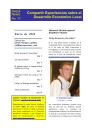
EMBRACING PARTICIPATION IN DEVELOPMENT: Wisdom from the Field 3.25<br />
STEPS<br />
1. Select an open space where the map can be prepared on the<br />
ground.<br />
2. Ask the local people to prepare a visual presentation of their<br />
settlement that can help us understand their community.<br />
3. Ask the group to show all the features of the settlement that they<br />
can think of.<br />
4. Leave the group to prepare the map and observe the process.<br />
5. Labels or symbols can be used to identify different facilities,<br />
features or infrastructure (allow the participants to select the<br />
symbols).<br />
6. Any additional information that the facilitators want to discuss<br />
should be introduced <strong>only</strong> at the end, after the group has finished<br />
preparing their map.<br />
7. Once the map is ready ‘interview the output’ by asking questions.<br />
Social maps can lead to discussions about diversity within the area and the<br />
differences between different parts of the settlement. Sometimes discussions<br />
may even bring out social, economic or political conflicts within the community,<br />
for which possible solutions can also be discussed.<br />
During participatory appraisals with adolescents in urban compounds in Zambia,<br />
we had to use social mapping in stages and sequences. On the first day, when we<br />
had a de-briefing session at the clinic, the NHC members and the clinicians that<br />
took part in the appraisals were asked to prepare a map of the compound. Since<br />
the compounds are very large, it was important to zone and divide the compound,<br />
so that we could capture the diversity and natural divisions within it. This also<br />
helped to crosscheck that we did not leave out any area during the appraisal. The<br />
NHC members, who are local residents, decided the basis on which to make these<br />
divisions. Usually the criteria included – population density, type of housing, plot<br />
sizes, access to services, perceptions of relative well-being, etc.<br />
Part 3<br />
Since the first social maps covered a large area, it was not feasible to have all the<br />
houses plotted on them at this stage. Once the different zones were identified,<br />
the facilitators were divided in smaller teams and were allotted separate work<br />
zones. Once the smaller team started working in a zone, a detailed map of the<br />
zone was prepared with the residents. Most of these also included a visual representation<br />
of all the households living in the area. Usually these were prepared by<br />
groups of adolescents, but there were instances when we started the mapping<br />
exercise with a group of adults. In both cases it proved to be an excellent way to<br />
introduce ourselves to the community and to build rapport with them.<br />
The local residents, using their own criteria, also divided the zonal social maps into<br />
different neighborhoods. When we worked with adolescents in several of these<br />
neighborhoods, detailed social information was either plotted on the zonal map or<br />
they prepared a separate neighborhood map. It was on these maps that demographic<br />
details were also presented (see Census Mapping in next section for details).