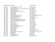
Volume 1 - Executive Summary - Office of the Chief Financial Officer
Volume 1 - Executive Summary - Office of the Chief Financial Officer
Volume 1 - Executive Summary - Office of the Chief Financial Officer

Create successful ePaper yourself
Turn your PDF publications into a flip-book with our unique Google optimized e-Paper software.
District, RLA, or any entity <strong>of</strong> <strong>the</strong> District, or by an urban renewal plan, shall apply;<br />
(4) The urban renewal plans for <strong>the</strong> District <strong>of</strong> Columbia urban renewal areas,<br />
including 14th Street, Columbia Plaza, Downtown, Fort Lincoln, H Street, Nor<strong>the</strong>ast No. 1,<br />
Northwest No. 1, Shaw School, Southwest B, Southwest C, and Southwest C-1, shall no longer be<br />
<strong>of</strong> any force or effect.<br />
(b) For <strong>the</strong> purposes <strong>of</strong> this section, <strong>the</strong> term “District <strong>of</strong> Columbia Urban Renewal<br />
Closeout Agreements” means closeout agreements between HUD and <strong>the</strong> District, RLA, or any<br />
entity <strong>of</strong> <strong>the</strong> District with respect to <strong>the</strong> urban renewal projects (including but not limited to all<br />
neighborhood development programs) <strong>of</strong> <strong>the</strong> District <strong>of</strong> Columbia, including but not limited to <strong>the</strong><br />
following: 14th Street Urban Renewal Project, Columbia Plaza Urban Renewal Project,<br />
Downtown Urban Renewal Project, Fort Lincoln Urban Renewal Project, H Street Urban Renewal<br />
Project, Nor<strong>the</strong>ast No. 1 Urban Renewal Project, Northwest No. 1 Urban Renewal Project, Shaw<br />
School Urban Renewal Project, Southwest B Urban Renewal Project, Southwest C Urban<br />
Renewal Project, and Southwest C-1 Urban Renewal Project.<br />
SEC. 210. An Act Authorizing <strong>the</strong> construction, repair, and preservation <strong>of</strong> certain public<br />
works on rivers and harbors, and for o<strong>the</strong>r purposes, approved August 30, 1935 (Pub. L. No.<br />
74-409; 49 Stat. 1028), is amended by adding a new section 15 to read as follows:<br />
“Sec. 15. The Secretary <strong>of</strong> <strong>the</strong> Army, acting through <strong>the</strong> <strong>Chief</strong> <strong>of</strong> Engineers, shall modify<br />
<strong>the</strong> Washington Channel portion <strong>of</strong> <strong>the</strong> Washington Harbor project for navigation, District <strong>of</strong><br />
Columbia, authorized by this act as follows:<br />
“The following portion <strong>of</strong> <strong>the</strong> existing Washington Channel is deauthorized: beginning at<br />
Washington Harbor Channel Geometry Centerline <strong>of</strong> <strong>the</strong> 400 foot wide main navigational ship<br />
channel, Centerline Station No. 103+73.12, coordinates North 441948.20, East 1303969.30, as<br />
stated and depicted on <strong>the</strong> Condition Survey Anacostia, Virginia, Washington and Magazine Bar<br />
Shoal Channels, Washington, D.C., Sheet 6 <strong>of</strong> 6, prepared by <strong>the</strong> U.S. Army Corps <strong>of</strong> Engineers,<br />
Baltimore district, July 2007; <strong>the</strong>nce departing <strong>the</strong> aforementioned centerline traveling <strong>the</strong><br />
following courses and distances: N. 40º 10’ 45” E., 200.00 feet to a point, on <strong>the</strong> outline <strong>of</strong> said<br />
400’ wide channel <strong>the</strong>nce binding on said outline <strong>the</strong> following three (3) courses and distances: S.<br />
49º 49’15” E., 1,507.86 feet to a point, <strong>the</strong>nce; S. 29º 44’ 42” E., 2,083.17 feet to a point, <strong>the</strong>nce; S.<br />
11º 27’ 04” E., 363.00 feet to a point, <strong>the</strong>nce; S. 78º 32’ 56” W., 200.00 feet to a point binding on<br />
<strong>the</strong> centerline <strong>of</strong> <strong>the</strong> 400 foot wide main navigational channel at Centerline Station No. 65+54.31,<br />
<strong>the</strong>nce; continuing with <strong>the</strong> aforementioned centerline <strong>the</strong> following courses and distances: N. 11º<br />
27’ 04” W., 330.80 feet to a point, Centerline Station No. 68+85.10, <strong>the</strong>nce; N. 29º 44’ 42” W.,<br />
2,015.56 feet to a point, Centerline Station No. 89+00.67, <strong>the</strong>nce; N. 49º 49’ 15” W., 1,472.45 feet<br />
to <strong>the</strong> point <strong>of</strong> beginning, such area in total containing a computed area <strong>of</strong> 777,284 square feet or<br />
17.84399 acres <strong>of</strong> riparian water way.”<br />
SEC. 211. (a) Within 90 days after <strong>the</strong> effective date <strong>of</strong> this section, <strong>the</strong> director <strong>of</strong> each<br />
federal agency with jurisdiction over <strong>the</strong> following properties in <strong>the</strong> District <strong>of</strong> Columbia shall<br />
transfer all right, title, and interest <strong>of</strong> <strong>the</strong> United States in each property to <strong>the</strong> government <strong>of</strong> <strong>the</strong><br />
District <strong>of</strong> Columbia. If jurisdiction over a property is held by <strong>the</strong> District <strong>of</strong> Columbia, <strong>the</strong> District<br />
<strong>of</strong> Columbia may execute a quitclaim deed on behalf <strong>of</strong> <strong>the</strong> United States to transfer all right, title,<br />
and interest <strong>of</strong> <strong>the</strong> United States in <strong>the</strong> property to <strong>the</strong> government <strong>of</strong> <strong>the</strong> District <strong>of</strong> Columbia:<br />
(1) Parcel 255, Lots 13, 15, and 24 (Southwest Waterfront), including <strong>the</strong> riparian<br />
area designated as Pier 5;<br />
(2) Square 473, Lots 819, 846, 847, 848, 849, 850, 884 (Southwest Waterfront);<br />
(3) Square 503, Lot 884 (Southwest Waterfront);<br />
(4) Square 390, Lot 54 (Southwest Waterfront);<br />
23