Final Technical Report - weADAPT
Final Technical Report - weADAPT
Final Technical Report - weADAPT
- No tags were found...

Create successful ePaper yourself
Turn your PDF publications into a flip-book with our unique Google optimized e-Paper software.
4 Characterization of Current Climate and Scenarios of Future Climate<br />
Change<br />
4.1 Activities Conducted: Development of high resolution regional climate scenario for<br />
the lower Mekong River region<br />
4.2 Description of Scientific Methods and Data<br />
This research had developed high resolution climate scenario for Southeast Asia<br />
region. The simulated climate scenario provides high resolution daily climate data at the<br />
resolution of 0.1 degree (approx. 10km), which would then be used as input for<br />
hydrological and crop model.<br />
The climate model used for this simulation is Conformal Cubic Atmospheric<br />
Model (CCAM), which is the second-generation regional climate model developed<br />
specifically for Australasian region by the CSIRO Division of Atmospheric Research in<br />
Australia. (McGregor et al, 1998) CCAM has also been evaluates in several international<br />
model inter-comparison exercises to be among the best climate model for Asian region.<br />
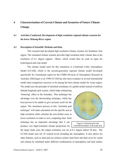
The model uses the principle of stretched coordinate of a global model instead of uniform<br />
latitude-longitude grid system, which helps minimizing<br />
‘bouncing’ effect at the boundary. This technique has<br />
advantage over the downscaling technique, which has<br />
been proven to be unable to give accurate result for the<br />
region. The simulation process in this “stretched grid<br />
technique” will make calculation for the specific area at<br />
high resolution while calculate the area further away at<br />
lower resolution in order to save computing time. Such<br />
technique has an important advantage that it can<br />
Figure 8: Stretched-grid with<br />
produce very high-resolution climate projections for controlled boundary in the study area<br />
the target study area, the output resolution was set at 0.1 degree (about 10 km). The<br />
CCAM model runs for 18 vertical levels including the stratosphere. It also allows for<br />
other features, such as land and sea surfaces surface land form and land cover be varied<br />
and climate be simulated under different combinations of atmospheric and land surface<br />
<strong>Final</strong> technical report – AIACC AS07 28