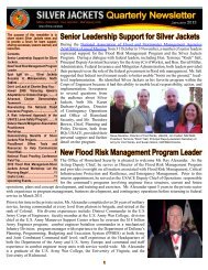
Using Multi-Objective Management to Reduce Flood Losses in Your
Using Multi-Objective Management to Reduce Flood Losses in Your
Using Multi-Objective Management to Reduce Flood Losses in Your

You also want an ePaper? Increase the reach of your titles
YUMPU automatically turns print PDFs into web optimized ePapers that Google loves.
COBRA: The Coastal Barrier Resources Act adm<strong>in</strong>istered by NOAA. COBRA<br />
places development restrictions on identified coastal barriers.<br />
Community: A term used by the Federal Emergency <strong>Management</strong> Agency <strong>to</strong><br />
designate local governments eligible <strong>to</strong> participate <strong>in</strong> the National <strong>Flood</strong> Insurance<br />
Program. A local government can be a “community” if the state enabl<strong>in</strong>g<br />
legislation gives it the authority <strong>to</strong> regulate land use and development. It usually<br />
<strong>in</strong>cludes cities, villages, <strong>to</strong>wnships, boroughs, Indian tribes, and counties (usually<br />
for their un<strong>in</strong>corporated areas only).<br />
Con<strong>to</strong>ur: A l<strong>in</strong>e of equal elevation on a <strong>to</strong>pographic (con<strong>to</strong>ur) map.<br />
Critical facilities: Build<strong>in</strong>gs or locations vital <strong>to</strong> the flood response effort, such<br />
as a police station or hospital, and build<strong>in</strong>gs or locations that if flooded would<br />
create secondary disasters, such as hazardous materials facilities.<br />
CRS: Community Rat<strong>in</strong>g System of the National <strong>Flood</strong> Insurance Program.<br />
Datum: A reference surface used <strong>to</strong> ensure that all elevation records are properly<br />
related. Many communities have their own datum, which was developed before<br />
there was a national standard. The current national datum is the National Geodetic<br />
Vertical Datum (NGVD), which is <strong>in</strong> relation <strong>to</strong> mean sea level. It is be<strong>in</strong>g<br />
replaced by the North American Vertical Datum (NAVD).<br />
Discharge: The amount of water that passes a po<strong>in</strong>t <strong>in</strong> a given period of time.<br />
Rate of discharge is usually measured <strong>in</strong> cubic feet per second (cfs).<br />
Divide: The boundary of a watershed. The divide is the high ground and the<br />
river or lake is the lowest ground. Ra<strong>in</strong> and snowmelt flow from the divide <strong>to</strong> the<br />
receiv<strong>in</strong>g stream or lake.<br />
Dra<strong>in</strong>age area: The <strong>to</strong>tal land area of a watershed, measured <strong>in</strong> acres or square<br />
miles.<br />
Dra<strong>in</strong>age bas<strong>in</strong>: See “watershed.”<br />
Dredg<strong>in</strong>g: Remov<strong>in</strong>g the sediment or sand from a stream channel, lake, or ocean<br />
<strong>to</strong> provide sufficient depth for navigation or <strong>to</strong> obta<strong>in</strong> material for construction or<br />
beach nourishment.<br />
EDA: U.S. Department of Commerce, Economic Development Adm<strong>in</strong>istration.<br />
EPA: The U.S. Environmental Protection Agency.<br />
Encroachment: An activity or development project with<strong>in</strong> a floodway that results<br />
<strong>in</strong> an obstruction <strong>to</strong> flood flows and/or an <strong>in</strong>crease <strong>in</strong> flood levels.<br />
Environmental assessment: An exam<strong>in</strong>ation of the positive and adverse impacts<br />
on the environment of a proposed project.<br />
C-2