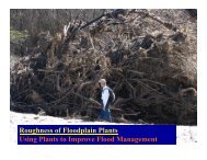
Using Multi-Objective Management to Reduce Flood Losses in Your
Using Multi-Objective Management to Reduce Flood Losses in Your
Using Multi-Objective Management to Reduce Flood Losses in Your

You also want an ePaper? Increase the reach of your titles
YUMPU automatically turns print PDFs into web optimized ePapers that Google loves.
Rip rap: Large rocks placed along a bank or shorel<strong>in</strong>e <strong>to</strong> protect it from erosion.<br />
Riparian ecosystem: A dist<strong>in</strong>ct association of flora, fauna, and soil occurr<strong>in</strong>g<br />
along a river, stream, or other body of water and dependent upon high water<br />
tables and occasional flood<strong>in</strong>g <strong>to</strong> ma<strong>in</strong>ta<strong>in</strong> its viability. These areas often exhibit<br />
high biological productivity and species diversity.<br />
River<strong>in</strong>e: Of or produced by a river. River<strong>in</strong>e floodpla<strong>in</strong>s have readily<br />
identifiable channels. <strong>Flood</strong>way maps can only be prepared for river<strong>in</strong>e<br />
floodpla<strong>in</strong>s.<br />
Sand dunes: Naturally occurr<strong>in</strong>g accumulations of sand that form ridges or<br />
mounds landward of a beach.<br />
SBA: U.S. Small Bus<strong>in</strong>ess Adm<strong>in</strong>istration.<br />
SCS: Soil Conservation Service, the old name for the U.S. Department of<br />
Agriculture’s Natural Resources Conservation Service.<br />
Sensitive area: An area def<strong>in</strong>ed by state or local regulations as deserv<strong>in</strong>g special<br />
protection because of its unique natural features or its value as habitat for a wide<br />
range of species of flora and fauna. A sensitive area is subject <strong>to</strong> more restrictive<br />
development regulations than other floodpla<strong>in</strong>s or wetlands.<br />
SFHA: Special <strong>Flood</strong> Hazard Area.<br />
Sheet flow: A condition of flood<strong>in</strong>g where there is mov<strong>in</strong>g water but no<br />
identifiable channel. <strong>Flood</strong><strong>in</strong>g depths are usually shallow (less than 3 feet). Sheet<br />
flow may have a high velocity, as on alluvial fans.<br />
SHMO: State hazard mitigation officer, usually <strong>in</strong> the state emergency<br />
management agency.<br />
SHPO: State his<strong>to</strong>ric preservation officer <strong>in</strong> the state his<strong>to</strong>ric preservation<br />
agency.<br />
Special <strong>Flood</strong> Hazard Area (SFHA): The base floodpla<strong>in</strong> del<strong>in</strong>eated on a <strong>Flood</strong><br />
Insurance Rate Map. The SFHA is mapped as a Zone A (see def<strong>in</strong>ition). In<br />
coastal situations, Zone V (see def<strong>in</strong>ition) is also a part of the SFHA. The SFHA<br />
may or may not encompass all of a community’s flood problems.<br />
Standard project flood: A very large, low-frequency flood used as the standard<br />
for design<strong>in</strong>g major flood control structures.<br />
Structural measures: <strong>Flood</strong> control techniques that modify flood flows.<br />
Examples are dams, reservoirs, levees, channel alterations, and diversions.<br />
Surcharge: An <strong>in</strong>crease <strong>in</strong> flood elevation due <strong>to</strong> an obstruction of the floodpla<strong>in</strong><br />
that has reduced its conveyance capacity. <strong>Flood</strong>way boundaries are usually set<br />
based on a specified surcharge that is allowed <strong>to</strong> be caused by new development <strong>in</strong><br />
the floodpla<strong>in</strong>.<br />
C-6