Draft Supplemental Environmental Impact Statement<strong>Keystone</strong> <strong>XL</strong> <strong>Project</strong>Table <strong>2.1</strong>-3Summary <strong>of</strong> Lands AffectedPreferred Alternative Route in NebraskaFinal EIS PortionRoute Modification PortionLand Affected Land Affected Land Affected Land AffectedDuringDuring DuringDuringConstruction a,d Operation b Construction a,d Operation bFacility(acres)(acres) (acres)(acres)Pipeline ROW 875.28 399.14 276<strong>2.1</strong>3 1264.54Additional TWAs 86.09 0.00 140.79 0.00Pump Stations e 2<strong>2.1</strong>2 2<strong>2.1</strong>2 45.00 45.00Access Roads c 12.02 0.00 58.48 0.00Pipe Stockpile Sites, Rail Sidings,Contractor Yards TBD 0.00 TBD f 0.00Construction Camp TBD 0.00 TBD f 0.00Totals 995.51 421.26 3006.40 1309.54aDisturbance is based on a total <strong>of</strong> 110-foot construction ROW for a 36-inch-diameter pipe, except in certain wetlands, culturalsites, shelterbelts, residential areas, and commercial/industrial areas where an 85-foot construction ROW will be used, or in areasrequiring extra width for workspace necessitated by site conditions.bOperational acreage was estimated based on a 50-foot permanent ROW in all areas. Any pigging facilities will be located withinpump stations. IMLVs and densitometers will be constructed within <strong>the</strong> construction easement and operated within a 50-foot-by50-foot area or 50-foot-by-66-foot area, respectively, within <strong>the</strong> permanently maintained 50-foot ROW. All MLVs and meterswill be located within <strong>the</strong> area associated with a pump station or permanent ROW. Consequently, <strong>the</strong> acres <strong>of</strong> disturbance for<strong>the</strong>se aboveground facilities are captured within <strong>the</strong> Pipeline ROW and Pump Station Facilities categories within <strong>the</strong> table.cTemporary and permanent disturbances associated with access roads are based on 30-foot width; all non-public roads areconservatively estimated to require upgrades and maintenance during construction.dTBD = To Be Determined.ePump station acreages are a nominal 15 acres each for <strong>the</strong> four pump stations that are tentatively sited. For PS-26 (sited on <strong>the</strong>Final EIS portion <strong>of</strong> <strong>the</strong> preferred alternative route) <strong>the</strong> actual acreage is 7.12 acres.fTypical sizes and numbers <strong>of</strong> ancillary facilities are: three pipe yards per spread averaging 40 acres each, one rail siding perspread averaging 10 acres, and one main contractor yard per spread averaging 30 acres. Construction camp sites can rangebetween 50 and 100 acres in size (may include a contractor yard adjacent to <strong>the</strong> camp).There are currently 48 access roads (private roads) along <strong>the</strong> Nebraska portion <strong>of</strong> <strong>the</strong> proposedroute, but additional access roads may be needed. The proposed <strong>Project</strong> would also includecontractor yards, pipe storage yards, and rail sidings. In addition, a construction worker campcould be required in nor<strong>the</strong>rn Nebraska to avoid occupying all <strong>of</strong> <strong>the</strong> limited available rentalunits and hotel rooms during construction. All pigging facilities (high-resolution internal lineinspection, maintenance, and cleaning tools) would be located within pump station yards (seeSection <strong>2.1</strong>.4.1, Pump Stations).All proposed <strong>Project</strong> facilities for which <strong>the</strong> locations have beenselected are depicted on <strong>the</strong> <strong>pipeline</strong> route sheets in Figures <strong>2.1</strong>.1-3, <strong>2.1</strong>.1-4, and <strong>2.1</strong>.1-5. Section<strong>2.1</strong>.2, Land Requirements, provides a full description <strong>of</strong> land requirements for <strong>the</strong> project.<strong>Project</strong> Description <strong>2.1</strong>-8 March 2013
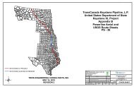
Draft Supplemental Environmental Impact Statement<strong>Keystone</strong> <strong>XL</strong> <strong>Project</strong>Source: exp Energy Services, Inc. 2012b.Figure <strong>2.1</strong>.1-3<strong>Proposed</strong> <strong>Project</strong> <strong>Overview</strong>—Montana<strong>Project</strong> Description <strong>2.1</strong>-9 March 2013