to download report - Geological Survey of Ireland
to download report - Geological Survey of Ireland
to download report - Geological Survey of Ireland
- No tags were found...
You also want an ePaper? Increase the reach of your titles
YUMPU automatically turns print PDFs into web optimized ePapers that Google loves.
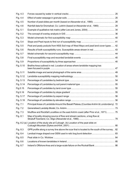
Fig. 4.3 Forces caused by water in vertical cracks ........................................................................ 25Fig. 4.4 Effect <strong>of</strong> water seepage in granular soils .......................................................................... 25Fig. 4.5 Number <strong>of</strong> peat slides per month (based on Alexander et al., 1985) ................................. 28Fig. 4.6 Rainfall data for Dromahair, Co. Leitrim (based on Alexander et al., 1985) ........................ 29Fig. 5.1 Example <strong>of</strong> qualitative risk matrix (after Lee and Jones, 2004) .......................................... 34Fig. 5.2 The concept <strong>of</strong> overlay analysis in GIS ............................................................................. 36Fig. 5.3 Model schematic for first susceptibility map ..................................................................... 40Fig. 5.4 Slope and Peat inputs <strong>to</strong> first run <strong>of</strong> susceptibility map .................................................... 41Fig. 5.5 Peat and peaty podzols from NSS Soil map <strong>of</strong> West Mayo and peat land cover types ..... 42Fig. 5.6 Results <strong>of</strong> both susceptibility runs. Susceptible areas shown in red ................................. 43Fig. 5.7 Model schematic for second susceptibility map ............................................................... 44Fig. 5.8 Final susceptibility map and recorded landslide events .................................................... 45Fig. 5.9 Proportions <strong>of</strong> susceptibility by three approaches ............................................................ 45Fig. 5.10 Breifne Area outlined in red. Location <strong>of</strong> areas where landslide mapping hasbeen focused in purple ..................................................................................................... 47Fig. 5.11 Satellite image and aerial pho<strong>to</strong>graph <strong>of</strong> the same area.................................................... 49Fig. 5.12 Landslide susceptibility mapping methodology ................................................................. 50Fig. 5.13 Percentage <strong>of</strong> Landslides by bedrock type ....................................................................... 54Fig. 5.14 Percentage <strong>of</strong> Landslides by soil parent material type ...................................................... 55Fig.5.15 Percentage <strong>of</strong> Landslides by land cover type .................................................................... 55Fig 5.16 Percentage <strong>of</strong> Landslides by slope gradient ..................................................................... 55Fig. 5.17 Percentage <strong>of</strong> Landslides by aspect range ....................................................................... 56Fig. 5.18 Percentage <strong>of</strong> Landslides by elevation range .................................................................... 56Fig. 7.1 Principal Areas <strong>of</strong> Landslide Around the Basalt Plateau (Counties Antrim & Londonderry) 72Fig. 7.2 Generalised Landslip Model, Co. Antrim ........................................................................... 73Fig. 7.3 Mudflow and Rockfall Localities on the east Antrim coast (after Prior et al., 1971) ............ 75Fig. 8.1 Map <strong>of</strong> locality showing source <strong>of</strong> flow and stream sections, a bog flow atStraduff Townland, Co. Sligo (Alexander et al., 1986)........................................................ 79Fig. 8.2 (a) Location <strong>of</strong> the study site at Cuilcagh. (b) Location <strong>of</strong> the peat slide onCuilcagh Mountain (Dykes and Kirk, 2001)....................................................................... 80Fig. 8.3 GPR pr<strong>of</strong>ile along a survey line above the scar that is located <strong>to</strong> the south <strong>of</strong> the survey .. 82Fig. 8.4 Landsat image draped over DEM used in relic bog burst detection ................................... 83Fig. 8.5 Peat slide in Co. Wicklow ................................................................................................ 84Fig. 8.6 Locations <strong>of</strong> known landslides in <strong>Ireland</strong> ........................................................................... 85Fig. 8.7 <strong>Ireland</strong>’s Offshore Area and a large-scale failure on the Rockall Bank ............................... 86


