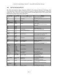
F2 - ATST
F2 - ATST
F2 - ATST

Create successful ePaper yourself
Turn your PDF publications into a flip-book with our unique Google optimized e-Paper software.
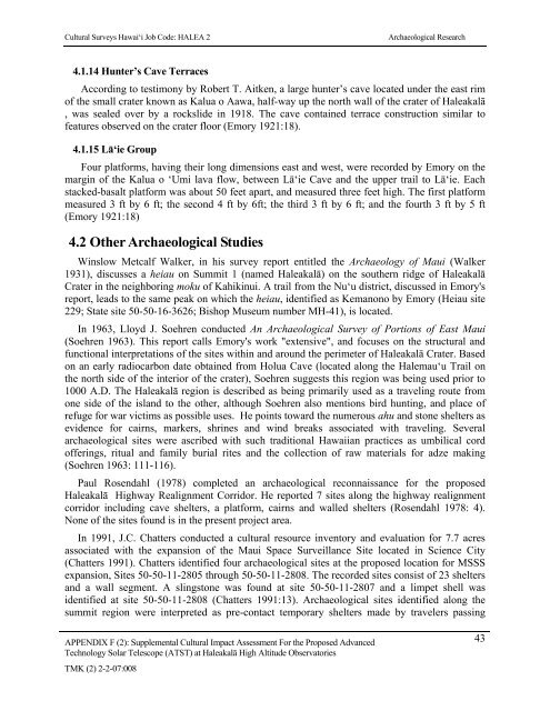
Cultural Surveys Hawai‘i Job Code: HALEA 2Archaeological Research4.1.14 Hunter’s Cave TerracesAccording to testimony by Robert T. Aitken, a large hunter’s cave located under the east rimof the small crater known as Kalua o Aawa, half-way up the north wall of the crater of Haleakalā, was sealed over by a rockslide in 1918. The cave contained terrace construction similar tofeatures observed on the crater floor (Emory 1921:18).4.1.15 Lā‘ie GroupFour platforms, having their long dimensions east and west, were recorded by Emory on themargin of the Kalua o ‘Umi lava flow, between Lā‘ie Cave and the upper trail to Lā‘ie. Eachstacked-basalt platform was about 50 feet apart, and measured three feet high. The first platformmeasured 3 ft by 6 ft; the second 4 ft by 6ft; the third 3 ft by 6 ft; and the fourth 3 ft by 5 ft(Emory 1921:18)4.2 Other Archaeological StudiesWinslow Metcalf Walker, in his survey report entitled the Archaeology of Maui (Walker1931), discusses a heiau on Summit 1 (named Haleakalā) on the southern ridge of HaleakalāCrater in the neighboring moku of Kahikinui. A trail from the Nu‘u district, discussed in Emory'sreport, leads to the same peak on which the heiau, identified as Kemanono by Emory (Heiau site229; State site 50-50-16-3626; Bishop Museum number MH-41), is located.In 1963, Lloyd J. Soehren conducted An Archaeological Survey of Portions of East Maui(Soehren 1963). This report calls Emory's work "extensive", and focuses on the structural andfunctional interpretations of the sites within and around the perimeter of Haleakalā Crater. Basedon an early radiocarbon date obtained from Holua Cave (located along the Halemau‘u Trail onthe north side of the interior of the crater), Soehren suggests this region was being used prior to1000 A.D. The Haleakalā region is described as being primarily used as a traveling route fromone side of the island to the other, although Soehren also mentions bird hunting, and place ofrefuge for war victims as possible uses. He points toward the numerous ahu and stone shelters asevidence for cairns, markers, shrines and wind breaks associated with traveling. Severalarchaeological sites were ascribed with such traditional Hawaiian practices as umbilical cordofferings, ritual and family burial rites and the collection of raw materials for adze making(Soehren 1963: 111-116).Paul Rosendahl (1978) completed an archaeological reconnaissance for the proposedHaleakalā Highway Realignment Corridor. He reported 7 sites along the highway realignmentcorridor including cave shelters, a platform, cairns and walled shelters (Rosendahl 1978: 4).None of the sites found is in the present project area.In 1991, J.C. Chatters conducted a cultural resource inventory and evaluation for 7.7 acresassociated with the expansion of the Maui Space Surveillance Site located in Science City(Chatters 1991). Chatters identified four archaeological sites at the proposed location for MSSSexpansion, Sites 50-50-11-2805 through 50-50-11-2808. The recorded sites consist of 23 sheltersand a wall segment. A slingstone was found at site 50-50-11-2807 and a limpet shell wasidentified at site 50-50-11-2808 (Chatters 1991:13). Archaeological sites identified along thesummit region were interpreted as pre-contact temporary shelters made by travelers passingAPPENDIX F (2): Supplemental Cultural Impact Assessment For the Proposed Advanced 43Technology Solar Telescope (<strong>ATST</strong>) at Haleakalā High Altitude ObservatoriesTMK (2) 2-2-07:008