

1 Background - mountain.PROJECTS
1 Background - mountain.PROJECTS
1 Background - mountain.PROJECTS

You also want an ePaper? Increase the reach of your titles
YUMPU automatically turns print PDFs into web optimized ePapers that Google loves.
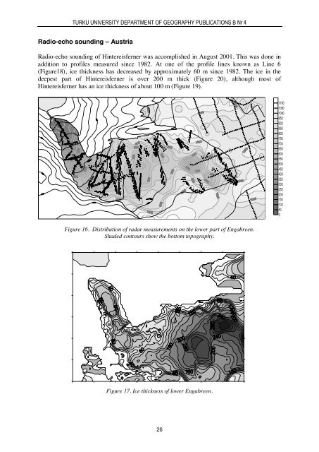
TURKU UNIVERSITY DEPARTMENT OF GEOGRAPHY PUBLICATIONS B Nr 4Radio-echo sounding – AustriaRadio-echo sounding of Hintereisferner was accomplished in August 2001. This was done inaddition to profiles measured since 1982. At one of the profile lines known as Line 6(Figure18), ice thickness has decreased by approximately 60 m since 1982. The ice in thedeepest part of Hintereisferner is over 200 m thick (Figure 20), although most ofHintereisferner has an ice thickness of about 100 m (Figure 19).110010501000950900850800750700650600550500450400350300250200150100500Figure 16. Distribution of radar measurements on the lower part of Engabreen.Shaded contours show the bottom topography.Figure 17. Ice thickness of lower Engabreen.26


