

1 Background - mountain.PROJECTS
1 Background - mountain.PROJECTS
1 Background - mountain.PROJECTS

Create successful ePaper yourself
Turn your PDF publications into a flip-book with our unique Google optimized e-Paper software.
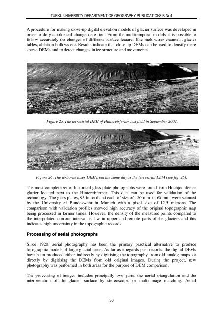
TURKU UNIVERSITY DEPARTMENT OF GEOGRAPHY PUBLICATIONS B Nr 4A procedure for making close-up digital elevation models of glacier surface was developed inorder to do glaciological change detection. From the multitemporal models it is possible tofollow accurately the changes of different surface features like melt water channels, glaciertables, ablation hollows etc. Results indicate that close-up DEMs can be used to densify moresparse DEMs and to detect changes in ice structure and movements.Figure 25. The terrestrial DEM of Hintereisferner test field in September 2002.Figure 26. The airborne laser DEM from the same day as the terrestrial DEM (see fig. 25).The most complete set of historical glass plate photographs were found from Hochjochfernerglacier located next to the Hintereisferner. This data can be used for validation of thetechnology. The glass plates, 93 in total and each of size of 120 mm x 160 mm, were scannedby the University of Bundeswehr in Munich with a pixel size of 12,5 microns. Thecomparison with validation profiles showed high accuracy of the original topographic mapbeing processed in former times. However, the density of the measured points compared tothe interpolated contour interval is low in upper and remote parts of the glaciers and thisindicates high uncertainty in the topographic records.Processing of aerial photographsSince 1920, aerial photography has been the primary practical alternative to producetopographic models of large glacial areas. As far as it regards past records, the digital DEMshave been produced either indirectly by digitising the topography from old analog maps, ordirectly by digitising the DEMs from old original images. During the project, newphotography was performed in both areas for the purpose of DEM comparison.The processing of images includes principally two parts, the aerial triangulation and theinterpretation of the glacier surface by stereoscopic or multi-image matching. Aerial36


