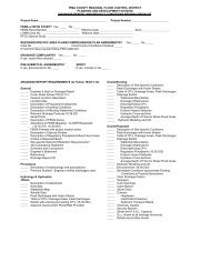
underline-strikeout version of the final draft ordinance - Pima County ...
underline-strikeout version of the final draft ordinance - Pima County ...
underline-strikeout version of the final draft ordinance - Pima County ...

You also want an ePaper? Increase the reach of your titles
YUMPU automatically turns print PDFs into web optimized ePapers that Google loves.
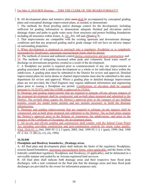
For May 4, 2010 BOS HearingTHIS THE CLERK OF THE BOARD FORMAT!!!B. All development plans and tentative plats must shall be accompanied by conceptual gradingplans and conceptual drainage improvement plans, as needed, to demonstrate:1. The methods for flood pro<strong>of</strong>ing and/or drainage control for <strong>the</strong> development, includingsufficient lot grading information to demonstrate adequate finished pad elevations and/ordrainage slopes and paths to guide water away from structures and protect building foundationsincluding all structures within Zones, A, AE, AO, AH and sShadesd X;2. That improvements are compatible with <strong>the</strong> existing upstream and downstream drainageconditions and that any proposed grading and/or grade change will not have an adverse impacton surrounding properties;3. When development is proposed to encroach into a regulatory floodplain or is completelysurrounded by floodwaters, maximum encroachment limits shall be shown;43. The methods <strong>of</strong> erosion and sediment control during construction and post construction; and54. The methods <strong>of</strong> mitigating increased urban peak and volumetric flood water run<strong>of</strong>f ordischarge on downstream properties created as a result <strong>of</strong> <strong>the</strong> development.C. A floodplain use permit is required prior to commencement <strong>of</strong> any site improvements orgrading associated with a subdivision development as a whole or for individual lot(s) within <strong>the</strong>subdivision. A grading plan must be submitted to <strong>the</strong> District for review and approval. Detailedimprovement plans for storm drains or channel improvements must also be submitted to <strong>the</strong> samedepartment for review and approval. Where a grading plan or detailed drainage improvementplans are not provided, <strong>the</strong> Chief Engineer may require additional information and engineeringplans prior to issuing a floodplain use permit. Certifications <strong>of</strong> elevation shall be requiredpursuant to 16.20.070, until <strong>the</strong> LOMR is approved by FEMA.D. Drainage and grading improvements that are required to mitigate <strong>of</strong>f-site adverse impacts <strong>of</strong><strong>the</strong> proposed development shall be constructed, and as-built plans prepared and submitted to <strong>the</strong>District. The as-built plans require <strong>the</strong> District’s approval prior to <strong>the</strong> issuance <strong>of</strong> any buildingpermits, except for model home permits and any permits necessary to build <strong>the</strong> drainageinfrastructure.E. Drainage and grading improvements that are required to mitigate on-site impacts shall beconstructed, and as-built plans prepared and submitted to <strong>the</strong> District. The as-built plans require<strong>the</strong> District’s approval prior to <strong>the</strong> Release <strong>of</strong> Assurances for subdivisions, and prior to <strong>the</strong>issuance <strong>of</strong> <strong>the</strong> Certificate <strong>of</strong> Occupancy for development plans.F. All on-site and <strong>of</strong>f-site grading and construction shall comply with <strong>the</strong> federal Clean WaterAct including providing construction and post-construction controls for storm water quality.(Ord. 2010 FC-1; Ord. 2005 FC-2 § 2 (part), 2005, Ord. 1999 FC-1 § 1 (part), 1999; Ord. 1988FC-2 Art. 11 (B) (2), (3), (4), 1988)16.36.040Floodplain and floodway boundaries - Drainage areas.A. All <strong>final</strong> plats and development plans shall indicate <strong>the</strong> limits <strong>of</strong> <strong>the</strong> regulatory floodplains,erosion hazard boundaries, maximum encroachment limits, when applicable, and <strong>the</strong> limits <strong>of</strong> <strong>the</strong>federally established regulatory floodplains and floodways (if applicable), and be delineated in asurveyable manner and sealed by an Arizona registered land surveyor.B. All <strong>final</strong> plats shall indicate both drainage areas and <strong>the</strong>ir respective base flood peakdischarges, with a note contained on <strong>the</strong> <strong>final</strong> plat that <strong>the</strong> drainage areas and base flood peakdischarges are provided by <strong>the</strong> owner for information purposes only.58