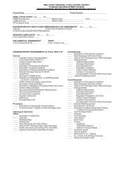
underline-strikeout version of the final draft ordinance - Pima County ...
underline-strikeout version of the final draft ordinance - Pima County ...
underline-strikeout version of the final draft ordinance - Pima County ...

You also want an ePaper? Increase the reach of your titles
YUMPU automatically turns print PDFs into web optimized ePapers that Google loves.
For May 4, 2010 BOS HearingTHIS THE CLERK OF THE BOARD FORMAT!!!Chapter 16.52SAND, GRAVEL AND OTHER EXCAVATION OPERATIONSSand and gravel excavations in a regulatory floodway, floodway fringe area, floodplains anderosion hazard areas including proposed operations and existing operations subject to permitrenewal are subject to A.R.S. § 11-830 and A.R.S. §27-1201, et. seq,, and are subject to <strong>the</strong>following provisions to <strong>the</strong> extent not inconsistent <strong>the</strong>rewith A.R.S. § 11-830 and A.R.S. §27-1201, et. seq,:A. Extraction <strong>of</strong> sand, gravel and o<strong>the</strong>r materials is allowed provided that excavations are notlocated nor <strong>of</strong> such depth, or width, or length, or combination <strong>of</strong> depth-width-length as to presenta hazard to structures including, but not limited to, roads, bridges, culverts, and utilities, <strong>the</strong>banks <strong>of</strong> watercourses, o<strong>the</strong>r property, or adversely affect groundwater recharge.B. Within a floodway area, <strong>the</strong>re shall be no stockpiling <strong>of</strong> materials or tailings that mayobstruct, divert, or retard <strong>the</strong> flow <strong>of</strong> flood waters except as reviewed and approved by <strong>the</strong> ChiefEngineer on an individual floodplain use permit basis.C. Excavations within a floodway area may be allowed only in those reaches <strong>of</strong> watercourseswhich have, at a minimum, a balanced sediment system, i.e., <strong>the</strong> sediment coming into <strong>the</strong> reachis equal to or greater than <strong>the</strong> sediment leaving <strong>the</strong> reach and <strong>the</strong> long-term sediment balance for<strong>the</strong> entire river system indicates that <strong>the</strong> stream channel will aggrade; or unless a reclamationplan is prepared and sealed by an Arizona registered civil engineer, approved by <strong>the</strong> ChiefEngineer, and adopted by <strong>the</strong> Board.D. Due to <strong>the</strong> rapidly changing hydraulic characteristics <strong>of</strong> watercourses within <strong>the</strong> <strong>County</strong>, and<strong>the</strong> effects excavations have on <strong>the</strong>se characteristics, floodplain use permits for excavations shallonly be issued for a limited time period, not to exceed one year, subject to annual renewal andreview by <strong>the</strong> Chief Engineer. Renewals will only be granted after receipt <strong>of</strong> a written statement,by <strong>the</strong> property owner or owner's representative, confirming that <strong>the</strong> sand and gravel excavationsremain in compliance with <strong>the</strong> conditions <strong>of</strong> <strong>the</strong> previous floodplain use permit, currentfloodplain conditions and all current related floodplain management regulations.E. In addition to those conditions provided for elsewhere, floodplain use permits for excavationsmay impose sites specific conditions based on a technical analysis <strong>of</strong> a flood hydraulic andsediment transport regarding <strong>the</strong> area and location in which excavations are allowed, <strong>the</strong>maximum amount <strong>of</strong> material to be excavated, and o<strong>the</strong>r reasonable restraints on <strong>the</strong> methods <strong>of</strong>operating in relationship to Floodplain conditions.F. Any extraction <strong>of</strong> sand and gravel, or related materials within a floodway area, floodwayfringe area, floodplain, and associated flood erosion hazard area shall be allowed after <strong>the</strong>effective date <strong>of</strong> <strong>the</strong> <strong>ordinance</strong> codified in this title only if a mining reclamation plan is alsoprovided for <strong>the</strong> extraction operation. The mining reclamation plan shall show in sufficient detail<strong>the</strong> actions that are proposed for <strong>the</strong> excavated areas so that all adverse effects <strong>of</strong> extraction aremitigated. The plan shall also contain a timetable for accomplishing reclamation as appropriateto <strong>the</strong> overall lateral extent and depth <strong>of</strong> <strong>the</strong> excavation, floodplain and channel conditions,adjacent land-uses, and associated flooding and erosion hazards.G. The <strong>County</strong> may charge permit and inspection fees, as appropriate, to recover costs associatedwith monitoring <strong>the</strong> sand and gravel extraction operation, plus a reasonable estimate <strong>of</strong>administrative costs and expenses that would be incurred by <strong>the</strong> <strong>County</strong> in doing so. Fees shallbe adopted by resolution <strong>of</strong> <strong>the</strong> Board as provided within A.R.S. 48-3603. E. The Chief Engineer71