

Archeomatica International 2017
Special supplement to Archeomatica 3 2017
Special supplement to Archeomatica 3 2017

You also want an ePaper? Increase the reach of your titles
YUMPU automatically turns print PDFs into web optimized ePapers that Google loves.
DOCUMENTATION<br />
NURNET – GEOPORTAL<br />
by Valentina Spanu, Eva Barbara Lorrai,<br />
Laura Muscas, Roberto Demontis<br />
The scope of this paper is to explain<br />
how the Geoportal Nurnet (net of<br />
Nuraghes, the typical Sardinian<br />
building from the Bronze Age )<br />
has been developed to manage,<br />
share and promote the Bronze Age<br />
culture in Sardinia, identified in the<br />
Pre-Nuragic (3200−2700 BC) and<br />
Nuragic (up to the 2nd century AD)<br />
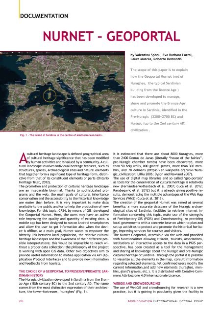
Fig. 1 - The island of Sardinia in the centre of Mediterranean basin.<br />
civilization .<br />
A<br />
cultural heritage landscape is defined geographical area<br />
of cultural heritage significance that has been modified<br />
by human activities and is valued by a community. A cultural<br />
landscape involves individual heritage features, such as<br />
structures, spaces, archaeological sites and natural elements<br />
that together form a significant type of heritage form, distinctive<br />
from that of its constituent elements or parts (Ontario<br />
Heritage Trust, 2012).<br />
The promotion and protection of cultural heritage landscape<br />
are an inseparable binomial. Thanks to sophisticated programs<br />
and the web, the main goals of cultural inheritance<br />
conservation and the accessibility to the historical knowledge<br />
are easier than before. It is very important to make data<br />
available to the public and/or to help the production of new<br />
knowledge. For this topic, CRS4, by means of GIS, developed<br />
the Geoportal Nurnet. Here, the users may have an active<br />
role improving the quality and quantity of existing data. A<br />
mobile app has been designed to run on Android smartphones<br />
and allow the user to get information also when the device<br />
is offline. As a main goal, Nurnet wants to empower the<br />
identity link between local population, the relative cultural<br />
heritage landscapes and the awareness of their different possible<br />
interpretations; this would be impossible to reach without<br />
a proper data collection: the philosophy of the project<br />
is working with open GIS data. Other two objectives aim to<br />
provide useful information to mobile application via API (Application<br />
Protocol Interface) and to provide new information<br />
and feedbacks from tourists.<br />
THE CHOICE OF A GEOPORTAL TO PRESERVE/PROMOTE SAR-<br />
DINIAN HISTORY<br />
The Nuragic civilization developed in Sardinia from the Bronze<br />
Age (18th century BC) to the 2nd century AD. The name<br />
comes from the most distinctive expression of their architecture,<br />
the tower-fortresses, ‘nuraghes’ (Fig. 1).<br />
It is estimated that there are about 8000 Nuraghes, more<br />
than 2400 Domus de Janas (literally “house of the fairies”,<br />
pre-Nuragic chamber tombs) have been discovered, more<br />
than 50 holy wells, 800 giants’ graves, more than 300 menhirs,<br />
and 78 dolmens (https://en.wikipedia.org/wiki/Nuragic_civilization;<br />
Lilliu 2006; Dyson and Rowland 2007).<br />
The use of digital map libraries and so called ‘geo-portals’<br />
as tools for the conservation of cultural heritage is relatively<br />
new (Fernández-Wyttenbach et al. 2007; Cuca et al. 2012;<br />
Karabegovic et al. 2012) but it is already giving positive results,<br />
demonstrating the multiple advantages of the Web Map<br />
Services (WMS) (Cuca et al. 2013).<br />
The creation of the geoportal Nurnet was aimed at several<br />
benefits: a more accurate database of the Nuragic archaeological<br />
sites of Sardinia, facilities to retrieve internet information<br />
concerning this topic, make use of the strengths<br />
of Participatory GIS (PGIS) and Crowdsourcing, so providing<br />
local governments with a concrete base on which to plan and<br />
set up activities to protect and promote the historical heritage,<br />
improving services for tourists and visitors.<br />
The Nurnet Geoportal, accessible via the web and provided<br />
with functionalities allowing citizens, tourists, associations,<br />
institutions an interactive access to the data in a PGIS perspective,<br />
has been created as a tool for the management<br />
and sharing of knowledge about the Nuragic and pre-Nuragic<br />
cultural heritage of Sardinia. Through the portal it is possible<br />
to visualize all the elements in the map, consult information<br />
regarding selected elements, let confirmed users modify the<br />
current information,and add new elements (nuraghes, menhirs,<br />
giant’s graves, etc.). It is distributed with Creative Commons<br />
Attribuzione 4.0 Internazionale Licence.<br />
WEBGIS AND CROWDSOURCING<br />
The use of WebGIS and crowdsourcing for research is a new<br />
practice, but it is gaining in popularity given the facility in<br />
26 ArcheomaticA <strong>International</strong> Special Issue


