Land Use Plan – 2002 - Stanly County, North Carolina
Land Use Plan – 2002 - Stanly County, North Carolina
Land Use Plan – 2002 - Stanly County, North Carolina
Create successful ePaper yourself
Turn your PDF publications into a flip-book with our unique Google optimized e-Paper software.
Wooded Areas<br />
STANLY COUNTY<br />
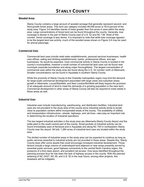
<strong>Stanly</strong> <strong>County</strong> contains a large amount of wooded acreage that generally represent second- and<br />
third-growth forest areas. This land use category includes 89,048 acres or 50.8 percent of the<br />
study area. Figure 3-6 identifies stands of trees greater than five acres in area within the study<br />
area. Large concentrations of forest land can be found throughout the county. Generally, tree<br />
coverage is denser in the part of <strong>Stanly</strong> <strong>County</strong> east of U.S. 52 and NC 138. West of this<br />
corridor, forest coverage is less dense. It is important to note that while tree coverage appears<br />
to be the largest land use activity, much of the wooded areas shown on Figure 3-6 may be used<br />
for animal pasturage.<br />
Commercial <strong>Use</strong>s<br />
Commercial land uses include retail sales establishments, personal services businesses, health<br />
care offices, eating and drinking establishments, banks, professional offices, and agribusinesses.<br />
As would be expected, most commercial activity in <strong>Stanly</strong> <strong>County</strong> is located in the<br />
county’s municipalities, however a small number of commercial land uses can be found near<br />
municipal corporate boundaries and along major thoroughfares. The largest concentration of<br />
commercial uses within the study area are found along the U.S. 52 corridor north of Albemarle.<br />
Smaller concentrations can be found in Aquadale in southern <strong>Stanly</strong> <strong>County</strong>.<br />
While the proximity of <strong>Stanly</strong> <strong>County</strong> to the Charlotte metropolitan region may limit the demand<br />
for large-scale commercial development associated with large urban and suburban areas,<br />
growth in Albemarle, Locust/Stanfield, and New London/Richfield will likely require the provision<br />
of an adequate amount of land to meet the demands of a growing population in the near term.<br />
Commercial development in other areas of <strong>Stanly</strong> <strong>County</strong> will also be required to meet needs in<br />
those areas as well.<br />
Industrial <strong>Use</strong>s<br />
Industrial uses include manufacturing, warehousing, and distribution facilities. Industrial land<br />
uses are not prevalent in the study area of the county since industrial activity tends to locate<br />
close to population centers within incorporated areas of the county. The availability of utilities<br />
and transportation infrastructure—streets, highways, and rail lines—also play an important role<br />
in determining the location of industrial operations.<br />
The two largest industrial activities in the study area are Albemarle-<strong>Stanly</strong> <strong>County</strong> Airport and the<br />
solite plant in the south-central part of the county. Small pockets of industrial activity can be<br />
found immediately west of Norwood and in Aquadale and along NC 740 in northeastern <strong>Stanly</strong><br />
<strong>County</strong> near the airport. All told, 1,284 acres of industrial land uses are located within the study<br />
area.<br />
The limited number of industrial areas in the study area can be expected to continue as long as<br />
public services essential to industrial activity are not provided in these areas. Despite this, <strong>Stanly</strong><br />
<strong>County</strong> does offer some assets that could encourage increased industrial development. Those<br />
factors include a large volume of undeveloped land adjacent or near areas presently served by<br />
essential public services, good highway connectivity to the central <strong>North</strong> <strong>Carolina</strong> region, the<br />
presence of a first-class airport, and excellent rail access. One issue identified throughout the<br />
planning process thus far has been the lack of highway access in the county. With the planned<br />
widening of NC 24/27, NC 49, and U.S. 52 in the near future, among other projects, this<br />
drawback will be mitigated.<br />
<strong>Land</strong> <strong>Use</strong> <strong>Plan</strong> 3-13 6/02


