

Land Use Plan – 2002 - Stanly County, North Carolina
Land Use Plan – 2002 - Stanly County, North Carolina
Land Use Plan – 2002 - Stanly County, North Carolina

Create successful ePaper yourself
Turn your PDF publications into a flip-book with our unique Google optimized e-Paper software.
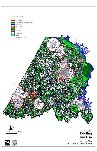
<strong>Land</strong> <strong>Use</strong> Classifications<br />
Commercial<br />
Parks, Recreation & Open Space<br />
Public / Semi-Public<br />
Residential<br />
Woodlands<br />
Industrial<br />
Agricultural<br />
Water<br />
Study Area Boundary<br />
STANFIELD<br />
1 0 1 2 Miles<br />
LOCUST<br />
NC 200<br />
Running Creek<br />
Church Rd.<br />
Millingport Rd.<br />
Swift Rd.<br />
Ridgecrest Rd.<br />
RED CROSS<br />
NC 205<br />
OAKBORO<br />
US 52<br />
NC 73<br />
Millingport Rd.<br />
NC 24/27<br />
RICHFIELD<br />
St. Martin Rd.<br />
NC 138<br />
NEW LONDON<br />
Austin Rd.<br />
Old Salisbury Rd.<br />
NC 49<br />
NC 8<br />
NC 138<br />
<strong>Plan</strong>k Rd.<br />
ALBEMARLE<br />
South <strong>Stanly</strong><br />
School Rd.<br />
Airport Rd.<br />
NC 740<br />
Stony Gap Rd.<br />
US 52<br />
NC 740<br />
Valley Dr.<br />
Indian Mound Rd.<br />
BADIN<br />
NC 73<br />
NORWOOD<br />
NC 731<br />
Figure 3-6<br />
Existing<br />
<strong>Land</strong> <strong>Use</strong><br />
<strong>Land</strong> <strong>Use</strong> <strong>Plan</strong><br />
<strong>Stanly</strong> <strong>County</strong>, <strong>North</strong> <strong>Carolina</strong>


