Land Use Plan – 2002 - Stanly County, North Carolina
Land Use Plan – 2002 - Stanly County, North Carolina
Land Use Plan – 2002 - Stanly County, North Carolina
Create successful ePaper yourself
Turn your PDF publications into a flip-book with our unique Google optimized e-Paper software.
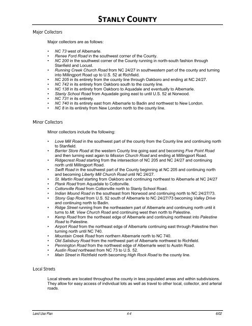
Major Collectors<br />
Major collectors are as follows:<br />
Minor Collectors<br />
Local Streets<br />
STANLY COUNTY<br />
NC 73 west of Albemarle.<br />
Renee Ford Road in the southwest corner of the <strong>County</strong>.<br />
NC 200 in the southwest corner of the <strong>County</strong> running in north-south fashion through<br />
Stanfield and Locust.<br />
Running Creek Church Road from NC 24/27 in southwestern part of the county and turning<br />
into Millingport Road up to U.S. 52 at Richfield.<br />
NC 205 in its entirety from the county line through Oakboro and ending at NC 24/27.<br />
NC 742 in its entirety from Oakboro south to the county line.<br />
NC 138 in its entirety from Oakboro to Aquadale and eventually to Albemarle.<br />
<strong>Stanly</strong> School Road from Aquadale going east to until U.S. 52 at Norwood.<br />
NC 731 in its entirety.<br />
NC 740 in its entirety east from Albemarle to Badin and northwest to New London.<br />
NC 8 in its entirety from New London north to the county line.<br />
Minor collectors include the following:<br />
Love Mill Road in the southwest part of the county from the <strong>County</strong> line and continuing north<br />
to Stanfield.<br />
Barrier Store Road at the western <strong>County</strong> line going east and becoming Five Point Road<br />
and then turning east again to Mission Church Road and ending at Millingport Road.<br />
Ridgecrest Road starting from the intersection of NC 205 and NC 24/27 and continuing<br />
north until Millingport Road.<br />
Swift Road in the southwest part of the <strong>County</strong> beginning at NC 205 and continuing north<br />
and becoming Liberty Mill Church Road until NC 24/27.<br />
St. Martin Road starting from Oakboro and continuing northeast to Albemarle at NC 24/27<br />
<strong>Plan</strong>k Road from Aquadale to Cottonville.<br />
Cottonville Road from Cottonville north to <strong>Stanly</strong> School Road.<br />
Indian Mound Road in the southeast from Norwood and continuing north to NC 24/27/73.<br />
Stony Gap Road from U.S. 52 south of Albemarle to NC 24/27/73 becoming Valley Drive<br />
and continuing north to Badin.<br />
Ridge Street running from the northeastern part of Albemarle and continuing north until it<br />
turns to Mt. View Church Road and continuing west then north to Palestine.<br />
Kemp Road from the northeast edge of Albemarle and continuing northeast into Palestine<br />
Road to Palestine.<br />
Airport Road from the northeast edge of Albemarle continuing east through Palestine then<br />
turning north until NC 740.<br />
Mountain Creek Road from northern Albemarle north to NC 740.<br />
Old Salisbury Road from the northwest part of Albemarle northwest to Richfield.<br />
Pennington Road from the northwest edge of Albemarle west to Austin Road.<br />
Austin Road northeast from NC 73 to U.S. 52.<br />
Main Street in Richfield north becoming High Rock Road to the county line.<br />
Local streets are located throughout the county in less populated areas and within subdivisions.<br />
They allow for easy access of individual lots as well as travel to other local, collector, and arterial<br />
roads.<br />
<strong>Land</strong> <strong>Use</strong> <strong>Plan</strong> 4-4 6/02


