

Soil Report - Agriculture et Agroalimentaire Canada
Soil Report - Agriculture et Agroalimentaire Canada
Soil Report - Agriculture et Agroalimentaire Canada

Create successful ePaper yourself
Turn your PDF publications into a flip-book with our unique Google optimized e-Paper software.
tations .<br />
(2) Brantford soils are fair to good for forest productivity,<br />
with limitations mainly relating to their high clay content .<br />
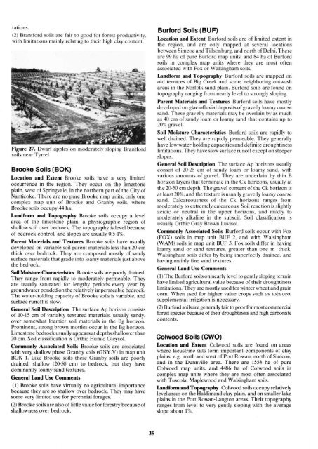
Figure 27 . Dwarf apples on moderately sloping Brantford<br />
soils near Tyrrel<br />
Brooke <strong>Soil</strong>s (BOK)<br />
Location and Extent Brooke soils have a very limited<br />
occurrence in the region . They occur on the limestone<br />
plain, west of Springvale, in the northern part of the City of<br />
Nanticoke . There are no pure Brooke map units, only one<br />
complex map unit of Brooke and Granby soils, where<br />
Brooke soils occupy 44 ha .<br />
Landform and Topography Brooke soils occupy a level<br />
area of the limestone plain . a physiographic region of<br />
shallow soil over bedrock . The topography is level because<br />
of bedrock control, and slopes are usually 0.5-1% .<br />
Parent Materials, and Textures Brooke soils have usually<br />
developed on variable soil parent materials less than 20 cm<br />
thick over bedrock . They are composed mostly of sandy<br />
surface materials that grade into loamy materials just above<br />
the bedrock .<br />
<strong>Soil</strong> Moisture Characteristics Brooke soils are poorly drained .<br />
They range from rapidly to moderately permeable . They<br />
are usually saturated for lengthy periods every year by<br />
groundwater ponded on the relatively impermeable bedrock .<br />
The water-holding capacity of Brooke soils is variable, and<br />
surface runoff is slow .<br />
General <strong>Soil</strong> Description The surface Ap horizon consists<br />
of 10-15 cm of variably textured materials, usually sandy,<br />
over somewhat loamier soil materials in the Bg horizon .<br />
Prominent, strong brown mottles occur in the Bg horizon .<br />
Limestone bedrock usually appears at depths shallower than<br />
20 cm . <strong>Soil</strong> classification is Orthic Humic Gleysol .<br />
Commonly Associated <strong>Soil</strong>s Brooke soils are associated<br />
with very shallow phase Granby soils (GNY.V) in map unit<br />
BOK 1 . Like Brooke soils these Granby soils are poorly<br />
drained, shallow (20-50 cm) to bedrock, but they have<br />
dominantly loamy sand textures.<br />
General Land Use Comments<br />
(1) Brooke soils have virtually no agricultural importance<br />
because they are so shallow over bedrock . They may have<br />
some very limited use for perennial forages .<br />
(2) Brooke soils are also of little value for forestry because of<br />
shallowness over bedrock .<br />
Burford <strong>Soil</strong>s (BUF)<br />
Location and Extent Burford soils are of limited extent in<br />
the region, and are only mapped at several locations<br />
b<strong>et</strong>ween Simcoe and Tillsonburg, and north of Delhi . There<br />
are 99 ha of pure Burford map units, and 84 ha of Burford<br />
soils in complex map units where they are most often<br />
associated with Fox or Walsingham soils .<br />
Landform and Topography Burford soils are mapped on<br />
old terraces of Big Creek and some neighboring outwash<br />
areas in the Norfolk sand plain . Burford soils are found on<br />
topography ranging from nearly level to strongly sloping .<br />
Parent Materials and Textures Burford soils have mostly<br />
developed on glaciofluvial deposits of gravelly loamy coarse<br />
sand . These gravelly materials may be overlain by as much<br />
as 40 cm of sandy loam or loamy sand that contains up to<br />
20% gravel .<br />
<strong>Soil</strong> Moisture Characteristics Burford soils are rapidly to<br />
well drained . They are rapidly permeable . They generally<br />
have low water-holding capacities and definite droughtiness<br />
limitations . They have slow surface runoff except on steeper<br />
slopes .<br />
General <strong>Soil</strong> Description The surface Ap horizons usually<br />
consist of 20-25 cm of sandy loam or loamy sand, with<br />
various amounts of gravel . They are underlain by thin B<br />
horizon layers that terminate in the Ck horizons, usually at<br />
the 20-50 cm depth . The gravel content of the Ck horizon is<br />
at least 20%, and the texture is usually gravelly loamy coarse<br />
sand . Calcareousness of the Ck horizons ranges from<br />
moderately to extremely calcareous. <strong>Soil</strong> reaction is slightly<br />
acidic or neutral in the upper horizons, and mildly to<br />
moderately alkaline in the subsoil . <strong>Soil</strong> classification is<br />
usually Orthic Gray Brown Luvisol .<br />
Commonly Associated <strong>Soil</strong>s Burford soils occur with Fox<br />
(FOX) soils in map unit BUF 2, and with Walsingham<br />
(WAM) soils in map unit BUF 3 . Fox soils differ in having<br />
loamy sand or sand textures, greater than one m thick .<br />
Walsingham soils differ by being imperfectly drained, and<br />
having mainly fine sand textures .<br />
General Land Use Comments<br />
(1) The Burford soils on nearly level to gently sloping terrain<br />
have limited agricultural value because of their droughtiness<br />
limitations . They are mostly used for winter wheat and grain<br />
corn . When used for higher value crops such as tobacco,<br />
supplemental irrigation is necessary .<br />
(2) Burford soils are generally fair to poor for most commercial<br />
forest species because of their droughtiness and high carbonate<br />
contents .<br />
Colwood <strong>Soil</strong>s (CWO)<br />
Location and Extent Colwood soils are found on areas<br />
where lacustrine silts form important components of clay<br />
plains, e .g. north and west of Port Rowan, north of Simcoe,<br />
and in the Dunnville area . There are 1558 ha of pure<br />
Colwood map units, and 4486 ha of Colwood soils in<br />
complex map units where they are most often associated<br />
with Tuscola, Maplewood and Walsingham soils .<br />
Landform and Topography Colwood soils occupy relatively<br />
level areas on the Haldimand clay plain, and on smaller lake<br />
plains in the Port Rowan-Langton areas . Their topography<br />
ranges from level to very gently sloping with the average<br />
slope about 1% .


