

Scientific Theme: Advanced Modeling and Observing Systems
Scientific Theme: Advanced Modeling and Observing Systems
Scientific Theme: Advanced Modeling and Observing Systems

Create successful ePaper yourself
Turn your PDF publications into a flip-book with our unique Google optimized e-Paper software.
Complementary Research: Faculty Fellows Research<br />
Rio Gr<strong>and</strong>e Rift GPS Tectonics Project Underway<br />
Anne Sheehan<br />
Funding: NSF (project initiated with 2001 CIRES IRP seed grant)<br />
Twenty-two high precision GPS monuments, with two more in progress, have been installed<br />
<strong>and</strong> instrumented throughout Colorado <strong>and</strong> New Mexico as part of an NSF-funded project to<br />
measure the crustal deformation of the Rio Gr<strong>and</strong>e Rift.<br />
Accomplishments<br />
The purpose of this NSF-sponsored study is to precisely measure the ground movement <strong>and</strong><br />
earthquake potential of the Rio Gr<strong>and</strong>e Rift in Colorado <strong>and</strong> New Mexico. Using state-of-the-art Global Positioning<br />
System instruments at 24 sites in Colorado <strong>and</strong> New Mexico, we will track the rift‘s movement in millimeters during<br />
most of the next five years. This study will provide modern satellite geodetic estimates of the active tectonics of<br />
Colorado <strong>and</strong> New Mexico. The Rio Gr<strong>and</strong>e Rift formed between 35 <strong>and</strong> 29 million years ago when the crust began<br />
to spread apart, triggering volcanism in the region. The Rio Gr<strong>and</strong>e Rift extends hundreds of miles from Colorado‘s<br />
central Rocky Mountains to Mexico, <strong>and</strong> geologists have estimated it spreads apart up to five millimeters each year.<br />
However, the margin of error in these estimates can be nearly as much as the estimates themselves. A better<br />
underst<strong>and</strong>ing of the variable character of the rift could help us underst<strong>and</strong> how <strong>and</strong> why tectonic plates undergo<br />
stretching, as well as the earthquake <strong>and</strong> volcanic hazards within rift zones. The project is part of NSF‘s EarthScope<br />
initiative, a NSF MRE project. Earthscope is funded by NSF <strong>and</strong> conducted in partnership with the U.S. Geological<br />
Survey <strong>and</strong> NASA to study North American geologic evolution, earthquakes <strong>and</strong> volcanic activity.<br />
Education <strong>and</strong> Outreach<br />
Anne Sheehan teamed with the CU Science Explorers program to develop a hazards curriculum. This curriculum<br />
was taught to nearly 1800 middle school aged children at 17 different locations throughout the state of Colorado.<br />
Over 350 Colorado middle school teachers were trained on the hazards curriculum, <strong>and</strong> they were given materials to<br />
take back to their classrooms to reach even more students.<br />
Mark McCaffrey from the CIRES‘ Education <strong>and</strong> Outreach program developed a one-page FAQ h<strong>and</strong>out on the Rio<br />
Gr<strong>and</strong>e Rift experiment. This FAQ was adopted by the Earthscope national office <strong>and</strong> is being widely distributed<br />
throughout the country. This FAQ has also been distributed at all of the CU Science Explorers workshops, to large<br />
geology classes at the University of Colorado, <strong>and</strong> to the public.<br />
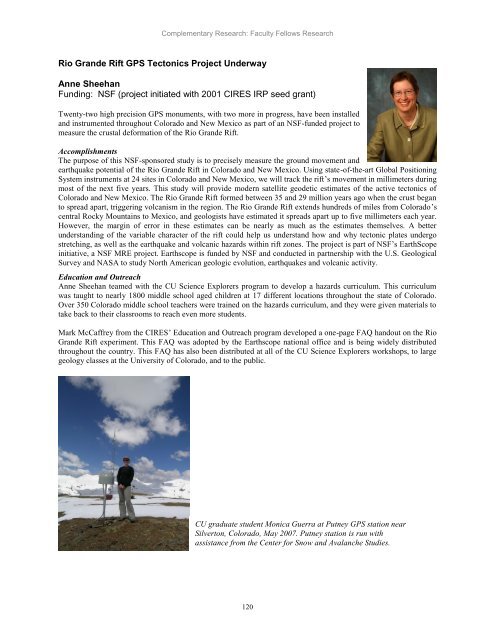
CU graduate student Monica Guerra at Putney GPS station near<br />
Silverton, Colorado, May 2007. Putney station is run with<br />
assistance from the Center for Snow <strong>and</strong> Avalanche Studies.<br />
120


