2020 Vision for Athy - Entire Document - Kildare.ie
2020 Vision for Athy - Entire Document - Kildare.ie
2020 Vision for Athy - Entire Document - Kildare.ie
You also want an ePaper? Increase the reach of your titles
YUMPU automatically turns print PDFs into web optimized ePapers that Google loves.
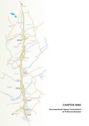
9 DEVELOPMENT OF PREFERRED SCENARIO<br />
9.1 Introduction<br />
This chapter describes in detail the Preferred Development Scenario <strong>for</strong> <strong>Athy</strong> under each of the stud<strong>ie</strong>s objectives<br />
as identif<strong>ie</strong>d in Section 5 of this Study.<br />
9.2 Summary of Preferred Development Scenario<br />
Figure 9.1 illustrates the overall strategy <strong>for</strong> the town at macro level with the development pattern <strong>for</strong> the town<br />
focussed on the reinvigoration of town centre and waterways with limited development to the east of the railway<br />
line. Such a focus will maximise the potential to incorporate the existing built heritage and waterways into the<br />
future development of the town.<br />
The focus of development will be on key town centre sites as illustrated on Figure 9.2 with access to and within<br />
these areas maximised through the provision of sustainable transport links, including bus, pedestrian and cyclists as<br />
illustrated on Figures 9.3 and 9.4. Sites identif<strong>ie</strong>d include the Inner Rel<strong>ie</strong>f Street and existing Main Street,<br />
Triangle site, sites west of Grand Canal and Shaw’s Square. Figures 9.4 and 9.5 also refer to the transport<br />
management objectives <strong>for</strong> the town which are listed in Appendix A. These objectives are derived from the<br />
description of the development of the town in relation to the study objectives in section 9.3.<br />
As outlined numerically in Figure 9.1 and further expanded under Objective 3 of the Study, the focus <strong>for</strong> future<br />
residential development will be to the northwest and southwest of town centre, east of the railway line, north of<br />
Leinster Street and within infill sites in the town centre and Coneyburrow. Varying residential densit<strong>ie</strong>s and types<br />
are advocated throughout, with higher densit<strong>ie</strong>s accommodated within the town centre.<br />
Various options <strong>for</strong> high-density employment sites are proposed in the town centre and on the edge of town centre<br />
on high quality sites. Low-density employment sites are to be located on the existing site to the west of the Canal<br />
and on a new site in the south east of the town adjacent the N9 road link.<br />
Amenity and open space will be a mixture of waterfront walks, river and canal marinas, public parks, urban<br />
squares, playing pitches together with open spaces in lower density residential areas. New community facilit<strong>ie</strong>s<br />
such as a cinema, theatre and landmark civic buildings should be located in the town centre. All of these features<br />
will provide a base <strong>for</strong> increased tourist activity in the town, which will be based on its existing heritage status and<br />
this focus on tourism should be underpinned by hotel developments incorporating banqueting and conference<br />
facilit<strong>ie</strong>s.<br />
Primary schools will be dispersed throughout the residential clusters in the town. A new primary facility will be<br />
located at Ardrew. The secondary schools north of the town centre on the Monasterevin Road will remain at their<br />
current location, whilst the existing secondary school on the Carlow Road south of the town is planning to relocate<br />
to a new facility in Rathstewart. An additional secondary facility will be required within the timeframe of this<br />
Study. The schools will be accessible through the network of walking and cycling links and it is envisaged that the<br />
secondary schools would utilise proposed playing f<strong>ie</strong>lds on the west bank of the river on the Monasterevin Road.<br />
The roads h<strong>ie</strong>rarchy <strong>for</strong> the town is shown on Figure 9.5 with associated car park locations. In facilitating the<br />
various land uses a southern bypass is proposed, to facilitate more effic<strong>ie</strong>nt movement of traffic travelling in an<br />
east-west direction through the town. The option of developing this bypass on the route designated in the current<br />
Town Development Plan or on a route to the south of the anticipated built environment is rev<strong>ie</strong>wed in this section.<br />
The development of the outer bypass could allow the current bypass alignment to function as a local distributor<br />
road in the southwest area, not necessarily providing a link across the river and railway to the east of the town. The<br />
town would also be connected to the N9 by the proposed link road providing a direct connection to the N9 on<br />
National Primary Network.<br />
Transport management measures are specif<strong>ie</strong>d in Appendix A that complement the land use patterns and that were<br />
incorporated into the MEPLAN and SATURN modelling. The measures are set out in terms of their anticipated<br />
phasing. Details of the transport modelling are discussed in section 9.4 and further details are contained in<br />
Appendix B.<br />
<strong>Athy</strong> IFPLUT Study 85 Final Report December 2004


