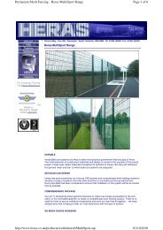
Supporting documents - Renfrewshire Council
Supporting documents - Renfrewshire Council
Supporting documents - Renfrewshire Council

You also want an ePaper? Increase the reach of your titles
YUMPU automatically turns print PDFs into web optimized ePapers that Google loves.
Dawn Developments Ltd/467374673/Queen’s Quay Masterplan EIA/KD<br />
04/01/2012<br />
Major Mixed Use Development, Queen's Quay, Clydebank<br />
EIA Scoping Report<br />
No other known surface water bodies are located within or immediately adjacent to the<br />
Development site; however, other water bodies can be noted within the general vicinity of<br />
the site:<br />
• The River Cart (downstream of the confluence between the Black Cart and the White<br />
Cart) flows into the River Clyde from the south approximately 430m upstream of the<br />
development site.<br />
• A second unnamed watercourse/ channel flows north-westwards along the line of the<br />
former River Clyde channel, south west of Newshot Island located adjacent to the<br />
southern embankment circa 1.3km downstream.<br />
• The Forth and Clyde Canal is present circa 120m to 800m north of the site. Given the<br />
difference in level and distance from the site in it not expected that the Canal will be<br />
directly affected by the proposals. Historically, a junction canal provided a link<br />
between the Forth and Clyde Canal and the River Clyde that ran through the eastern<br />
edge of the Development site but this has been infilled.<br />
8.3.1.1 Water quality<br />
Waterbody water quality classifications are defined by SEPA under the River Basin<br />
Management Plan (RBMP) database. This information also details target water quality<br />
objectives for a range of target years as defined in support of the Water Framework<br />
Directive (WFD).<br />
The RBMP database defines various water bodies and is based on an ecological<br />
classification system with five quality classes. These classifications are further split into<br />
sub sections to define areas which are heavily modified or have been artificially altered.<br />
The classification system has been devised in accordance with European Union (EU) and<br />
UK guidance and is underpinned by a range of biological quality elements supported by<br />
chemistry, hydrology (changes to levels and flows) and morphology (changes to the<br />
shape and function of water bodies).<br />
The classification of a length of river is calculated from the monitoring point and the<br />
results are then broken down into the following main categories:<br />
• High<br />
• Good<br />
• Moderate<br />
• Poor<br />
• Bad<br />
Page 35<br />
Final for Issue