Supporting documents - Renfrewshire Council
Supporting documents - Renfrewshire Council
Supporting documents - Renfrewshire Council

Create successful ePaper yourself
Turn your PDF publications into a flip-book with our unique Google optimized e-Paper software.
Major Mixed Use<br />
Development, Queen's<br />
Quay, Clydebank<br />
EIA Scoping Report<br />
04 January 2011<br />
Final for Issue<br />
Issue No 1<br />
46374673/EDRP0001
Dawn Developments Ltd/467374673/Queen’s Quay Masterplan EIA/KD<br />
04/01/2012<br />
Major Mixed Use Development, Queen's Quay, Clydebank<br />
EIA Scoping Report<br />
Project Title: Major Mixed Use Development, Queen's Quay, Clydebank<br />
Report Title: EIA Scoping Report<br />
Project No: 46374673<br />
Report Ref: EDRP0001<br />
Status: Draft<br />
Client Contact Name: Steve McConnell<br />
Client Company Name: Dawn Group Ltd<br />
Issued By:<br />
URS Scott Wilson Ltd<br />
23 Chester Street<br />
Edinburgh EH3 7EN<br />
United Kingdom<br />
Tel: +44 (0) 131 225 1230<br />
Fax: +44 (0) 131 225 5582<br />
www.ursglobal.com<br />
Document Production / Approval Record<br />
Issue No:<br />
1<br />
Prepared<br />
by<br />
Checked<br />
by<br />
Approved<br />
by<br />
Name Signature Date Position<br />
Kathryn Dennis<br />
Jean Curran<br />
Jean Curran<br />
Document Revision Record<br />
Issue No Date Details of Revisions<br />
1 04.01.2012 Final for Issue<br />
04.01.12 Principal Consultant<br />
04.01.12 Associate Director<br />
04.01.12 Associate Director<br />
Final for Issue
CONTENTS<br />
Dawn Developments Ltd/467374673/Queen’s Quay Masterplan EIA/KD<br />
04/01/2012<br />
Major Mixed Use Development, Queen's Quay, Clydebank<br />
EIA Scoping Report<br />
SECTION PAGE NO<br />
1. INTRODUCTION.............................................................................................................. 1<br />
1.1 Background ...................................................................................................................... 1<br />
1.2 Environmental Impact Assessment.................................................................................. 1<br />
1.3 Report structure................................................................................................................ 3<br />
1.4 Limitations ........................................................................................................................ 4<br />
1.5 Copyright .......................................................................................................................... 4<br />
2. DEVELOPMENT PROPOSAL DESCRIPTION............................................................... 5<br />
2.1 Site location...................................................................................................................... 5<br />
2.2 Site history........................................................................................................................ 6<br />
2.3 Masterplan proposal......................................................................................................... 7<br />
3. PLANNING AND POLICY FRAMEWORK...................................................................... 8<br />
3.1 Extant planning consent for Queen’s Quay ..................................................................... 8<br />
3.2 Comparison of proposed and consented Masterplan .................................................... 10<br />
3.3 In-combination development .......................................................................................... 10<br />
3.4 Planning policy overview and development context ...................................................... 11<br />
4. EIA SCOPING STUDY METHODOLOGY..................................................................... 16<br />
4.1 Environmental baseline.................................................................................................. 16<br />
4.2 Methods.......................................................................................................................... 16<br />
4.3 Consultation ................................................................................................................... 17<br />
5. ENVIRONMENTALLY DESIGNATED SITES AND FEATURES.................................. 21<br />
5.1 European designated sites............................................................................................. 21<br />
5.2 UK designated sites ....................................................................................................... 21<br />
5.3 Local designations.......................................................................................................... 23<br />
5.4 Other designations ......................................................................................................... 24<br />
6. ECOLOGY & NATURE CONSERVATION ................................................................... 26<br />
7. LANDSCAPE & VISUAL ............................................................................................... 30<br />
7.1 Introduction..................................................................................................................... 30<br />
7.2 Consultation ................................................................................................................... 30<br />
7.3 Baseline.......................................................................................................................... 30<br />
7.4 Key issues ...................................................................................................................... 32<br />
8. WATER RESOURCES .................................................................................................. 34<br />
8.1 Introduction..................................................................................................................... 34<br />
8.2 Consultation ................................................................................................................... 34<br />
8.3 Baseline.......................................................................................................................... 34<br />
8.4 Potential receptors ......................................................................................................... 38<br />
8.5 Key issues ...................................................................................................................... 38<br />
8.6 Proposed studies for EIA ............................................................................................... 38<br />
Page i<br />
Final for Issue
CONTENTS<br />
Dawn Developments Ltd/467374673/Queen’s Quay Masterplan EIA/KD<br />
04/01/2012<br />
Major Mixed Use Development, Queen's Quay, Clydebank<br />
EIA Scoping Report<br />
SECTION PAGE NO<br />
9. GEOLOGY & SOILS...................................................................................................... 40<br />
9.1 Introduction..................................................................................................................... 40<br />
9.2 Ground Investigation ...................................................................................................... 40<br />
9.3 Consultation ................................................................................................................... 40<br />
9.4 Baseline.......................................................................................................................... 40<br />
9.5 Potential receptors ......................................................................................................... 41<br />
9.6 Key issues ...................................................................................................................... 42<br />
9.7 Proposed studies for EIA ............................................................................................... 42<br />
10. TRAFFIC ........................................................................................................................ 45<br />
10.1 Introduction..................................................................................................................... 45<br />
10.2 Traffic Assessment method............................................................................................ 45<br />
10.3 Consultation ................................................................................................................... 47<br />
10.4 Baseline.......................................................................................................................... 47<br />
10.5 Queen’s Quay traffic comparison................................................................................... 50<br />
11. NOISE & VIBRATION.................................................................................................... 52<br />
11.1 Introduction..................................................................................................................... 52<br />
11.2 Consultation ................................................................................................................... 52<br />
11.3 Baseline.......................................................................................................................... 52<br />
11.4 Potential receptors ......................................................................................................... 52<br />
11.5 Key issues ...................................................................................................................... 53<br />
11.6 Proposed assessment for EIA........................................................................................ 53<br />
12. AIR QUALITY ................................................................................................................ 55<br />
12.1 Introduction..................................................................................................................... 55<br />
12.2 Consultation ................................................................................................................... 55<br />
12.3 Baseline.......................................................................................................................... 55<br />
12.4 Potential receptors ......................................................................................................... 55<br />
12.5 Key issues ...................................................................................................................... 56<br />
12.6 Proposed studies for EIA ............................................................................................... 56<br />
13. ARCHAEOLOGY & CULTURAL HERITAGE............................................................... 57<br />
13.1 Introduction..................................................................................................................... 57<br />
13.2 Consultation ................................................................................................................... 57<br />
13.3 Baseline.......................................................................................................................... 57<br />
13.4 Potential receptors ......................................................................................................... 58<br />
13.5 Key issues ...................................................................................................................... 59<br />
13.6 Proposed studies for EIA ............................................................................................... 59<br />
14. SOCIO-ECONOMICS .................................................................................................... 61<br />
14.1 Introduction..................................................................................................................... 61<br />
14.2 Consultation ................................................................................................................... 61<br />
14.3 Baseline.......................................................................................................................... 62<br />
14.4 Potential receptors ......................................................................................................... 62<br />
14.5 Key issues ...................................................................................................................... 63<br />
Page ii<br />
Final for Issue
CONTENTS<br />
Dawn Developments Ltd/467374673/Queen’s Quay Masterplan EIA/KD<br />
04/01/2012<br />
Major Mixed Use Development, Queen's Quay, Clydebank<br />
EIA Scoping Report<br />
SECTION PAGE NO<br />
14.6 Proposed studies for EIA ............................................................................................... 64<br />
15. FORMAT OF THE ENVIRONMENTAL STATEMENT (ES).......................................... 67<br />
15.1 Environmental issues to be included within the EIA ...................................................... 67<br />
15.2 Environmental issues to be “scoped out” of the EIA...................................................... 67<br />
15.3 EIA team......................................................................................................................... 67<br />
15.4 Format of the environmental information ....................................................................... 68<br />
16. ABBREVIATIONS.......................................................................................................... 69<br />
APPENDIX A SCREENING DECISION<br />
APPENDIX B FIGURES<br />
Page iii<br />
Final for Issue
1. INTRODUCTION<br />
1.1 Background<br />
Dawn Developments Ltd/467374673/Queen’s Quay Masterplan EIA/KD<br />
04/01/2012<br />
Major Mixed Use Development, Queen's Quay, Clydebank<br />
EIA Scoping Report<br />
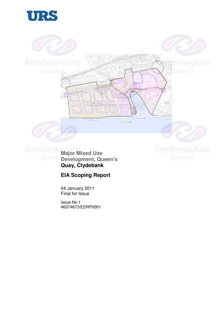
The Queen’s Quay site is situated in Clydebank on the north bank of the River Clyde (see<br />
Figure 1, Appendix B). The site is centred on OS Grid reference NS 4950 6990.<br />
Dawn Group Ltd. and Clydeside Regeneration Ltd. (the Applicants) are seeking planning<br />
permission in principle for a Masterplan of the Queen’s Quay site (hereafter referred to as<br />
‘the Development’). The Development site would comprise a mixed land use<br />
development to include residential areas, offices, and leisure and retail together with<br />
public realm and greenspace provision.<br />
1.2 Environmental Impact Assessment<br />
1.2.1 Screening opinion<br />
An Environmental Impact Assessment (EIA) screening decision for the Development was<br />
obtained from the Local Planning Authority (LPA), West Dunbartonshire <strong>Council</strong> (WDC),<br />
in October 2011 (see Appendix A). In their response the <strong>Council</strong> stated that:<br />
“Under the Regulations the proposal is a Schedule 2 development by<br />
reason of exceeding the threshold criteria (size of site) and in being<br />
within a “sensitive area”. On the basis of the selection criteria, the<br />
guidance in Circular 3/2011 and the consultation response from SNH<br />
it is considered that the environmental impacts of the development are<br />
significant and require further assessment. Individually, some of the<br />
impacts identified could be addressed by other supporting <strong>documents</strong><br />
as part of the planning process, but cumulatively the potential impacts<br />
are considered to be sufficient to require an EIA in order to allow the<br />
environmental impacts to be properly addressed.”<br />
An EIA, under the Environmental Impact Assessment (Scotland) Regulations 2011<br />
therefore has to be undertaken.<br />
Furthermore, as part of the site along the waterfront of the River Clyde is designated as a<br />
Special Protection Area (SPA) (see Chapter 5 and Figure 5, Appendix B), under the<br />
Conservation (Natural Habitats & c.) Regulations 1994 (as amended) the Competent<br />
Authority (in this case the LPA, WDC) will also need to undertake a Habitat Regulations<br />
Assessment (HRA) to assess the impacts of the Development on the conservation<br />
objectives of the Inner Clyde SPA and its qualifying interest – Redshank (Tringa totanus).<br />
A stand alone report to inform the HRA will require to be submitted to the <strong>Council</strong> (the<br />
Competent Authority) with the planning application<br />
This report will also be used to inform the EIA and will be included as technical appendix<br />
within the Environmental Statement (ES).<br />
Page 1<br />
Final for Issue
1.2.2 EIA scoping<br />
Dawn Developments Ltd/467374673/Queen’s Quay Masterplan EIA/KD<br />
04/01/2012<br />
Major Mixed Use Development, Queen's Quay, Clydebank<br />
EIA Scoping Report<br />
EIA scoping is the process of determining which environmental issues should be covered<br />
within the environmental information to be submitted to the Competent Authority within<br />
the ES and the scope of the assessments to be undertaken. This scoping report has<br />
been produced to inform the <strong>Council</strong>’s formal scoping opinion for the proposed Queen’s<br />
Quay Masterplan EIA. The purpose of the report is to:<br />
• provide a description of the proposed Development (Masterplan);<br />
• outline the baseline environmental characteristics of the area potentially affected by<br />
the Development;<br />
• identify the environmental themes (e.g. ecology, landscape, noise etc.) that will<br />
require to be addressed within the environmental information submitted within the<br />
ES; and<br />
• specify the proposed scope, extent and methods of environmental studies to be<br />
carried out as part of the EIA to identify potential environmental effects caused by<br />
the Masterplan proposals and to assess the magnitude and significance of these<br />
effects.<br />
In accordance with the Environmental Impact Assessment (Scotland) Regulations 2011,<br />
this Scoping Report together with a request for a formal scoping opinion will be issued to<br />
the West Dunbartonshire <strong>Council</strong> (WDC). To inform their decision, WDC is statutorily<br />
obliged to consult with a number of EIA consultees, which for the proposed Development<br />
will include:<br />
• BAA Glasgow Airport;<br />
• Crown Estates;<br />
• Health and Safety Executive;<br />
• Historic Scotland;<br />
• Marine Scotland;<br />
• Scottish Environment Protection Agency (SEPA);<br />
• Scottish Government;<br />
• Scottish Natural Heritage (SNH);<br />
• Scottish Water;<br />
• Transport Scotland; and<br />
• West Dunbartonshire <strong>Council</strong> (WDC).<br />
Page 2<br />
Final for Issue
Dawn Developments Ltd/467374673/Queen’s Quay Masterplan EIA/KD<br />
04/01/2012<br />
Major Mixed Use Development, Queen's Quay, Clydebank<br />
EIA Scoping Report<br />
The statutory consultees are invited to comment on the environmental baseline, the<br />
planned content of the EIA and the proposed assessment methods and to provide<br />
additional relevant environmental information where available.<br />
All comments and information received from the statutory consultees will be used to<br />
inform the EIA process, the content of the final ES, and the scope, extent and methods<br />
used to carry out the various environmental assessments required. A statutory<br />
consultation period of 28 days is allowed for the return of the scoping opinion to the<br />
Applicant(s).<br />
1.3 Report structure<br />
The structure of the remainder of the Scoping Report is as follows:<br />
2. DEVELOPMENT PROPOSAL DESCRIPTION: Provides a general overview of the site<br />
location, context and history; gives a description of the history of the Masterplan area;<br />
and provides details of the Masterplan proposals.<br />
3. PLANNING AND POLICY FRAMEWORK: Describes the recent planning history of the<br />
Development site; identifies in-combination development that will be considered as part of<br />
the EIA; and details the planning policy relevant to the Development that will be examined<br />
within the EIA policy review.<br />
4. EIA SCOPING STUDY METHODOLOGY: Sets out the methods used to undertake the<br />
EIA Scoping Study.<br />
5. ENVIRONMENTALLY DESIGNATED SITES AND FEATURES: Identifies the<br />
environmentally designated sites and protected features within 5km of the site boundary.<br />
6 – 14. ENVIRONMENTAL BASELINE AND PROPOSED EIA SCOPE: For each<br />
environmental discipline the relevant chapter provides a description of the existing<br />
environmental baseline; <strong>documents</strong> the consultation undertaken to date; identifies key<br />
environmental issues to be considered during the EIA process; and outlines the proposed<br />
scope and methods of environmental studies to be undertaken to assess the nature,<br />
extent, magnitude and significance of these effects.<br />
The individual environmental disciplines examined within this Scoping Study are:<br />
• 6. ECOLOGY & NATURE CONSERVATION<br />
• 7. LANDSCAPE & VISUAL<br />
• 8. WATER RESOURCES<br />
• 9. GEOLOGY & SOILS<br />
• 10. TRAFFIC<br />
• 11. NOISE & VIBRATION<br />
Page 3<br />
Final for Issue
Dawn Developments Ltd/467374673/Queen’s Quay Masterplan EIA/KD<br />
04/01/2012<br />
• 12. AIR QUALITY<br />
Major Mixed Use Development, Queen's Quay, Clydebank<br />
EIA Scoping Report<br />
• 13. ARCHAEOLOGY & CULTURAL HERITAGE<br />
• 14. SOCIO-ECONOMIC IMPACTS<br />
15. FORMAT OF THE ENVIRONMENTAL STATEMENT (ES): Introduces the EIA team,<br />
summarises the environmental topics for inclusion within the EIA, and describes the<br />
format of the final ES.<br />
16. ABBREVIATIONS<br />
APPENDICES A - C<br />
1.4 Limitations<br />
URS Infrastructure & Environment UK Ltd (URS) has prepared this Report for the sole<br />
use of Dawn Group Ltd in accordance with the Agreement under which our services were<br />
performed. No other warranty, expressed or implied, is made as to the professional<br />
advice included in this Report or any other services provided by us. This Report may not<br />
be relied upon by any other party without the prior and express written agreement of<br />
URS. Unless otherwise stated in this Report, the assessments made assume that the<br />
sites and facilities will continue to be used for their current purpose without significant<br />
change. The conclusions and recommendations contained in this Report are based upon<br />
information provided by others and upon the assumption that all relevant information has<br />
been provided by those parties from whom it has been requested. Information obtained<br />
from third parties has not been independently verified by URS, unless otherwise stated in<br />
the Report.<br />
1.5 Copyright<br />
© This Report is the copyright of URS Infrastructure & Environment UK Ltd. Any<br />
unauthorised reproduction or usage by any person other than the addressee is strictly<br />
prohibited.<br />
Page 4<br />
Final for Issue
2. DEVELOPMENT PROPOSAL DESCRIPTION<br />
2.1 Site location<br />
Dawn Developments Ltd/467374673/Queen’s Quay Masterplan EIA/KD<br />
04/01/2012<br />
Major Mixed Use Development, Queen's Quay, Clydebank<br />
EIA Scoping Report<br />
The Development site is situated in the town of Clydebank on the north bank of the River<br />
Clyde. The site is centred on OS Grid reference NS 4950 6990 (see Figure 1, Appendix<br />
B).<br />
The site is bounded by the River Clyde to the south-west; Queen’s Quay Enterprise and<br />
Learning District/ Queen’s Gate residential development to the south-east; undeveloped<br />
land and light industry/ commercial properties along Cable Depot Road to the north; and<br />
the A814 Glasgow Road/ residential, commercial and civic properties along Dumbarton<br />
Road to the northeast and east.<br />
The site is generally flat but there is a gentle gradient (typically falling south-east to northwest)<br />
from Dumbarton Road down towards the River Clyde. Ground levels range<br />
between 8.7m above ordnance datum (AOD) (in the north-eastern corner of the site at<br />
the Dumbarton Road boundary) and 4.5m AOD (at the quayside). The majority of the site,<br />
north-west of the Queen’s Dock, is lower than 5.7m AOD.<br />
The site is underlain by made ground deposited in the 19 th century during the original<br />
development of the greenfield site to raise the existing ground level and accommodate<br />
the dock infrastructure. The natural drift deposits below the made ground comprise<br />
alluvium overlying glacial till. The bedrock is mudstone, believed to be part of the<br />
Lawmuir Formation (sandstones and mudstones with thin bands of limestone and coal<br />
measures).<br />
Plate 1: Queen’s Quay cleared site looking north-west<br />
The majority of the Development site has been cleared and has been predominantly<br />
vacant over the past 10 years. Two major features within the site are the Queen’s Quay<br />
Page 5<br />
Final for Issue
Dawn Developments Ltd/467374673/Queen’s Quay Masterplan EIA/KD<br />
04/01/2012<br />
Major Mixed Use Development, Queen's Quay, Clydebank<br />
EIA Scoping Report<br />
dock and the Titan Crane. A purpose-built education centre was opened at the base of<br />
the crane in June 2011.<br />
2.2 Site history<br />
Historical mapping suggests that the Development site was used for agricultural pasture<br />
until it was first developed in 1871 by J & G Thomson as a shipbuilding and engineering<br />
yard. The yard was bought by John Brown and Co. in 1899 and became one of the most<br />
important shipyards on the Clyde. Famous ships associated with the yard include the<br />
Lusitania, Aquitania, the Royal Yacht Britannia and the Queen Elizabeth the 2 nd . The<br />
shipyard operated at the Queen’s Quay site up until its closure in the 1970s.<br />
Plate 2: John Brown’s Shipyard<br />
Plate 3: The Queen Elizabeth II at Clydebank<br />
The shipyard was purchased by Marathon Manufacturing in 1972 and was used for the<br />
manufacture of oil drilling rigs and platforms. The site was subsequently bought by<br />
UiE/Kvaerner in 1980 and continued to manufacture oil rigs until 1999.<br />
Page 6<br />
Final for Issue
Dawn Developments Ltd/467374673/Queen’s Quay Masterplan EIA/KD<br />
04/01/2012<br />
Major Mixed Use Development, Queen's Quay, Clydebank<br />
EIA Scoping Report<br />
Since its closure in 1999, the Development site has been completely cleared, with the<br />
exception of the Titan Crane structure. The Crane was refurbished and opened as a<br />
tourist attraction in 2007. The Titan Enterprise visitor centre, located to the south-east of<br />
the dock and outwith the Development site boundary, was opened in June 2011.<br />
2.3 Masterplan proposal<br />
2.3.1 Overview<br />
The Development area is approximately 24.08 Ha. The Masterplan proposes a mixed use<br />
development on the Queen’s Quay site that may include the following development<br />
classes:<br />
• Residential (including affordable housing and care homes);<br />
• Retail (including a large format superstore with petrol filling station);<br />
• Offices;<br />
• Leisure;<br />
• Food and drink and/or public house;<br />
• Hotel development;<br />
• Creche/ Nursery;<br />
• Car parking; and<br />
• Public realm.<br />
The zoning of these development categories within the site is highlighted on Figure 2,<br />
Appendix B. The Development would also include hard and soft landscaping works and<br />
repairs to the existing quayside.<br />
Vehicular access to and from the site will be taken from the existing site access points:<br />
Cable Depot Road and Cart Street.<br />
Construction of the Development is likely to occur in up to six phases (see Figure 3,<br />
Appendix B).<br />
Page 7<br />
Final for Issue
3. PLANNING AND POLICY FRAMEWORK<br />
Dawn Developments Ltd/467374673/Queen’s Quay Masterplan EIA/KD<br />
04/01/2012<br />
Major Mixed Use Development, Queen's Quay, Clydebank<br />
EIA Scoping Report<br />
This chapter describes the planning history of the site and the extant planning<br />
permissions thereon and identifies other development projects currently being proposed<br />
in the local Clydebank area that will need to be considered “in combination” with the<br />
Queen’s Quay Masterplan proposals.<br />
The chapter also examines the national and local planning policy framework and<br />
identifies the planning policies and guidance that will need to be considered as part of the<br />
EIA planning policy review and assessment.<br />
3.1 Extant planning consent for Queen’s Quay<br />
In July 2005, Clydeside Regeneration Ltd obtained outline planning consent for a mixed<br />
use development Masterplan of the Queen’s Quay site.<br />
Plate 4: Extant Masterplan for Queen’s Quay<br />
The primary planning permissions in relation to the Development site are as follows:<br />
• DC02/283 – mixed use development, granted 1 July 2005;<br />
• DC07/334/FUL – S42 to amend some of the conditions in the above permission;<br />
• DC07/333/REM – reserved matters application in relation to DC02/283 for housing<br />
element;<br />
• DC10/084/FUL – S42 to extend timescales of above permission.<br />
Page 8<br />
Final for Issue
3.1.1 Environmental statement<br />
Dawn Developments Ltd/467374673/Queen’s Quay Masterplan EIA/KD<br />
04/01/2012<br />
Major Mixed Use Development, Queen's Quay, Clydebank<br />
EIA Scoping Report<br />
An EIA was carried out by McInally Associates Ltd in 2003 1 to inform the 2005 planning<br />
consent. The EIA covered a number of environmental themes including: traffic, noise,<br />
visual amenity, contaminated land, ecology, hydrology and hydrogeology, industrial<br />
archaeology and pollution control. A chapter on flood risk and another on sustainable<br />
urban drainage systems (SUDS) were also included.<br />
Detailed survey work was carried out to inform the EIA including:<br />
• junction surveys (traffic flow), November 2002;<br />
• baseline noise survey, March 2003;<br />
• viewpoint analysis (visual impact);<br />
• ground investigation, 2001;<br />
• phase 1 habitat survey, March 2003;<br />
• bat roost potential survey, 2003; and<br />
• archaeology walkover survey.<br />
3.1.2 Queen’s Quay Enterprise and<br />
Learning District<br />
In March 2005, Clydebank Property<br />
Company (a subsidiary of Clydebank Re-<br />
Built) acquired 16 acres of the Queen’s<br />
Quay site (located to the south-east of the<br />
current Development site boundary). The<br />
site was named the Queen’s Quay<br />
Enterprise and Learning District (QQELD)<br />
and a series of new developments have<br />
now been completed in this area including:<br />
• Refurbishment of the quayside;<br />
• Provision of a new pontoon;<br />
• Clydebank College;<br />
• Purser’s Office<br />
(Titan Crane Visitor’s Centre);<br />
1 Clydeside Regeneration Ltd. June 2003. Proposed Redevelopment of Queen’s Quay, Clydebank:<br />
Environmental Statement.<br />
Plate 5: Titan Enterprise building<br />
Page 9<br />
Final for Issue
Dawn Developments Ltd/467374673/Queen’s Quay Masterplan EIA/KD<br />
04/01/2012<br />
• Titan Enterprise<br />
(office development);<br />
• Aurora House<br />
(office development).<br />
Major Mixed Use Development, Queen's Quay, Clydebank<br />
EIA Scoping Report<br />
3.2 Comparison of proposed and consented Masterplan<br />
The proposed Masterplan covers a smaller area than the currently consented Queen’s<br />
Quay Masterplan (ref: DC10/084/FUL – S42) as the south-eastern portion of this site has<br />
been developed out since 2005 (see QQELD description above). There is also a slight<br />
difference in the line of the north-western boundary of the site with the new Masterplan<br />
boundary not extending as far downstream along the river bank as the current<br />
Masterplan.<br />
Other than the changes to the red line boundary, the proposed Masterplan is very similar<br />
to the consented Masterplan in that it comprises mixed use development which includes<br />
residential, office, leisure, and retail development. The key difference is that the new<br />
Masterplan includes provision for a large format supermarket development within the<br />
eastern corner of the site. The proposed petrol station associated with the supermarket<br />
plot mirrors the proposals for a new petrol station on Cart Street within the consented<br />
Masterplan.<br />
3.3 In-combination development<br />
In order to assess in-combination environmental effects, the planning department of WDC<br />
was approached for information on other developments in the local area that have either<br />
been given planning consent or which are currently being taken forward for consideration<br />
through the planning application process. Table 3.1 below provides details of the incombination<br />
developments that have been identified to date:<br />
Table 3.1: In-combination development<br />
Ref No. Site Development Decision Built<br />
DC04/512 Cable Depot<br />
Road<br />
DC11/119/FUL<br />
Cable Depot<br />
Road<br />
DC03/346 Tesco site at<br />
Argyll Road/<br />
Abbotsford Road<br />
Erection of residential<br />
development with associated road<br />
works & landscaping (outline).<br />
Variation of conditions 1 & 2 of<br />
DC04-512 to extend time period for<br />
commencement of residential<br />
development.<br />
Erection of class 1 food store<br />
(84,000 square feet (sqft)) retail<br />
units (2,500 sqft) petrol filling<br />
station parking and relocation of<br />
Credit Union building (outline).<br />
GRA –<br />
18/04/06<br />
N<br />
Pending N<br />
GRA –<br />
16/06/04<br />
N<br />
Page 10<br />
Final for Issue
Dawn Developments Ltd/467374673/Queen’s Quay Masterplan EIA/KD<br />
04/01/2012<br />
Major Mixed Use Development, Queen's Quay, Clydebank<br />
EIA Scoping Report<br />
Ref No. Site Development Decision Built<br />
DC10/102/FUL Tesco site at<br />
Argyll Road/<br />
Abbotsford Road<br />
Erection of a Class 1 food store<br />
(84,000 sqft) retail units (2,500<br />
sqft) petrol filling station parking<br />
and relocation of credit union<br />
building (variation of conditions 1<br />
and 2 of permission DC03/346 to<br />
extend time limits for<br />
commencement of development<br />
and submission of matters<br />
specified in conditions).<br />
DC04/354 Cart Street Erection of business enterprise<br />
pavilion office building with<br />
associated infrastructure parking &<br />
landscaping.<br />
DC07/197/OUT Land to east of<br />
Golden Jubilee<br />
Hospital, Cable<br />
Depot Road<br />
DC09/060/FUL Land to east of<br />
Golden Jubilee<br />
Hospital, Cable<br />
Depot Road<br />
DC08/072/FUL Stanford Street,<br />
Whitecrook<br />
Erection of Class 4 Office<br />
Accommodation (11,115 m²) with<br />
associated parking formation of<br />
new roundabout & realignment of<br />
Cable Depot road formation of<br />
riverside walkway and landscaping<br />
(outline).<br />
GRA –<br />
01/06/10<br />
GRA –<br />
30/11/04<br />
GRA –<br />
05/11/07<br />
Erection of office/day nursery. GRA –<br />
02/10/09<br />
Erection of 92 flats with associated<br />
parking.<br />
3.4 Planning policy overview and development context<br />
GRA –<br />
03/06/08<br />
N<br />
Under<br />
construction<br />
The ES for the Queen’s Quay Masterplan will provide a detailed planning policy overview<br />
that will outline the policies relevant to the proposed Development and examine how<br />
compliant the proposals are within a national and local development planning context.<br />
The <strong>documents</strong> that will be used to inform the planning review chapter are listed in<br />
Sections 3.4.1 to 3.4.3 below.<br />
3.4.1 National Planning Policy<br />
The Scottish Government’s planning policies are set out in the National Planning<br />
Framework for Scotland 2 (NPF2), Scottish Planning Policy (SPP), Policy Statements,<br />
Planning Advice Notes (PANs) and Circulars.<br />
N<br />
Y<br />
N<br />
Page 11<br />
Final for Issue
3.4.1.1 National Planning Framework for Scotland 2<br />
Dawn Developments Ltd/467374673/Queen’s Quay Masterplan EIA/KD<br />
04/01/2012<br />
Major Mixed Use Development, Queen's Quay, Clydebank<br />
EIA Scoping Report<br />
The NPF2 was published in June 2009 with the aim of guiding Scotland’s development<br />
until 2030 by setting out the Government’s strategic development priorities for achieving<br />
sustainable economic growth. The aims of the strategy for Scotland’s spatial<br />
development to 2030 are to:<br />
• contribute to a wealthier and fairer Scotland by supporting sustainable economic<br />
growth and improved competitiveness and connectivity;<br />
• promote a greener Scotland by contributing to the achievement of climate change<br />
targets and protecting and enhancing the quality of the natural and built<br />
environments;<br />
• help build safer, stronger and healthier communities, by promoting improved<br />
opportunities and a better quality of life; and<br />
• contribute to a smarter Scotland by supporting the development of the knowledge<br />
economy.<br />
NPF2 recognises the Clyde Corridor as a national regeneration priority with the Clyde<br />
Waterfront and Clyde Gateway areas highlighted as the main foci for redevelopment in<br />
the medium term.<br />
3.4.1.2 Scottish planning policy (2010)<br />
The SPP document sets out the Scottish Government’s policy on nationally important<br />
land use planning matters. The document comprises:<br />
• a statement on the purpose of planning;<br />
• core principles for the operation of the planning system and objectives for key parts<br />
of the system;<br />
• guidance on sustainable development;<br />
• a series of concise subject planning policies; and<br />
• a statement of the Government’s expected planning outcomes.<br />
The key subject planning policies within the SPP relevant to the Queen’s Quay<br />
development are:<br />
• economic development<br />
• town centres and retailing<br />
• housing<br />
• historic environment<br />
Page 12<br />
Final for Issue
Dawn Developments Ltd/467374673/Queen’s Quay Masterplan EIA/KD<br />
04/01/2012<br />
• landscape and natural heritage<br />
• open space and physical activity<br />
• transport<br />
• flooding and drainage<br />
3.4.1.3 Policy statements<br />
Major Mixed Use Development, Queen's Quay, Clydebank<br />
EIA Scoping Report<br />
To date the Scottish Government has published three policy statements on design:<br />
‘Designing Places’ (2001); ‘Designing Streets’ (2010); and ‘Green Infrastructure: Design<br />
and Placemaking’ (2011). These policy statements set out the Government’s aspirations<br />
for architectural design in Scotland and outline the role of the planning system in<br />
delivering good quality and sustainable designs.<br />
3.4.1.4 National Planning Advice<br />
The Scottish Government’s Planning Advice Notes (PANs) and Circulars relevant to the<br />
proposed Development will also be considered within the planning review including:<br />
• PAN 1/2011:Planning and Noise;<br />
• PAN 2/2011: Planning and Archaeology;<br />
• PAN 33: Contaminated Land;<br />
• PAN 44: Fitting New Housing Development into the Landscape<br />
• PAN 51: Planning, Environmental Protection and Regulation;<br />
• PAN 52: Planning and Small Towns;<br />
• PAN 59: Improving Town centres;<br />
• PAN 58: Environmental Impact Assessment;<br />
• PAN 60: Planning for Natural Heritage;<br />
• PAN 61: Planning and Sustainable Urban Drainage Systems;<br />
• PAN 63: Waste Management Planning;<br />
• PAN 65: Planning and Open Space;<br />
• PAN 67: Housing Quality;<br />
• PAN 69: Planning and Building Standards Advice on Flooding;<br />
• PAN 75: Planning for Transport;<br />
• PAN 75: Designing Safer places;<br />
Page 13<br />
Final for Issue
Dawn Developments Ltd/467374673/Queen’s Quay Masterplan EIA/KD<br />
04/01/2012<br />
• PAN 78: Inclusive Design;<br />
• PAN 79: Water and Drainage;<br />
• PAN 83: Masterplanning;<br />
Major Mixed Use Development, Queen's Quay, Clydebank<br />
EIA Scoping Report<br />
• Development Planning Appendix 1: The Habitats Regulations (Circular 1/2009<br />
Appendix 1);<br />
• Environmental Impact Assessment (Scotland) Regulations 2011 (circular 3/2011);<br />
• Environmentally Sensitive Areas (Circular 17/1997); and<br />
• National Planning Policy Guideline (NPPG) 8: Retailing (Circular 16/1996).<br />
3.4.2 Development Plan<br />
The development plan that covers the Clydebank areas comprises the Glasgow & Clyde<br />
Valley Joint Structure Plan 4th Alteration (approved 2009) and the West Dunbartonshire<br />
Local Plan (adopted 2010).<br />
3.4.2.1 Structure Plan<br />
The approved Structure Plan sets out a common strategy for the long term planning and<br />
development of Glasgow and the Clyde Valley. Underpinning this strategy is an agenda<br />
for ‘Sustained Growth’ and to achieve this, the Structure Plan identifies four inter-related<br />
aims:<br />
• increase economic competitiveness;<br />
• promote greater social inclusion and integration;<br />
• sustain and enhance the natural and built environment; and<br />
• increase the integration of land use and transportation.<br />
To achieve these aims a number of shared targets are identified. The targets which are<br />
relevant to the proposed Queen’s Quay development are:<br />
• economic performance closer to the national average by 2011, with reduced outmigration;<br />
• a further 200ha of land provided in brownfield locations in existing employment<br />
areas, to encourage firms to relocate to and to improve access to jobs in ‘priority<br />
areas’ (Clydebank is listed as a priority area);<br />
• improving the range of local employment opportunities;<br />
• improving urban brownfield housing opportunities particularly within ‘priority areas’;<br />
• 33% increase in the rate at which urban brownfield land is developed;<br />
Page 14<br />
Final for Issue
Dawn Developments Ltd/467374673/Queen’s Quay Masterplan EIA/KD<br />
04/01/2012<br />
Major Mixed Use Development, Queen's Quay, Clydebank<br />
EIA Scoping Report<br />
• the maintenance and, if possible, increase of existing levels of public transport use;<br />
• a doubling of the proportion of the population with access to dedicated / prioritised<br />
public transport routes.<br />
3.4.2.2 Emerging planning policy<br />
3.4.2.3 Local Plan<br />
The adopted structure plan is due to be replaced by the Glasgow and the Clyde Valley<br />
Strategic Development Plan (GCVSDP). The GCVSDP was sent to the Scottish Ministers<br />
for their approval on the 31 st October 2011.<br />
Although not yet the adopted plan for the area, the GCSVSDP will be an important<br />
consideration for future development and planning management in Glasgow and the<br />
Clyde Valley and therefore it will be reviewed as part of the EIA planning policy review<br />
exercise.<br />
The West Dunbartonshire Local Plan was adopted in 2010 and provides an up to date<br />
policy document on issues affecting the local authority area. The key aims of the Local<br />
Plan are to:<br />
• promote sustainable development and communities;<br />
• create economic well-being and a sustainable and competitive place through the<br />
development of strategic locations; and<br />
• maintain and enhance the natural and built environment.<br />
It is also important to note that the Local Plan contains policies specific to the Queen’s<br />
Quay Development site.<br />
The proposed development will be reviewed against relevant policies within the plan<br />
within the detailed policy review in the ES.<br />
3.4.3 Other plans and strategic guidance<br />
Other plans and guidance that will be reviewed as part of the EIA policy assessment of<br />
the proposed Development will include:<br />
• Clyde Waterfront Green Network Strategy (2010); and<br />
• Scottish Historic Environment Policy (SHEP) (2009).<br />
Page 15<br />
Final for Issue
4. EIA SCOPING STUDY METHODOLOGY<br />
4.1 Environmental baseline<br />
4.2 Methods<br />
Dawn Developments Ltd/467374673/Queen’s Quay Masterplan EIA/KD<br />
04/01/2012<br />
Major Mixed Use Development, Queen's Quay, Clydebank<br />
EIA Scoping Report<br />
Establishing the environmental baseline is an important part of the EIA process as it<br />
provides the starting point for identifying the types of impacts that could potentially occur<br />
as a result of a proposed development and for determining the magnitude and<br />
significance of the resulting environmental effects.<br />
An environmental baseline comprises a description of the present nature of the<br />
environment within development site and the wider area (hereafter referred to as the<br />
‘Study Area’) and an inventory of the features and receptors located. The extent of the<br />
Study Area for EIA is not a fixed width buffer but is tailored at the outset of the project to<br />
cover the area over which the Development may have significant environmental effects.<br />
An EIA baseline description often includes a valuation (which can be quantitative or<br />
qualitative) of the features and/or receptors within a study area or indeed the Study Area<br />
as a whole.<br />
The environmental baseline is described differently across the spectrum of EIA<br />
disciplines (e.g. noise, water resources) because the environmental features and<br />
receptors can vary from theme to theme. The spatial extent of the environmental baseline<br />
can also differ for each discipline as a result of the varying extents/ ranges of potential<br />
impacts caused by a development.<br />
Chapters 6 to 14 of this report describe the environmental baseline for each of the EIA<br />
disciplines being considered in relation to the Queen’s Quay Development. Each chapter<br />
also:<br />
• indicates gaps within the baseline data available;<br />
• provides a high level preliminary appraisal of potential environmental effects that<br />
may be caused as a result of implementing the development; and<br />
• outlines the proposed scope, method and spatial extent of the environmental studies<br />
that will be undertaken to update or provide further information on the environmental<br />
baseline and enable the assessment of the magnitude and significance of the<br />
environmental effects.<br />
For the purposes of the Scoping Report, the environmental baseline for the Development<br />
has been established through desk study, walkover survey and consultation.<br />
4.2.1 Desk study<br />
A desk study was undertaken to identify environmentally sensitive sites, features and<br />
receptors within 5km of the site Boundary (the Study Area) that may be affected by the<br />
proposed Development and highlight potential environmental issues that could place<br />
Page 16<br />
Final for Issue
Dawn Developments Ltd/467374673/Queen’s Quay Masterplan EIA/KD<br />
04/01/2012<br />
Major Mixed Use Development, Queen's Quay, Clydebank<br />
EIA Scoping Report<br />
constraints on the Masterplan design and require further consideration/ detailed study.<br />
The 5km Study Area boundary is demarcated on Figure 4, Appendix B.<br />
4.2.2 Site visits and surveys<br />
As outlined in Section 3.1.1, a number of surveys were carried out at the site in 2002 –<br />
2003 as part of an EIA 2 to inform the planning application of the extant Masterplan, which<br />
received consent in 2005 (extended in 2010).<br />
Various ground investigations of the site were undertaken between 2001 and 2007.<br />
A site walkover was undertaken by the current EIA project manager on the 7 th November<br />
2011 as part of this scoping exercise.<br />
4.3 Consultation<br />
Consultation is an important part of the EIA process for a number of reasons:<br />
• an important source of environmental baseline information;<br />
• a good method of identifying key environmental concerns/ issues (both factual and<br />
perceived);<br />
• can highlight new information/ concepts not previously considered and thereby<br />
inform the design process;<br />
• influences the scope of the EIA process, the methods used to undertake the<br />
environmental assessments, and the content of the ES;<br />
• a way of gauging the overall acceptability of a proposed development or a<br />
preference for a particular scheme option(s).<br />
4.3.1 Design consultation<br />
Over the course of the redesign of the Masterplan, the Project Team has undertaken<br />
consultation with various bodies and third parties including:<br />
• Architecture and Design Scotland (25 th October 2011);<br />
• Clydebank East Community <strong>Council</strong> (23 rd August 2011 & 3 rd October 2011);<br />
• Parkhall, North Kilbowie and Central Community <strong>Council</strong> (23 rd August 2011 & 3 rd<br />
October 2011); and<br />
• WDC (various dates).<br />
2 Clydeside Regeneration Ltd. June 2003. Proposed Redevelopment of Queen’s Quay, Clydebank:<br />
Environmental Statement.<br />
Page 17<br />
Final for Issue
4.3.2 Public exhibition<br />
Dawn Developments Ltd/467374673/Queen’s Quay Masterplan EIA/KD<br />
04/01/2012<br />
Plate 6: Public exhibition<br />
Major Mixed Use Development, Queen's Quay, Clydebank<br />
EIA Scoping Report<br />
A public exhibition, to present the draft Masterplan to the general public, was held on the<br />
site between the 1 st and the 3 rd September 2011.<br />
4.3.3 EIA consultation<br />
4.3.3.1 Scoping<br />
The EIA team is undertaking/ has undertaken a number of consultation exercises with the<br />
statutory EIA consultees, relevant departments within WDC and other third parties. The<br />
purpose of these consultations has been to:<br />
• inform the scope of the EIA;<br />
• gather baseline environmental data;<br />
• allow consultees to raise environmental issues and concerns (factual or perceived);<br />
• identify in combination developments for assessment; and<br />
• highlight potential conflicts of interest.<br />
To date, pre-scoping consultations have been undertaken with the following<br />
organisations:<br />
• Scottish Natural Heritage (SNH);<br />
• WDC (various departments including: planning, environmental health, access, and<br />
roads);<br />
Page 18<br />
Final for Issue
Dawn Developments Ltd/467374673/Queen’s Quay Masterplan EIA/KD<br />
04/01/2012<br />
Major Mixed Use Development, Queen's Quay, Clydebank<br />
EIA Scoping Report<br />
• West of Scotland Archaeological Society (WoSAS).<br />
A number of statutory EIA consultees will be formally consulted by WDC as part of the<br />
EIA Scoping request process and asked to provide written comment on this Scoping<br />
Report document. These consultees will include:<br />
• BAA Glasgow Airport;<br />
• Crown Estates;<br />
• Health and Safety Executive;<br />
• Historic Scotland;<br />
• Marine Scotland;<br />
• Scottish Environmental Protection Agency (SEPA);<br />
• Scottish Government;<br />
• SNH;<br />
• Scottish Water;<br />
• Transport Scotland; and<br />
• WDC.<br />
Glasgow City <strong>Council</strong> and <strong>Renfrewshire</strong> <strong>Council</strong> will also be approached by WDC for<br />
comment on the scoping exercise.<br />
4.3.4 Additional EIA consultation<br />
As part of the EIA process, a formal consultation letter was issued to a number of<br />
additional consultees on the 9 th November 2011. The purpose of this consultation<br />
exercise was to provide an opportunity for non-statutory consultees, with a potential<br />
environmental or operational interest in the proposals, to: comment on the proposed<br />
Masterplan; highlight potential environmental issues/ concerns; and provide the project<br />
team with environmental data for the site and its environs. The following consultees were<br />
contacted as part of this exercise:<br />
• Association of Salmon Fisheries Boards;<br />
• British Waterways;<br />
• Civil Aviation Authority;<br />
• Clyde River Foundation;<br />
• Clydebank Local History Society;<br />
Page 19<br />
Final for Issue
Dawn Developments Ltd/467374673/Queen’s Quay Masterplan EIA/KD<br />
04/01/2012<br />
• Clydebank Restoration Trust;<br />
• Clydebelt;<br />
• Clydeport;<br />
• Coal Authority;<br />
Major Mixed Use Development, Queen's Quay, Clydebank<br />
EIA Scoping Report<br />
• Glasgow & Clyde Valley Green Network Partnership;<br />
• National Air Traffic Services (NATS);<br />
• Royal Society for the Protection of Birds (RSPB); and<br />
• Strathclyde Police.<br />
Page 20<br />
Final for Issue
Dawn Developments Ltd/467374673/Queen’s Quay Masterplan EIA/KD<br />
04/01/2012<br />
Major Mixed Use Development, Queen's Quay, Clydebank<br />
EIA Scoping Report<br />
5. ENVIRONMENTALLY DESIGNATED SITES AND FEATURES<br />
This chapter identifies and describes the designated sites and features located within<br />
5km of the Development site boundary (the Search Area). The location of each of the<br />
sites and features identified is highlighted on Figures 4 to 9, Appendix B.<br />
5.1 European designated sites<br />
5.1.1 Inner Clyde Special Protection Area and Ramsar Site<br />
The River Clyde adjacent to the Development site boundary is designated as part of the<br />
Inner Clyde Special Protection Area (SPA) and Ramsar site. The designated area incurs<br />
into the Development site in two places. The spatial extent of the SPA and Ramsar site<br />
boundary in relation to the Development site is highlighted on Figure 5, Appendix B.<br />
The site designation is due to the importance of the extensive intertidal mudflat habitats<br />
within the River Clyde estuary; which support large numbers of overwintering wildfowl.<br />
The site qualifies as an SPA because it regularly supports an internationally important<br />
wintering population of redshank (Tringa tetanus).<br />
5.1.2 Black Cart SPA<br />
The Black Cart SPA is situated along a 3km reach of the Black Cart Water, a tributary of<br />
the River Clyde. The SPA boundary is located approximately 1.6km south of the<br />
Development site (see Figure 5, Appendix B). The site has been designated because it<br />
regularly supports an internationally important wintering population of Icelandic whooper<br />
swan (Cygnus cygnus).<br />
5.2 UK designated sites<br />
5.2.1 Air Quality Management Areas<br />
The development site is not located within or adjacent to an Air Quality Management<br />
Area (AQMA). Within the Study Area, the closest designated AQMA is located<br />
approximately 4.2km north east of the Development site along the A809 in East<br />
Dunbartonshire (see Figure 7, Appendix B).<br />
5.2.2 Conservation Areas<br />
The Development site is not located within or adjacent to a Conservation Area.<br />
5.2.3 Gardens and Designed Landscapes<br />
There are no Gardens and Designed Landscapes (GDL) within or with views to the<br />
Development site.<br />
Page 21<br />
Final for Issue
5.2.4 Listed Buildings<br />
Dawn Developments Ltd/467374673/Queen’s Quay Masterplan EIA/KD<br />
04/01/2012<br />
Major Mixed Use Development, Queen's Quay, Clydebank<br />
EIA Scoping Report<br />
The Titan Crane, located within the Development site, is an A listed structure. There are a<br />
further seven B listed structures and a C(s) listed structure within 500m of the<br />
development site boundary (see Figure 6, Appendix B).<br />
Reference Description/ Address Listing<br />
Category<br />
22986 Municipal Buildings, 49 Dumbarton Road B<br />
22987 Public Library, Dumbarton Road B<br />
22988 Clydebank Riverside Station B<br />
22989 Hall Street former Fire Station B<br />
22990 Church of our Holy Redeemer, Glasgow Road B<br />
22991 2 Sylvania Way South/ Chalmers Street B<br />
22992 11 Hume Street B<br />
22993 Titan Cantilever Crane A<br />
51432 Bruce Street, former Public Baths and Swimming Pool C(s)<br />
5.2.5 National Scenic Areas<br />
There are no National Scenic Areas (NSAs) designated within the Study Area.<br />
5.2.6 Rights of Way<br />
Formal rights of way/ core paths located on or immediately adjacent to the Development<br />
site are highlighted on Figure 8, Appendix B.<br />
The River Clyde adjacent to the development site is classed as a core path on water.<br />
The Clydebank College core path (ref 158) runs along the north bank of the River Clyde<br />
between the Queen’s Dock in the south-east corner of the Development site and the<br />
college.<br />
Core Paths 170 and 178 skirt around the eastern site boundary along Cart Street.<br />
Core Paths 119 and 120, although within 60m of the site boundary, are located along the<br />
canal tow path and will not be directly affected by the proposed Development. The canal<br />
itself is designated as a core path on water.<br />
Core paths Ren/1 and Ren/2 are located on the south bank of the River Clyde, opposite<br />
the Development site. Although the neither of these footpaths would be directly impacted<br />
by the proposed development of the site, both have views into the site and there is<br />
potential for the development to cause visual impacts on the core path users (either<br />
positive or negative).<br />
Page 22<br />
Final for Issue
5.2.7 Scheduled Monuments<br />
Dawn Developments Ltd/467374673/Queen’s Quay Masterplan EIA/KD<br />
04/01/2012<br />
Major Mixed Use Development, Queen's Quay, Clydebank<br />
EIA Scoping Report<br />
There are no Scheduled Monuments located within the Development site boundary;<br />
however, the Forth and Clyde Canal (ref 6778) is located approximately 60m north of the<br />
Development site boundary.<br />
5.2.8 Sites of Special Scientific Interest (SSSI)<br />
5.2.8.1 Inner Clyde SSSI<br />
The Inner Clyde SPA is underpinned by the site’s designation as an SSSI. The SSSI<br />
designation relates to the importance of the saltmarsh, swamp and grassland habitats for<br />
non-breeding wintering wildfowl and wading bird populations. The notified features of the<br />
site are:<br />
• Saltmarsh habitat;<br />
• Cormorant (Phalacrocorax carbo);<br />
• Eider (Somateria mollissima);<br />
• Goldeneye (Bucephala clangula);<br />
• Oystercatcher (Haematopus ostralegus);<br />
• Red-breasted merganser (Mergus serrator);<br />
• Red-throated diver (Gavia stellata); and<br />
• Redshank (Tringa totanus).<br />
The Inner Clyde SSSI boundary is coincident with the SPA and Ramsar Site boundary<br />
(see Figure 5, Appendix B).<br />
5.2.8.2 Black Cart SSSI<br />
The Black Cart SPA is also underpinned by its SSSI designation. As with the SPA, the<br />
SSSI designation relates to the site’s importance as an overwintering habitat for Icelandic<br />
whooper swans. The boundary of the Black Cart SSSI is coincident with the SPA<br />
boundary (see Figure 5, Appendix B).<br />
5.3 Local designations<br />
5.3.1 Local Nature Conservation Sites<br />
There are no Local Nature Conservation Sites (LNCS) within or immediately adjacent to<br />
the Development site; however there are several within the Study Area. The closest<br />
LNCS to the Queen’s Quay site is a disused railway corridor located approximately 720m<br />
north-west of the Development site boundary. The proposed Development would have no<br />
impact on this site.<br />
Page 23<br />
Final for Issue
5.3.2 Local Nature Reserves<br />
Dawn Developments Ltd/467374673/Queen’s Quay Masterplan EIA/KD<br />
04/01/2012<br />
Major Mixed Use Development, Queen's Quay, Clydebank<br />
EIA Scoping Report<br />
There are currently three Local Nature Reserves (LNRs) within the Study Area (see<br />
Figure 5, Appendix B):<br />
• Gascadden Wood LNR is located approximately 3.6km north-east of the<br />
Development site. There will be no impact on this site as a result of the proposals.<br />
• The Saltings LNR is located approximately 4.2km north-west of the Development<br />
site at Old Kilpatrick. As this site is located downstream of the Development and<br />
comprises flood meadow habitat situated along the north bank of the River Clyde<br />
site, there may be potential for impacts on the ecology and geomorphology of the<br />
site as a result of accidental pollution events/ operational discharges and/ or<br />
changes to the geomorphological response of the river.<br />
• Paisley Moss LNR is located approximately 4.7km south south-west of the<br />
Development site and will not be affected by the proposals.<br />
A new LNR designation is currently being proposed at Newshot Island, which is located<br />
on the south bank of the River Clyde
5.4.4 Salmonid waters<br />
Dawn Developments Ltd/467374673/Queen’s Quay Masterplan EIA/KD<br />
04/01/2012<br />
Major Mixed Use Development, Queen's Quay, Clydebank<br />
EIA Scoping Report<br />
The River Clyde adjacent to the Development site is not classified as a Salmonid Water.<br />
Page 25<br />
Final for Issue
6. ECOLOGY & NATURE CONSERVATION<br />
6.1 Introduction<br />
Dawn Developments Ltd/467374673/Queen’s Quay Masterplan EIA/KD<br />
04/01/2012<br />
Major Mixed Use Development, Queen's Quay, Clydebank<br />
EIA Scoping Report<br />
The Development has the potential to impact upon the terrestrial and marine habitats and<br />
species of the site and the Inner Clyde Estuary. This chapter presents the proposed<br />
methods that will be used to assess the potential ecological impacts of the Development.<br />
6.2 Consultation<br />
Early consultation has been undertaken with West Dunbartonshire <strong>Council</strong> and SNH<br />
regarding the requirement for a Habitat Regulations Assessment (HRA) to assess the<br />
impacts of the Development on the conservation objectives of the Inner Clyde SPA and<br />
its qualifying interest – Redshank (Tringa totanus). The <strong>Council</strong>, in consultation with SNH,<br />
has determined that an HRA will be required. A stand alone report to inform the HRA will<br />
require to be submitted to the <strong>Council</strong> (the Competent Authority) with the planning<br />
application.<br />
Further consultations regarding the scope of the EIA and the HRA were undertaken with<br />
Scottish Natural Heritage (SNH) on the 14 th October. SNH highlighted that they would<br />
expect the potential for impacts on the following species to be assessed within the EIA for<br />
the Development:<br />
• Inner Clyde SPA redshank;<br />
• Inner Clyde SSSI birds;<br />
• Otters;<br />
6.3 Baseline<br />
• River Clyde fish (salmon).<br />
SNH stated that due to the distance of the south bank redshank roosts from the<br />
development, it may be possible to avoid/ mitigate potential for adverse impacts on<br />
redshank at the source. Using this approach, a revised wintering bird survey would not be<br />
necessary as existing data (e.g. a 2005/6 redshank survey for an adjacent site, WeBS<br />
count) and a few basic assumptions could be relied upon to undertake the assessment.<br />
Additional consultation will be held with bodies such as the Royal Society for the<br />
Protection of Birds (RSPB), The British Trust for Ornithology (BTO) and the Clyde<br />
Ringing Group to determine if additional records (primarily of Redshank adjacent to the<br />
development site) are available.<br />
A number of designated sites for nature conservation are located within and adjacent to<br />
the Development site. These have been described in Chapter 5.<br />
All of the former shipyard buildings have now been demolished and cleared from the site.<br />
During the demolition works the ground was stripped of hardstanding and vegetation<br />
Page 26<br />
Final for Issue
Dawn Developments Ltd/467374673/Queen’s Quay Masterplan EIA/KD<br />
04/01/2012<br />
Major Mixed Use Development, Queen's Quay, Clydebank<br />
EIA Scoping Report<br />
leaving a bare earth surface. Since the demolition works, the bare earth has been<br />
colonised by early establishing plant species and today the site typically comprises rank<br />
grassland interspersed with short perennial and tall ruderal habitat and large patches of<br />
bare ground. The ecological value of the site is considered to be low.<br />
6.3.1 Existing ecological data<br />
A wintering redshank survey was undertaken in 2005/ 2006 to inform the HRA of the<br />
development at Hospital Gate. The report contains information on the local population<br />
and important habitat adjacent to the site.<br />
If available, additional data will be obtained the RSPB, the BTO and the local ringing<br />
group.<br />
The data gathered from these sources will be used to inform the ecological baseline<br />
description of the site.<br />
6.4 Potential receptors<br />
The proposed development is likely to impact (positively or negatively) on the following<br />
ecological receptors:<br />
• The Inner Clyde SPA and the qualifying interests (Redshank);<br />
• The Inner Clyde SSSI and the qualifying interests(see section 6.3);<br />
• Otter (Lutra lutra); and<br />
• Salmon (Salmo salar).<br />
As the Black Cart SPA is 1.6km from the proposed development, it is deemed that the<br />
proposed development will not have an impact on the qualifying interest of the SPA.<br />
6.5 Key issues<br />
The key issues to be considered with respect to the ecological assessment are:<br />
• The conservation objectives of the Inner Clyde SPA<br />
• The status of the otter within the development site;<br />
• The potential impact of the proposed development to migrating salmon, especially<br />
during the peak period of March – May (when young salmon are leaving the rivers<br />
as smolts) and July (when adults are returning to the rivers); and<br />
• Cumulative impacts of the proposed development with other, neighbouring<br />
developments.<br />
Page 27<br />
Final for Issue
6.6 Proposed studies for EIA<br />
Dawn Developments Ltd/467374673/Queen’s Quay Masterplan EIA/KD<br />
04/01/2012<br />
Major Mixed Use Development, Queen's Quay, Clydebank<br />
EIA Scoping Report<br />
The ecological baseline will be established through a combination of desk study and field<br />
surveys. Key to the assessment process will be the collation of historical ecological<br />
records through a desk study. Existing data and information to determine the known<br />
presence of nationally notable or protected species, habitats and/or designations will be<br />
sought from the following sources (and others as appropriate):<br />
• The National Biodiversity Network;<br />
• UK Biodiversity Action Plan;<br />
• SNH’s Sitelink;<br />
• BTO WeBS data;<br />
• RSPB;<br />
• The Dunbartonshire Local Biodiversity Action Plan; and<br />
• The West Dunbartonshire Local Plan.<br />
Field studies on the site will be limited to an Extended Phase 1 Habitat Survey and an<br />
otter survey.<br />
The Extended Phase 1 Habitat Survey will be undertaken to concisely describe the nature and<br />
extent of the habitats on the site with the objective of producing:<br />
• a habitat map;<br />
• a constraints map for employment at the design stage of the development;<br />
• target notes that describe the habitats and locate and describe point features too small<br />
to map;<br />
• a plant species list, including the detection of protected species; and<br />
• evidence for the potential or definitive presence of notable fauna.<br />
The survey will be undertaken according to the standard method developed by the Joint<br />
Nature Conservancy Committee (JNCC) 3 as well as the best practice guidelines produced by<br />
the Institute of Ecology and Environmental Management 4 .<br />
The otter survey will be carried out in accordance with standard methods 5 .<br />
The methods used to undertake the Ecological Impact Assessment (EcIA) will be based<br />
on Institute of Ecological and Environmental Management (IEEM) Guidelines 6 . The EcIA<br />
3<br />
JNCC ,2003. Handbook for Phase I habitat survey: a technique for environmental audit<br />
(revised reprint). England Field Unit, Nature Conservancy <strong>Council</strong>.<br />
4<br />
IEEM guidance on undertaking surveys. Available on-line at:<br />
http://www.ieem.net/surveymethods.asp.<br />
5<br />
Chanin, P (2003). Monitoring the Otter Lutra lutra. Conserving Natura 2000 Rivers.<br />
Monitoring Series No.10. English Nature, Peterborough.<br />
6<br />
Institute of Ecology and Environmental Management (IEEM) Guidelines of Ecological<br />
Impact Assessment in Britain and Ireland: Coastal and Marine<br />
(http://www.ieem.net/marine-ecia/introduction.html).<br />
Page 28<br />
Final for Issue
Dawn Developments Ltd/467374673/Queen’s Quay Masterplan EIA/KD<br />
04/01/2012<br />
Major Mixed Use Development, Queen's Quay, Clydebank<br />
EIA Scoping Report<br />
will seek to evaluate habitats and species and place them into context based on<br />
consultation and published guidance. The source, nature and magnitude of each impact<br />
will be identified and an assessment of the significance of the impact on valued ecological<br />
receptors will be made.<br />
Page 29<br />
Final for Issue
7. LANDSCAPE & VISUAL<br />
7.1 Introduction<br />
Dawn Developments Ltd/467374673/Queen’s Quay Masterplan EIA/KD<br />
04/01/2012<br />
Major Mixed Use Development, Queen's Quay, Clydebank<br />
EIA Scoping Report<br />
A Landscape and Visual Impact Assessment (LVIA) will be undertaken as part of the EIA<br />
of the Development to determine the impact of the proposals on landscape character and<br />
key views of the site.<br />
7.2 Consultation<br />
An initial consultation response on the scope of the LVIA has already been received from<br />
Scottish Natural Heritage and it is expected that the comments made will be repeated<br />
formally within the <strong>Council</strong>’s written Scoping Opinion. The following key points were<br />
raised by SNH during the consultation exercise:<br />
“LANDSCAPE OBJECTIVES<br />
We consider that the creative challenge is how the development would incorporate a<br />
robust and high quality green network (contributing to the wider green network<br />
beyond) which enhances local landscape features and particularly the connectivity of the<br />
Clyde waterfront for people and wildlife. This should ensure that ‘personality’ in the<br />
landscape is an integral part of the development design, meeting Scottish Government<br />
objectives for increased quality of place. Relevant guidelines are in PAN 83- Good<br />
practice advice on master planning, and in the Government publications “Designing<br />
Places” and "Designing streets”.<br />
DETAILS RE LVIA<br />
7.3 Baseline<br />
Analysis within the LVIA should include landform, views in and out, historical features,<br />
surrounding built forms, local architectural styles and materials, and existing and potential<br />
connections with the Clydebank townscape, the riverside, and adjoining sites. It should<br />
highlight positive aspects of the location and visual relationships, which the design should<br />
strive to relate to. It should also take account of the following:<br />
• the site forms a key part of Clydebank's urban boundary, and its landscape<br />
character has a rural element, visually influenced by the farmland (and wooded<br />
drumlins behind) south-west of the Clyde;<br />
• the site is set within a complex landscape defined by strong topographical<br />
contrasts, vegetation patterns (including absence!) and man-made divisions created<br />
by transportation corridors.”<br />
The Development site is a particularly urban area and it is expected that this type of site<br />
would be fairly simple to assess; however, the previous shipyard was home to widely<br />
diverging areas. It will be necessary to establish, and consider, the landscape and urban<br />
Page 30<br />
Final for Issue
Dawn Developments Ltd/467374673/Queen’s Quay Masterplan EIA/KD<br />
04/01/2012<br />
Major Mixed Use Development, Queen's Quay, Clydebank<br />
EIA Scoping Report<br />
characters of each of the constituent components of the proposed development area.<br />
For the purposes of describing the baseline the site is split into four areas:<br />
• Area 1: the western end of the Development site facing the river;<br />
• Area 2: Queen’s Dock;<br />
• Area 3: Supermarket plot; and<br />
• Area 4: East of Queen’s Dock.<br />
7.3.1 Area 1: West end<br />
Area 1 comprises the western portion of the Development site from the site boundary<br />
east to Queen’s Dock. It is separated from the rest of Clydebank by the buildings along<br />
Glasgow Road; however, it can clearly be seen from both the River Clyde and the south<br />
bank. As in the days when the shipyard was operational, it will be a key part of the views<br />
of those going “doon the water” and will need to be assessed as a key feature on the<br />
water route from Glasgow to Greenock.<br />
At the same time, there is a need to open up views from Clydebank to the river. The<br />
opportunity for views from the town out to the river is a key element of the potential of this<br />
development.<br />
7.3.2 Area 2: Queen’s Dock<br />
Area 2 comprises the Queen’s Dock basin. This was originally formed to launch the large<br />
ocean liners and so has a strong historic context. It is a very insular part of the site which<br />
can be seen from both the river and the south bank.<br />
The large Titan Crane, an important attraction and also an important landmark, is located<br />
in the next to the basin and the Queen’s Dock now has major potential as a tourist<br />
attraction and as a focal point for the whole development.<br />
There are opportunities to link Area 2 visually and physically with the rest of Clydebank.<br />
7.3.3 Area 3: Supermarket plot<br />
The proposed location for the supermarket is on the main Glasgow Road. This is the<br />
principal road link through Clydebank connecting Glasgow and Dumbarton. The<br />
supermarket will impact on the perception of Clydebank held by all of those who pass<br />
along this route. It will also affect the sense of place experienced by the residents of<br />
Clydebank.<br />
7.3.4 Area 4: East of Queen’s Dock<br />
Area 4 encompasses the parcel of land south of Area 3 between the Queen’s Dock and<br />
Clydebank College. It has a different character from the other areas described and<br />
provides a crucial link between Clydebank College, the supermarket site, and the<br />
Queen’s Dock basin.<br />
Page 31<br />
Final for Issue
Dawn Developments Ltd/467374673/Queen’s Quay Masterplan EIA/KD<br />
04/01/2012<br />
Major Mixed Use Development, Queen's Quay, Clydebank<br />
EIA Scoping Report<br />
The four areas all have a different landscape character and each plays a different role in<br />
linking the wider Clydebank to the River Clyde. At the same time, they are being<br />
developed as one unit, so the combined impact is important.<br />
7.3.5 Potential receptors<br />
Within the Development site each component area will generate its own receptors. The<br />
receptors will be established by production of a computer-generated Zone of Visual<br />
Influence plan and through detailed site visits to establish which specific viewers are the<br />
receptors, how sensitive the view is that they have, and what potential impact on that<br />
view that the proposed Development might have.<br />
The main the receptors are likely to be:<br />
• Clydebank;<br />
• users of the River Clyde;<br />
• the south bank; and<br />
• the Titan Crane.<br />
It is clear that the potential for visual links to the river, the shopping centre and other key<br />
locations within Clydebank need to be explained. The impact of the Development on the<br />
Glasgow Road and the perception of local residents and persons passing through the<br />
town will be considered.<br />
The River Clyde is, as yet, an untapped recreational and tourist resource. As this<br />
becomes a more active area, it is important that Clydebank contributes positively to this<br />
opportunity.<br />
The south bank of the river is mainly rural with Erskine set back from the edge of the river<br />
and largely out of view. Although the receptors are not likely to be particularly sensitive, it<br />
is still important that they should be considered.<br />
It is essential to ensure that the proposed development does not affect the majestic<br />
setting of the Titan Crane.<br />
7.4 Key issues<br />
The possibility of bringing urban Clydebank closer to the River Clyde is a key issue for<br />
this development. The town was established because of the river and was made famous<br />
around the world because of its connection to it. If this development can re-establish a<br />
visual and physical link between Clydebank and the River Clyde it will be a major<br />
contribution to the perception of the town.<br />
The Glasgow Road is the main transport link through and to the town. Any development<br />
along this route must be seen to contribute to its quality. The development would also<br />
impact on the three main arterial routes north into the conurbation of Clydebank. The<br />
impact of the Development on these routes will be closely considered within the EIA.<br />
Page 32<br />
Final for Issue
Dawn Developments Ltd/467374673/Queen’s Quay Masterplan EIA/KD<br />
04/01/2012<br />
Major Mixed Use Development, Queen's Quay, Clydebank<br />
EIA Scoping Report<br />
Clydebank’s river frontage stretches from Clydebank College in the east to the Golden<br />
Jubilee Hospital in the west. The proposed development covers a major part of that<br />
stretch, so this must also be considered as a key issue for assessment.<br />
The Titan Crane has now become established as an important part of the town. It is<br />
important that views of the crane are not affected in either short or long distance and that<br />
its setting retains its current prominence.<br />
7.5 Proposed studies for EIA<br />
The LVIA will be carried out in accordance with the “Guidelines for Landscape and Visual<br />
Impact Assessment second edition”.<br />
7.5.1 Desk study<br />
A full computer-generated Zone of Visual Influence plan covering a 30km diameter area<br />
based on Area 1 will be prepared. A further similar plan will be prepared based on Area<br />
3. These plans will establish where the potential receptors are for not only Areas 1 and 3<br />
but also Areas 2 and 4.<br />
7.5.2 Field study<br />
It will be necessary to look carefully at the constituent areas of the Development site to<br />
establish their landscape and urban character.<br />
Following establishment of the baseline, the wider area will be considered taking account<br />
of the ZVI plan. The ZVI plans are based on the Ordnance Survey maps and relate to<br />
contours and they assume no building or tree cover. It is therefore necessary to<br />
undertake detailed field studies to establish whether a view is present.<br />
Where a view is established as present, an assessment of its sensitivity will be made and<br />
the magnitude and significance of potential impacts on it will be determined.<br />
Page 33<br />
Final for Issue
8. WATER RESOURCES<br />
8.1 Introduction<br />
Dawn Developments Ltd/467374673/Queen’s Quay Masterplan EIA/KD<br />
04/01/2012<br />
Major Mixed Use Development, Queen's Quay, Clydebank<br />
EIA Scoping Report<br />
The Water Resources chapter of the EIA will consider the potential impacts of the<br />
proposed Development upon the water environment. In addition, it will identify the<br />
potential for existing groundwater contamination conditions that may affect sensitive<br />
receptors during construction and operational phases.<br />
8.2 Consultation<br />
8.3 Baseline<br />
Consultation will be held with relevant stakeholders such as the SEPA, WDC, Scottish<br />
Water and the British Geological Society (BGS) in order to obtain all relevant water<br />
resource quality and water use related information. This may include information such<br />
as:<br />
• Key aquifers and water bodies which should be safeguarded,<br />
• Current water quality classification status and associated ecological potential,<br />
These discussions will also be informed by pre-planning consultations undertaken as part<br />
of the development of the Queens Quay area.<br />
8.3.1 Surface waters<br />
The Queens Quay development site covers an area of some 23.6 ha and is situated on<br />
the northern hinterland of the River Clyde.<br />
The southern boundary of the site extends approximately 1.1km along the bank of the<br />
River Clyde. This boundary and its river front structures generally comprise a combination<br />
of quay walls and rock armour type embankments that extend into the existing Queens<br />
Quay Flotation Basin. The river channel width adjacent to the site at mean low water<br />
springs is approximately 280m.<br />
The River Clyde flows east to west along the site boundary. Through review of the SEPA<br />
water quality classification data it can be identified that the River Clyde is classed as<br />
‘transitional waters’ at this location. Transitional waters are defined as bodies of surface<br />
water in the vicinity of river mouths that are partially saline in character as a result of their<br />
proximity to coastal waters but which are substantially influenced by freshwater flows.<br />
This classification identifies that the section of the River Clyde adjacent to the<br />
Development site is influenced by both fresh and coastal waters.<br />
Page 34<br />
Final for Issue
Dawn Developments Ltd/467374673/Queen’s Quay Masterplan EIA/KD<br />
04/01/2012<br />
Major Mixed Use Development, Queen's Quay, Clydebank<br />
EIA Scoping Report<br />
No other known surface water bodies are located within or immediately adjacent to the<br />
Development site; however, other water bodies can be noted within the general vicinity of<br />
the site:<br />
• The River Cart (downstream of the confluence between the Black Cart and the White<br />
Cart) flows into the River Clyde from the south approximately 430m upstream of the<br />
development site.<br />
• A second unnamed watercourse/ channel flows north-westwards along the line of the<br />
former River Clyde channel, south west of Newshot Island located adjacent to the<br />
southern embankment circa 1.3km downstream.<br />
• The Forth and Clyde Canal is present circa 120m to 800m north of the site. Given the<br />
difference in level and distance from the site in it not expected that the Canal will be<br />
directly affected by the proposals. Historically, a junction canal provided a link<br />
between the Forth and Clyde Canal and the River Clyde that ran through the eastern<br />
edge of the Development site but this has been infilled.<br />
8.3.1.1 Water quality<br />
Waterbody water quality classifications are defined by SEPA under the River Basin<br />
Management Plan (RBMP) database. This information also details target water quality<br />
objectives for a range of target years as defined in support of the Water Framework<br />
Directive (WFD).<br />
The RBMP database defines various water bodies and is based on an ecological<br />
classification system with five quality classes. These classifications are further split into<br />
sub sections to define areas which are heavily modified or have been artificially altered.<br />
The classification system has been devised in accordance with European Union (EU) and<br />
UK guidance and is underpinned by a range of biological quality elements supported by<br />
chemistry, hydrology (changes to levels and flows) and morphology (changes to the<br />
shape and function of water bodies).<br />
The classification of a length of river is calculated from the monitoring point and the<br />
results are then broken down into the following main categories:<br />
• High<br />
• Good<br />
• Moderate<br />
• Poor<br />
• Bad<br />
Page 35<br />
Final for Issue
8.3.1.1.1 River Clyde (Inner Clyde Estuary)<br />
8.3.1.1.2 Black Cart<br />
Dawn Developments Ltd/467374673/Queen’s Quay Masterplan EIA/KD<br />
04/01/2012<br />
Major Mixed Use Development, Queen's Quay, Clydebank<br />
EIA Scoping Report<br />
SEPA has classified the section of the Inner Clyde Estuary as having an overall status of<br />
Moderate ecological potential with Medium confidence in 2008.<br />
SEPA also set environmental objective targets for a range of RBMP timeframes cycles.<br />
These are specific to the Inner Clyde Estuary and are detailed in the table below.<br />
Year 2015 2021 2027<br />
Status Moderate Moderate Good<br />
Under the WFD, the long term goal under the WFD is to achieve ‘good’ ecological<br />
potential by 2027.<br />
The lower reach of the Cart is included within the Inner Clyde Estuary reach and there is<br />
no separate classification for this reach.<br />
8.3.1.1.3 Unnamed watercourses<br />
No separate classification is made for these small tributaries.<br />
8.3.1.1.4 The Forth and Clyde Canal<br />
Designated as an AWB, the Forth and Clyde (Mountblow to Maryhill) is currently<br />
classified as having ‘Good ecological potential’ with medium confidence.<br />
8.3.2 Hydrogeology<br />
BGS mapping indicates that the underlying solid geology of the area comprises rocks of<br />
the Lower Limestone Formation of Carboniferous age, consisting predominantly of<br />
sandstones, siltstones, mudstones with sub-ordinate siltstones, ironstone and occasional<br />
marine limestones and coal horizons. Bedrock is classified as a minor aquifer.<br />
The shallow aquifer beneath the site is recorded within the alluvial sand and gravel<br />
deposits. The glacial till deposits overlying bedrock act as an aquitard restricting recharge<br />
to the underlying bedrock aquifer. The bedrock and sand and gravel aquifers have been<br />
assigned to the Clydebank and Kirkintilloch Drinking Water Protection Zone.<br />
Inferred groundwater flow direction is southwards towards the River Clyde. Previous<br />
groundwater monitoring results indicated groundwater fluctuations between monitoring<br />
visits indicating that the site is likely to be subject to tidal fluctuation in groundwater level.<br />
8.3.2.1 Aquifer productivity<br />
In order to assist in implementing the requirements of the Water Framework Directive<br />
(WFD) to characterise all groundwater bodies, the SEPA and the BGS have produced<br />
maps of aquifer productivity for groundwater bodies in bedrock and superficial deposits<br />
Page 36<br />
Final for Issue
Dawn Developments Ltd/467374673/Queen’s Quay Masterplan EIA/KD<br />
04/01/2012<br />
Major Mixed Use Development, Queen's Quay, Clydebank<br />
EIA Scoping Report<br />
throughout Scotland, together with supporting technical documentation 7 . All<br />
Carboniferous formations (except mudstones and the Passage Group) have been<br />
assigned a moderate productivity rating. Carboniferous mudstones are assigned a low<br />
productivity rating. Groundwater flow within these Carboniferous rocks is predominantly<br />
through fractures and other discontinuities. Intergranular flow may be important.<br />
Alluvial sand and gravel is assigned a high productivity rating. Alluvial clays and the low<br />
and moderate permeability glacial tills of Central Scotland are classified as non-aquifers.<br />
8.3.2.2 Water quality<br />
Within SEPA’s RBMP groundwater within bedrock and localised sand and gravel aquifers<br />
in the vicinity of the site is assigned to overall status classification ‘poor’ based on its poor<br />
chemical quality, which is attributed to diffuse pollution impacts associated with chemical<br />
production and historical mining activity.<br />
8.3.3 Flood risk<br />
A Flood Risk Assessment (FRA) for the Queens Quay development area was undertaken<br />
on behalf of URS Corporation Ltd by Dr JF Riddell in February 2006 8 . This identified that<br />
the critical flood risk to the Development site is flooding associated with extreme coastal<br />
and tidal events and not from high fluvial flow within the River Clyde.<br />
Estimates of coastal and tidal flood levels during extreme flood events at Queens Quay<br />
are:<br />
• 4.8m AOD during the 200 year event<br />
• 5.1m AOD during the 500 year event.<br />
These figures are based on still water levels and do not account for wave action or<br />
allowance for climate change.<br />
Based on these figures and topographic data available for the site, there is localised area<br />
of the brownfield site which sits below the estimated 1 in 200 year flood level. This portion<br />
of the site will therefore be defined as at flood risk. As the duration of flooding events<br />
would be linked to tidal movements, flooding of the site is unlikely to last more than an<br />
hour.<br />
Flood risk from tidal and coastal flooding is likely to be mitigated at the site as part of the<br />
proposed Development. This may include land raising sections of the site which currently<br />
sit below the 1 in 200 year event flood level and has been addressed in the FRA.<br />
No other flooding issues were identified within the FRA for the Queens Quay<br />
Development.<br />
7 Macdonald AM, Ball DF, and O Dochartaigh BE (2004). A GIS of Aquifer Productivity in Scotland:<br />
Explanatory Notes. British Geological Survey Commissioned Report CR/04/047W.<br />
8 Dr John Riddell. 2006. Proposed Development, Queens Quay, Clydebank. Flood Risk Assessment.<br />
Page 37<br />
Final for Issue
8.4 Potential receptors<br />
Dawn Developments Ltd/467374673/Queen’s Quay Masterplan EIA/KD<br />
04/01/2012<br />
The water environment receptors include:<br />
Major Mixed Use Development, Queen's Quay, Clydebank<br />
EIA Scoping Report<br />
• River Clyde (downstream of the site and upstream to the tidal limit);<br />
• The River Cart (within its tidal limit); and<br />
• groundwater beneath the site.<br />
8.5 Key issues<br />
The proposed Development has the potential to result in a number of effects on water<br />
quality. Water quality effects will relate to the exposure to/ prevention of exposure to<br />
pollutants.<br />
During the construction works there is potential for works activities to cause pollution of<br />
soils, surface waters and groundwaters. The release of potentially polluting material (e.g.<br />
silts, organics, salts, concrete, fuels, greases, oils and other chemicals/ compounds)<br />
during the construction phases has the potential to result in significant adverse impacts to<br />
the water environment. The magnitude and significance of such an event will depend<br />
upon the scale of the pollution incident and the type of pollutant released.<br />
Given the immediate proximity of the works to the River Clyde, if appropriate measures<br />
are not implemented then polluting material may directly or indirectly enter the Inner<br />
Clyde estuary. Pollutants can also result in adverse impacts on aquatic and riparian flora<br />
and fauna.<br />
Due to the large channel volume of the River Clyde adjacent to the site and its tidal<br />
nature, there is liable to be immediate dilution of any polluting material entering the<br />
watercourse. The result is that a small magnitude polluting event would not be anticipated<br />
to have a significant effect on the water quality of the Inner Clyde Estuary. Having said<br />
this, there is potential for polluting material to be carried upstream and downstream and<br />
into the smaller tributaries of the Clyde. In these smaller watercourses, the magnitude of<br />
polluting effects on water chemistry and aquatic/ riparian habitats could potentially be<br />
much greater.<br />
The hydraulics and hydromorphology of the River Clyde will not be significantly affected<br />
by the proposed Development. Works to the river banks and river front structures will<br />
comprise a like for like replacement of the existing quay walls and the only direct water<br />
inputs from the site to the River Clyde will be routed via an appropriately designed<br />
Sustainable Urban Drainage System (SUDS).<br />
8.6 Proposed studies for EIA<br />
A description of the water environment baseline (hydrology, flood risk, water quality and<br />
hydrogeology) will be provided within the ES. This baseline will be derived by undertaking<br />
a detailed desk study and review of water quality, flood risk and hydrogeomorphological<br />
data available for the site and the Inner Clyde Estuary. A review of relevant ground<br />
Page 38<br />
Final for Issue
Dawn Developments Ltd/467374673/Queen’s Quay Masterplan EIA/KD<br />
04/01/2012<br />
Major Mixed Use Development, Queen's Quay, Clydebank<br />
EIA Scoping Report<br />
investigation reports will be undertaken to assess the potential for contamination and to<br />
derive baseline groundwater quality across the site.<br />
Consultation will be carried out with SEPA, WDC, Scottish Water and the BGS in order to<br />
obtain all relevant water resource quality and water use related information.<br />
The desk-based study will be supplemented by a site walkover to assess the current<br />
condition of the site and to obtain more information on potential site sources of<br />
contamination. During the site walkover detailed site notes, photographs and sketches<br />
will be taken and used to compliment the desk based information. The data obtained will<br />
include assessment of general site conditions, with particular focus on identification of<br />
waterlogged areas and obvious signs of contamination (e.g. oily sheen).<br />
A full assessment of the potential for the scheme to impact upon the identified water<br />
resources will be made and reported within the ES. The assessment will be based on the<br />
description of the proposed works, phasing and construction methods available at the<br />
time of the assessment. Risk to the water environment (surface waters) will be assessed<br />
with respect to Environmental Standards derived for the protection of transitional waters.<br />
Where required, the ES will outline mitigation to minimise the effects of any adverse<br />
impacts identified and a residual impact assessment will be made.<br />
Page 39<br />
Final for Issue
9. GEOLOGY & SOILS<br />
9.1 Introduction<br />
Dawn Developments Ltd/467374673/Queen’s Quay Masterplan EIA/KD<br />
04/01/2012<br />
Major Mixed Use Development, Queen's Quay, Clydebank<br />
EIA Scoping Report<br />
This geology and soils chapter of the ES will consider the potential for the proposed<br />
Development to affect the soils and bedrock geology underlying the site. The<br />
Development is unlikely to result in significant long term contamination sources and<br />
therefore the EIA will relate primarily to the effects of disturbance to the ground and<br />
groundwater by construction activities and possible contamination that may be mobilised<br />
as a result.<br />
The chapter will describe the existing soil and groundwater contamination conditions on<br />
the site and assess the potential for contaminated materials to affect sensitive receptors<br />
during the construction and operational phases of the development. Potential waste<br />
management issues will also be addressed within this chapter of the ES. Issues<br />
surrounding contamination of the water environment will be referred to as necessary;<br />
however, a separate chapter of the ES will deal specifically with water resources.<br />
9.2 Ground Investigation<br />
Between 2001 and 2007, a number of Phase 1 and Phase 2 ground investigations were<br />
undertaken across the Development site, with some areas of the site being investigated<br />
in more detail than others. The main objective of these investigations was to determine<br />
the overall ground conditions across the site in relation to foundation design, earthworks<br />
and soil and groundwater contamination.<br />
Following on from the ground investigation, contamination assessments of the<br />
Development site were undertaken and environmental remediation strategies for specific<br />
areas within the wider Queens Quay site were prepared. These remediation strategies<br />
were based upon a development comprising predominantly residential property with a<br />
minor element of commercial development.<br />
9.3 Consultation<br />
9.4 Baseline<br />
9.4.1 Geology<br />
As part of the initial Phase 1 studies, WDC was consulted regarding their records on<br />
potential contamination sources on site. Further consultations with the contaminated land<br />
officer at WDC took place throughout various phases of investigations.<br />
The ground investigation information indicates that the geology of the site comprises<br />
man-made deposits overlying natural superficial deposits. Natural superficial deposits are<br />
recorded to comprise alluvial deposits (sand with lenses of clay and silt and sands and<br />
gravels) overlying glacial till deposits. Bedrock described as mudstone was encountered<br />
at depths between 24.8m and 46.65m bgl. BGS geological mapping indicates that the<br />
majority of the site is expected to be underlain by solid strata representative of the<br />
Page 40<br />
Final for Issue
Dawn Developments Ltd/467374673/Queen’s Quay Masterplan EIA/KD<br />
04/01/2012<br />
Major Mixed Use Development, Queen's Quay, Clydebank<br />
EIA Scoping Report<br />
Lawmuir Formation comprising of sandstone with mudstone and a few thin limestones<br />
and coal seams.<br />
9.4.2 Groundwater<br />
Standpipe monitoring on the site records groundwater at depths between -0.91mAOD<br />
and 1.69mAOD, which is representative of groundwater at depths in excess of 3m below<br />
ground level. The groundwater below the site is believed to be tidal.<br />
9.4.3 Site history<br />
A review of the available historical Ordnance Survey maps for the site was carried out<br />
that highlighted various potentially contaminating activities had been undertaken on the<br />
site. The plans indicate that the site has been utilised as a shipyard for passenger and<br />
military vessels since 1871. The shipyard experienced several phases of expansion and<br />
reconstruction from 1899 when the site was identified as Clydebank Engineering and<br />
Shipbuilding Works. Activities on site included saw mills, joiner shops, boiler works,<br />
coppersmiths, coal stores, foundry, railway sidings and gas works. Prior to final closure<br />
part of the site was used for Oil Rig fabrication. All of these previous activities could have<br />
contributed to potential sources of contamination.<br />
9.4.4 Site clearance<br />
As part of the demolition works, parts of the site have been cleared of known<br />
underground structures and any obstructions encountered; however, there are areas<br />
awaiting further clearance works. A number of stockpiles from the demolition works are<br />
also known to be present on site and these comprise various materials (demolition<br />
materials, organic materials, and hydrocarbon contaminated materials).<br />
9.5 Potential receptors<br />
Given the mixed nature of the proposed development (as described in Chapter 2), the<br />
following potential sensitive receptors have been identified:<br />
• construction and maintenance staff,<br />
• residents within neighbouring areas,<br />
• future site users (residents, employees, visitors to the site),<br />
• buildings,<br />
• water supply pipes, and<br />
• the water environment (River Clyde and groundwater beneath the site).<br />
The receptors will be described in more detail within the EIA and will be characterised in<br />
terms of their sensitivity.<br />
Page 41<br />
Final for Issue
9.6 Key issues<br />
Dawn Developments Ltd/467374673/Queen’s Quay Masterplan EIA/KD<br />
04/01/2012<br />
Major Mixed Use Development, Queen's Quay, Clydebank<br />
EIA Scoping Report<br />
The key issues to be considered with respect to the geology and soils chapter of the EIA<br />
include:<br />
• the extended industrial history of the site;<br />
• existing underground structures and services;<br />
• current condition and nature of waste stockpiles present on site;<br />
• the potential for any contamination present within the proposed development site to<br />
impact upon the Firth of Clyde;<br />
• the potential for residual contamination known to be present on site to impact upon<br />
future site users and adjacent land; and<br />
• the potential for ground gas generation across the site with potential for impacts on<br />
buildings and people on site.<br />
9.7 Proposed studies for EIA<br />
A desk-based assessment will be carried out to determine the baseline geology and spoil<br />
conditions for the site. No additional intrusive ground investigations will be carried out at<br />
the site to inform the EIA.<br />
A number of intrusive ground investigations have been undertaken across the site and it<br />
is proposed that the desk study will include a review of the site investigation reports<br />
produced for these studies, including:<br />
• URS Thorburn Colquhoun (now URS) – Clyde Riverside UiE Site, Stage 1<br />
Investigation, May 2001<br />
• URS Thorburn Colquhoun (now URS) – Clyde Riverside UiE Site, Stage 2<br />
Investigation, September 2001<br />
• URS Thorburn Colquhoun (now URS) – Clyde Riverside UiE Site, Stage 3<br />
Investigation, September 2001<br />
• URS - Queens Quay, Clydebank, Report on Ground Contamination November 2003<br />
(revised January 2004)<br />
• URS - EIA Scoping Report, Final, August 2005, Report ref. xxxxyyyy/GLRP0001<br />
• URS - Queens Quay Residential Phase 1 – Cart Street Hydrocarbon Hotspot<br />
Delineation and Removal Letter Report, 29 February 2008, URS Report Ref.<br />
49335215/GLRP0002<br />
Page 42<br />
Final for Issue
Dawn Developments Ltd/467374673/Queen’s Quay Masterplan EIA/KD<br />
04/01/2012<br />
Major Mixed Use Development, Queen's Quay, Clydebank<br />
EIA Scoping Report<br />
• URS - Queens Quay Residential Phase 1 – Additional Soils Characterisation Letter<br />
Report, 10 June 2008, URS Report Ref. 49335215/GLRP0002<br />
• URS - Queens Quay Residential Phase 1 – Stockpile Material, 09 September 2008,<br />
URS Letter Report Ref. 49335215/GLLT1005<br />
• URS - Queens Quay Residential Phase 2, 3 and Affordable Housing - Stage 2 Site<br />
Investigation Report, Final, August 2006, URS Report ref. 44762902 / GLRP0452<br />
• URS - Queens Quay Residential Phase 2 – Peat Removal Works Summary,<br />
December 2007, URS Ref. 49335215/GLRP0007<br />
• URS - Queens Quay – Organic Stockpile Characterisation Letter Report, August<br />
2008, URS Report Ref. 49335215/GLRP0013<br />
• Queens Quay – Clydebank, Hydrocarbon Contaminated Soils, May 2006, URS<br />
Letter Report Ref. 447629021/GLLT0983<br />
• Queens Quay – Clydebank, Hydrocarbon Contaminated Soils, may 2006, URS<br />
Letter Report Ref. 447629021/GLLT0983<br />
• Queens Quay Boilermakers Social Club, Stage 2 Site Investigation Report, February<br />
2007, URS Report Ref.<br />
• Queens Quay, Phase 1 Residential - Remediation Strategy, Final, August 2007,<br />
URS Report Ref. 44762902/GLRP0463<br />
• Queens Quay Residential Phase 2 and 3 - Remediation Strategy, Final, February<br />
2008, URS Report Ref. 49335215 /GLRP0005<br />
• Queens Quay Residential Affordable Housing - Remediation Strategy, Final,<br />
February 2008, URS Report Ref. 49335215 /GLRP0003<br />
The desk-study will also take into account historical and existing operations within the<br />
development boundary. In addition, a site walkover will be undertaken to assess current<br />
condition of the site and to obtain more information on potential site sources of<br />
contamination, if appropriate. During the site walkover detailed site notes, photographs<br />
and sketches will be taken and used to compliment the desk based information. The data<br />
would include assessment of general site condition, features present on site (e.g.<br />
stockpiles), overgrown invasive vegetation (knotweed etc.) and other geomorphological<br />
features pertinent to the proposed development.<br />
The main objective for the desk-based impact assessment will be to identify viable<br />
contaminant pathways to sensitive receptors on and in the vicinity of the site and to<br />
assess the potential significance and magnitude of the effects of contaminated soil on<br />
these receptors. The potential for contaminated land and the risk assessment will be<br />
identified in accordance with the relevant legislation and guidance.<br />
Page 43<br />
Final for Issue
Dawn Developments Ltd/467374673/Queen’s Quay Masterplan EIA/KD<br />
04/01/2012<br />
Major Mixed Use Development, Queen's Quay, Clydebank<br />
EIA Scoping Report<br />
Where significant adverse environmental impacts are identified, remediation strategies<br />
will be incorporated as mitigation measures. Remediation strategies are already in place<br />
for some areas of the wider Queens Quay site and these will be updated to reflect<br />
changes in the proposed development layout. Conceptual site models (CSMs) previously<br />
prepared in relation to the wider site area may have to be redefined to reflect the altered<br />
layout and nature of the Masterplan. The residual impacts on ground conditions at the<br />
site will then be assessed.<br />
Page 44<br />
Final for Issue
10. TRAFFIC<br />
10.1 Introduction<br />
Dawn Developments Ltd/467374673/Queen’s Quay Masterplan EIA/KD<br />
04/01/2012<br />
Major Mixed Use Development, Queen's Quay, Clydebank<br />
EIA Scoping Report<br />
A Transport Assessment (TA) is being prepared for the proposed Development and a<br />
report on the findings of this assessment will be submitted to WDC with the planning<br />
application as part of a package of supplementary information. The TA report will be<br />
submitted as a stand alone document and will not form part of the ES; however, a<br />
summary of the findings of the TA report will be provided within the ES.<br />
10.2 Traffic Assessment method<br />
The purpose of the TA being undertaken is to appraise the existing site accessibility from<br />
the surrounding road networks (over the full range of traffic modes) and will identify<br />
impacts associated with the day-to-day traffic movements associated with the<br />
Development.<br />
The project team is in ongoing dialogue with the WDC Roads Officers with respect to the<br />
development of the TA and the scope of the TA has been broadly agreed with them.<br />
The TA will generally follow the advice set out in the Scottish Government publication<br />
‘Transport Assessment and Implementation – a Guide’ 9 and will be developed with<br />
reference to current national and local policies including adopted transport polices and<br />
national Scottish Planning Policy (SPP).<br />
The key aims of the TA will be:<br />
• to set out the baseline conditions (including pedestrian and cycle networks, public<br />
transport availability and local road networks) taking into account the influence<br />
and scale of approved (committed) development in the area;<br />
• to assess the baseline conditions and report on the impact of the development in<br />
comparison to the ‘committed’ base situation; and<br />
• to provide an outline Travel Plan for the scheme.<br />
It is proposed that the approach to traffic assessment within the TA will utilise a technique<br />
known as microsimulation modelling. A series of traffic surveys have been undertaken,<br />
principally along the Glasgow Road corridor, and these will be used to help build the<br />
traffic model and inform the assessment. Validation of the traffic modelling will be<br />
undertaken in line with criteria outlined within the Department for Transport publication<br />
‘Design Manual for Roads and Bridges’.<br />
9 Scottish Executive. August 2005. Transport Assessment and Implementation – a Guide.<br />
Page 45<br />
Final for Issue
10.2.1 Guidance and significance criteria<br />
10.2.1.1 Guidance<br />
Dawn Developments Ltd/467374673/Queen’s Quay Masterplan EIA/KD<br />
04/01/2012<br />
Major Mixed Use Development, Queen's Quay, Clydebank<br />
EIA Scoping Report<br />
The significance of likely traffic impacts associated with the proposed Development has<br />
been determined with reference to the following published guidance:<br />
• Institution of Highways and Transportation (IHT). October 1994. Guidelines for<br />
Traffic Impact Assessment (the IHT Guidelines);<br />
• Scottish Government. August 2005. Transport Assessment and Implementation:<br />
A Guide. (Scottish Government Guidelines); and<br />
• Institute of Environmental Assessment (IEA). 1993. Guidelines for the<br />
Environmental Assessment of Road Traffic (the IEA Guidelines).<br />
10.2.1.2 Significance criteria<br />
The criteria used to determine the significance level of traffic associated with the<br />
proposed Development and the need for traffic to be assessed as part of the EIA have<br />
been taken from the Guidance <strong>documents</strong> listed above. The specific local characteristics<br />
of the road network have also been considered using professional judgement, experience<br />
of similar developments, and committed development information supplied by WDC.<br />
The IHT Guidance makes the following statement on the need for the predicted traffic<br />
impacts of a proposed development to be included within an environmental assessment:<br />
“In general, the impact of marginal changes in traffic on the<br />
perceptible environment is less sensitive than changes in traffic flows<br />
at junctions in the surrounding network. It is recommended that the<br />
following criteria should be adopted to assess whether particular links<br />
in the network should be subject to environmental assessment:<br />
- Include traffic links where traffic flows will increase by more than<br />
30% in the opening year as a result of development traffic;<br />
- Include any other sensitive areas affected by traffic increases of at<br />
least 10%, or similar changes in HGV movements.”<br />
The Scottish Government Guidelines states the following in relation to perceived traffic<br />
impacts and the capacity of road networks:<br />
“The significance of a traffic impact depends not only on the<br />
percentage increase of traffic but the available capacity. A 10%<br />
increase on a lightly trafficked route may not be significant, whereas a<br />
1% increase on a congested motorway will be. “<br />
The IEA Guidelines make reference to the above statements as two broad rules that can<br />
be used as a screening process to delimit the scale and extent of a traffic assessment.<br />
Increases in traffic flow which amount to less than 10% of the baseline are generally<br />
Page 46<br />
Final for Issue
Dawn Developments Ltd/467374673/Queen’s Quay Masterplan EIA/KD<br />
04/01/2012<br />
Major Mixed Use Development, Queen's Quay, Clydebank<br />
EIA Scoping Report<br />
considered to have a negligible impact on the road network given that daily fluctuations<br />
equal to this figure can occur.<br />
10.3 Consultation<br />
10.4 Baseline<br />
In addition to consultation with the WDC Roads Department on the scope of the TA, the<br />
project team has also consulted with the WDC Planning Department. This consultation<br />
has highlighted that there are a number of committed developments in the area (a list of<br />
which is provided in Chapter 3 of this report). The transport effects of these committed<br />
developments will be considered within the TA.<br />
Consultation with the WDC Roads officers will continue to be held as the scheme<br />
progresses.<br />
It has been agreed with the WDC Planning and Roads Departments that the baseline for<br />
the TA should comprise the existing baseline traffic together with the traffic scenarios<br />
generated by the committed developments identified in Section 10.2 above. Of particular<br />
relevance is the extant planning permission for the Queen’s Quay site and its associated<br />
traffic scenario.<br />
The TA will focus on the degree to which the proposed Development will add or subtract<br />
traffic on the network in comparison to the committed traffic baseline.<br />
10.4.1 Road network<br />
The Development is located off the A814 Glasgow Road in Clydebank, which borders the<br />
Site to the north. Vehicular access to and from the site will be taken from the existing site<br />
access points off Cable Depot Road to the west and Cart Street to the east. Previous<br />
traffic studies have considered the impact of development on the A814 from Agamemnon<br />
Street in the north to North Elgin Street in the south and the present Transport work<br />
replicates that approach.<br />
10.4.2 Existing baseline<br />
In order to establish existing baseline traffic data for the TA, a range of classified traffic<br />
turning count surveys at seven separate locations along the A814 corridor as agreed with<br />
WDC were carried out. An independent expert data collection consultancy (Streetwise)<br />
carried out these surveys using video monitoring equipment during peak periods on the<br />
1 st (Thursday) and 3 rd (Saturday) of September 2011. Weekday information was gathered<br />
from 0700 – 1000 and 1600 – 1900 with weekend information gathered from 1000 –<br />
1400. Queue length information and journey time data was also collected.<br />
An automatic traffic counter (ATC) is maintained on Glasgow Road a short distance from<br />
the site close to North Elgin Street at (NS 50531 69272). The counter records eastbound<br />
and westbound traffic flow on the Glasgow Road corridor and Annual Average Weekday<br />
Traffic (AAWT) and Annual Average Daily Traffic (AADT).<br />
Page 47<br />
Final for Issue
Dawn Developments Ltd/467374673/Queen’s Quay Masterplan EIA/KD<br />
04/01/2012<br />
Major Mixed Use Development, Queen's Quay, Clydebank<br />
EIA Scoping Report<br />
As part of the TA desk study, six years of data have been gathered from the Glasgow<br />
Road counter (2005 – 2010) and the recorded traffic in each month of each year have<br />
been compared. The comparisons illustrate that, over these six years, background traffic<br />
growth has been flat or in decline (see Tables 10.1 and 10.2). As a neutral month, March<br />
was randomly selected for the scoping assessment carried out.<br />
Table 10.1: AAWT Westbound<br />
2005 2006 2007 2008 2009 2010 Ave<br />
January 10050 6844 9660 9434 9735 9340 9177<br />
February 10533 10160 10430 10651 10315 10195 10381<br />
March 10474 10578 10486 10125 10504 10293 10410<br />
April 10829 10362 10246 10254 10168 9936 10299<br />
May 10847 10319 10261 9997 10172 10004 10267<br />
June 11001 10313 10408 10098 10116 10021 10326<br />
July 10222 9881 9982 9533 9661 9627 9818<br />
August 10611 10293 10842 10050 10170 10014 10330<br />
September 10363 10219 10519 10059 10388 9508 10176<br />
October 10508 10371 10383 10325 10236 9758 10264<br />
November 10644 10663 10435 10518 10209 9209 10280<br />
December 10224 8557 9606 9799 9687 8604 9413<br />
Table 10.2: AAWT Westbound<br />
2005 2006 2007 2008 2009 2010 Ave<br />
January 9725 6426 3982 9027 9126 8149 7739<br />
February 10202 9797 10079 9979 9481 9294 9805<br />
March 10070 10220 10017 9695 9678 9180 9810<br />
April 10404 10113 10049 9783 8960 9475 9797<br />
May 10122 9937 10094 9635 9437 9389 9769<br />
June 10308 9876 9995 9595 9257 9517 9758<br />
July 9881 9530 9760 9197 9245 9138 9459<br />
August 10308 9195 10511 9671 9871 9550 9851<br />
September 10029 9523 9993 9659 9882 9168 9709<br />
October 10188 9344 8873 7512 9746 9473 9189<br />
November 10204 7378 3416 9109 4673 8008 7131<br />
December 9894 5534 5593 8222 8202 3073 6753<br />
10.4.3 Committed baseline<br />
10.4.3.1 Extant Queen’s Quay committed traffic<br />
Traffic data for the committed development on the Queens Quay site was extracted from<br />
the transport reporting carried out during the process leading up to the grant of the extant<br />
Queens Quay consent(s) 10 . The broad development content assessed as part of this<br />
10 Steer Davies Gleave. November 2007. Queens Quay, Clydebank Transport Modelling Report.<br />
Page 48<br />
Final for Issue
Dawn Developments Ltd/467374673/Queen’s Quay Masterplan EIA/KD<br />
04/01/2012<br />
Major Mixed Use Development, Queen's Quay, Clydebank<br />
EIA Scoping Report<br />
earlier work included housing, retail (food and non-food), restaurants cafes and bars,<br />
leisure uses, office and light industry, education and student accommodation. The vehicle<br />
trip generation data used within the previous traffic assessments is reproduced in Table<br />
10.3 below.<br />
The committed development data contained in Table 10.3 was analysed to ascertain the<br />
traffic that would cross the counter in its present location on Glasgow Road. The<br />
predicted committed traffic over the course of a typical weekday is 1233 vehicular trips<br />
would head eastbound and 1280 westbound. By adding these trip totals to the March<br />
averages highlighted on the previous page, the total ‘committed’ flows for the extant<br />
Queen’s Quay Masterplan can be taken to be – eastbound 11643 (10410+1233) and<br />
westbound 11090 (9810+1280).<br />
Table 10.3: Committed Queen’s Quay development trips<br />
From Development To Development<br />
0600 - 0700- 0800- 0900- 0600- 0600 - 0700- 0800- 0900- 0600-<br />
0700 0800 0900 1000 1000 0700 0800 0900 1000 1000<br />
Housing 231 482 492 281 1486 31 57 88 89 265<br />
Retail 0 1 1 8 10 0 12 8 17 37<br />
Education 0 0 0 0 0 0 7 100 64 171<br />
Restaurant 0 0 0 0 0 0 0 0 0 0<br />
Total 231 483 493 289 1496 31 76 196 170 473<br />
From Development To Development<br />
1500- 1600- 1700- 1800- 1500- 1500- 1600- 1700- 1800- 1500-<br />
1600 1700 1800 1900 1900 1600 1700 1800 1900 1900<br />
Housing 69 65 72 87 293 408 448 498 390 1744<br />
Retail 68 70 66 68 272 70 59 48 46 233<br />
Education 55 90 48 25 218 0 0 0 0 0<br />
Restaurant 36 37 35 36 144 77 65 54 51 247<br />
Total 228 262 221 216 927 555 572 600 487 2214<br />
1000<br />
1100<br />
1100<br />
1200<br />
From Development To Development<br />
1200<br />
1300<br />
1300<br />
1400<br />
1400<br />
1500<br />
1500<br />
1600<br />
Housing 197 251 240 251 188 202 1329 179 198 254 239 216 243 1329<br />
Retail 33 50 58 64 66 70 341 54 61 59 70 69 68 381<br />
Education 0 0 0 0 0 0 0 0 0 0 0 0 0 0<br />
Restaurant 22 34 40 44 45 48 233 42 47 46 54 53 52 294<br />
Total 252 335 338 359 299 320 1903 275 306 359 363 338 363 2004<br />
10.4.3.2 Other committed traffic<br />
1000<br />
1600<br />
1000<br />
1100<br />
1100<br />
1200<br />
1200<br />
1300<br />
1300<br />
1400<br />
1400<br />
1500<br />
1500<br />
1600<br />
1000<br />
1600<br />
In arriving at the data in the Table 10.3 above, only the committed development<br />
information associated with the Queens Quay site has been considered.<br />
As part of the TA, the Project Team will review the relevant traffic assessments<br />
undertaken for the other committed developments in the area, as identified by the WDC<br />
planning department, and will use the data from these assessments to finalise the<br />
committed traffic baseline.<br />
Page 49<br />
Final for Issue
10.5 Queen’s Quay traffic comparison<br />
Dawn Developments Ltd/467374673/Queen’s Quay Masterplan EIA/KD<br />
04/01/2012<br />
Major Mixed Use Development, Queen's Quay, Clydebank<br />
EIA Scoping Report<br />
A comparison of likely traffic generation between the committed Queen’s Quay<br />
development and the proposed Development was undertaken as part of this Scoping<br />
exercise. In essence, the residential component of the scheme will reduce and the retail<br />
component will increase. The area of land designated for other uses (e.g. hotels,<br />
restaurants etc) has not changed significantly from the extant Masterplan.<br />
For the proposed Development, traffic trip rates are assumed to be the same as for the<br />
committed scheme. Rates of 0.3 trips per dwelling and 3 trips per 100sqm gross floor<br />
area for business purposes were assumed. For retail purposes, retail trips from the<br />
previous study were doubled, as the retail floorspace is essentially doubling. Finally, the<br />
other ancillary uses (hotel / bars etc) were carried straight across from the previous work.<br />
This would result in predicted all day development traffic generation of 2312 trips<br />
outbound and 2712 inbound.<br />
Of this traffic, a proportion would cross the location of the Glasgow Road counter. Traffic<br />
distribution proportions utilised in the previous study were examined and these revealed<br />
that 60.7% of residential traffic, 50% of business traffic, 50% of retail traffic and 40% of<br />
ancillary traffic was predicted to cross the counter. The weighted calculation with this<br />
distribution applied illustrates that for the new development, 1192 trips were predicted to<br />
cross the counter eastbound and 1392 westbound, giving total traffic of eastbound<br />
(10410+1192) 11602 and westbound (9810+1392) 11202.<br />
Because retail trips are an intensive traffic generator, a sensitivity calculation was also<br />
undertaken in which the new retail floorspace trip assumption was doubled. Doing this<br />
resulted in total eastbound traffic of 12225 and westbound traffic of 11943.<br />
A summary of the above traffic information is provided in Table 10.4 below:<br />
Table 10.4: Predicted new traffic across Glasgow Road counter<br />
Baseline Committed<br />
Queens<br />
Quay<br />
Vehicles per day<br />
New<br />
Queens<br />
Quay<br />
%age over<br />
cttd base<br />
New<br />
Queens<br />
Quay (retail<br />
sensitivity)<br />
%age over<br />
cttd base<br />
Eastbound 10410 11643 11602 -0.3% 12225 5%<br />
Westbound 9810 11090 11202 1% 11943 7.5%<br />
The comparison illustrates that traffic increases over the committed base lie within the<br />
thresholds identified in the IEA guidelines and within the usual limits of daily variation of<br />
traffic flows. The effects of traffic from the proposed Development will be further diluted<br />
once the traffic data from the other committed developments have been taken into<br />
account.<br />
Page 50<br />
Final for Issue
10.5.1 Scope of traffic assessment within the ES<br />
Dawn Developments Ltd/467374673/Queen’s Quay Masterplan EIA/KD<br />
04/01/2012<br />
Major Mixed Use Development, Queen's Quay, Clydebank<br />
EIA Scoping Report<br />
Based on the guidance and criteria highlighted in Section 10.2.1 above, the traffic<br />
comparison study highlights that the operational traffic effects associated with the<br />
proposed Development are not significant and should accordingly be scoped out of the<br />
EIA.<br />
It is proposed that a traffic chapter is still included within the ES to provide a summary of<br />
the findings of the TA and to address the potential effects of construction traffic<br />
associated with the phased development of the site. Any residual traffic effects that<br />
emerge during the TA process would also be commented upon within the ES and the<br />
magnitude and significance of these would be assessed and mitigation measures<br />
identified.<br />
Page 51<br />
Final for Issue
11. NOISE & VIBRATION<br />
11.1 Introduction<br />
Dawn Developments Ltd/467374673/Queen’s Quay Masterplan EIA/KD<br />
04/01/2012<br />
Major Mixed Use Development, Queen's Quay, Clydebank<br />
EIA Scoping Report<br />
This chapter of the ES will examine the potential effect of construction and operational<br />
noise and vibration on sensitive receptors located on and adjacent to the Development<br />
site. This assessment method will have regard to the provisions of Planning Advice Note<br />
(PAN) 1/2011 and the corresponding Technical Advice Note ‘Assessment of Noise’.<br />
11.2 Consultation<br />
11.3 Baseline<br />
The scope and methodology of the noise and vibration assessment has been discussed<br />
with Karen O’Dell, the Environmental Health Officer at WDC. An initial meeting to discuss<br />
the proposed approach to traffic, noise and air quality was held with WDC at their<br />
Clydebank office on Monday 7 th November 2011.<br />
In 2003, baseline noise measurements were taken on site to inform the Environmental<br />
Statement for the consented Queen’s Quay Masterplan 11 . Ten minute measurements<br />
were taken at ten locations around the site during daytime hours (0700 to 2300) and six<br />
locations during night-time hours (2300 – 0700).<br />
The noise survey measurements were taken whilst demolition works were underway at<br />
the site and these works will undoubtedly have affected the baseline noise levels<br />
recorded. The site is much quieter now that demolition works are complete.<br />
The noise survey utilised the PPG24 Noise Exposure Categories (NEC) to classify the<br />
noise background. Despite, the influence of the demolition works on the baseline<br />
measurements, the 2003 ES reported that NECs at the noise monitoring locations were<br />
predominantly class “B” (planning authorities should increasingly take noise into account).<br />
Two locations were reported as class “C” (there should be a presumption against<br />
permitting a development) but these results were considered to be directly attributable to<br />
the demolition activities and not representative of the normal background situation.<br />
11.4 Potential receptors<br />
Noise sensitive receptors will be a combination of existing properties in the vicinity of the<br />
site and newly constructed residential dwellings which form part of the development<br />
proposals. The impact at all newly proposed residential properties will be determined by<br />
creating a noise model of the development using SoundPlan software. The nearest<br />
existing properties to the development site will be constructed within the noise model and<br />
will include:<br />
11 Clydeside Regeneration Ltd. June 2003. Proposed Redevelopment of Queen’s Quay, Clydebank:<br />
Environmental Statement.<br />
Page 52<br />
Final for Issue
Dawn Developments Ltd/467374673/Queen’s Quay Masterplan EIA/KD<br />
04/01/2012<br />
Major Mixed Use Development, Queen's Quay, Clydebank<br />
EIA Scoping Report<br />
• Residential properties directly adjacent to the northern site boundary on Dumbarton<br />
Road;<br />
• Residential properties directly adjacent to the northern site boundary on Bruce<br />
Street and Centenary Court;<br />
• Residential properties to the northeast of the site situated on the opposite side of<br />
Glasgow Road (A814);<br />
• Residential properties to the east of the site situated on the opposite side of Cart<br />
Street; and<br />
• Clydebank College buildings situated to the south-east corner of the site.<br />
11.5 Key issues<br />
The assessment of noise and vibration will consider the following potential impacts<br />
arising from the proposed development:<br />
• Noise and vibration during the construction phase potentially affecting nearby<br />
sensitive receptors in the vicinity of the site;<br />
• Noise impacts upon future residential occupiers arising from external noise sources,<br />
specifically road traffic noise;<br />
• Noise impacts at existing noise sensitive receptors due to changes in traffic flows<br />
with the proposed development in operation (taking the ‘committed’ traffic flows as<br />
the baseline – see Section 11.3.1 above); and<br />
• Noise impacts arising from the proposed Development with particular attention paid<br />
to proposed food store activities.<br />
11.6 Proposed assessment for EIA<br />
It is proposed that the existing 2003 noise monitoring data for the site be used for this<br />
revised application assessment. The baseline data will be used for the purposes of<br />
stipulating limiting levels for noise generating sources on the Development site.<br />
Environmental noise incident on sensitive properties will be dictated by road traffic noise<br />
which will be acoustically modelled. The baseline road traffic data used within the model<br />
will be the “committed baseline” described in Chapter 10 of this Scoping Report. The<br />
modelling will consider the proposed changes to the site and will account for increased<br />
traffic flows and building shielding.<br />
The assessment of construction impacts will be based on the available information on the<br />
likely construction programme and activities. If detailed information is available a<br />
quantitative assessment including predicted construction noise levels at selected<br />
receptors will be completed. If only limited information is available the assessment will be<br />
more qualitative and focus on best practice measures.<br />
Page 53<br />
Final for Issue
Dawn Developments Ltd/467374673/Queen’s Quay Masterplan EIA/KD<br />
04/01/2012<br />
Major Mixed Use Development, Queen's Quay, Clydebank<br />
EIA Scoping Report<br />
The assessment of noise levels at future residential properties will be based on<br />
predictions of traffic noise through the site in accordance with the Calculation of Road<br />
Traffic Noise (CRTN) guidance document. Mitigation measures will be proposed (where<br />
required) in order to meet good practice guidance on internal and external amenity noise<br />
levels.<br />
The assessment of noise levels at existing noise sensitive properties will be based on a<br />
comparison between the committed baseline and the predicted development traffic flows<br />
(as provided within the transport assessment). Calculations will be carried out in<br />
accordance with the Calculation of Road Traffic Noise (CRTN) guidance document.<br />
Page 54<br />
Final for Issue
12. AIR QUALITY<br />
12.1 Introduction<br />
Dawn Developments Ltd/467374673/Queen’s Quay Masterplan EIA/KD<br />
04/01/2012<br />
Major Mixed Use Development, Queen's Quay, Clydebank<br />
EIA Scoping Report<br />
The air quality chapter of the Environmental Statement (ES) will provide an assessment<br />
of the potential impacts to local air quality arising from the Development. It will present<br />
the potential impacts associated with the construction works, specifically additional road<br />
traffic and dust generation during site works, and operational emissions from traffic,<br />
heating plant and the petrol station. Where necessary, control and mitigation measures<br />
will be proposed to minimise or remove identified significant impacts.<br />
12.2 Consultation<br />
12.3 Baseline<br />
The scope and methodology of the air quality assessment has been discussed with<br />
Karen O’Dell, the Environmental Health Officer at WDC. An initial meeting to discuss the<br />
proposed approach to traffic, noise and air quality was held with WDC at their Clydebank<br />
office on Monday 7 th November 2011.<br />
The site is not located within, nor is it in close proximity to, an Air Quality Management<br />
Area (AQMA). The nearest AQMA to the site was declared by East Dunbartonshire<br />
<strong>Council</strong> at Bearsden, approximately 4km to the northeast (see Figure 6, Appendix B), due<br />
to exceedences of nitrogen dioxide (NO2) and particulate matter (PM10) National Air<br />
Quality Strategy objectives.<br />
Baseline, or existing, background air quality will be determined using the Local Air Quality<br />
Management Technical Guidance (LAQM.TG) (2009) estimated background<br />
concentrations, supplemented with representative automatic monitoring station data and<br />
Local Authority diffusion tube data as appropriate. NO2 diffusion tubes are located on<br />
Glasgow Road, which borders the site to the north. It is not proposed to conduct any<br />
diffusion tube monitoring as part of the EIA.<br />
12.4 Potential receptors<br />
Potential receptors include existing residential properties that border the site to the north<br />
and east that may be impacted by heating plant emissions, construction dust and<br />
benzene emissions from the proposed petrol station. Existing residences on Glasgow<br />
Road, Cart Street and the wider road network may also be impacted by increased traffic<br />
emissions from additional vehicle movements.<br />
The last group of receptors are those within the Masterplan site that are operational when<br />
other phases of development are being constructed, such as residential plots and the<br />
care home, which may be impacted by construction dust emissions and heating plant<br />
emissions.<br />
Page 55<br />
Final for Issue
12.5 Key issues<br />
Dawn Developments Ltd/467374673/Queen’s Quay Masterplan EIA/KD<br />
04/01/2012<br />
Major Mixed Use Development, Queen's Quay, Clydebank<br />
EIA Scoping Report<br />
Potential impacts include an increase in NO2 and PM10 levels due to emissions from<br />
construction road traffic, dust generation during site works, operational road traffic and<br />
heating plant (depending on energy source). Benzene emissions from the petrol station<br />
will also be assessed; however, they are not anticipated to be a key issue and are likely<br />
to be screened out at an early stage of assessment.<br />
12.6 Proposed studies for EIA<br />
For road traffic emissions (construction and operational) it is proposed that vehicle trips,<br />
which are in addition to those already consented and classed as committed development<br />
at the site, will be screened using the Environmental Protection UK (2010 Update) and<br />
Design Manual for Roads and Bridges (DMRB) Air Quality Screening Criteria. Both<br />
criteria consider changes in traffic flow characteristics with and without development and<br />
where changes are below set thresholds, no further assessment will be undertaken. If an<br />
accelerated construction approach is utilised or if the screening criteria are otherwise<br />
breached then an atmospheric dispersion model (ADMS-Roads) will be used to assess<br />
the impact to local air quality associated with any additional road traffic. The study would<br />
be desk-based and comprise a number of traffic flow scenarios, including modelling the<br />
present-day and a given future date both with and without the Development. The<br />
modelling will focus upon NO2 and PM10, the two main pollutants of concern from road<br />
traffic in the region. Model predictions will be verified, where possible, ideally using the<br />
same year of monitoring data as the present year traffic dataset. Oxides of nitrogen<br />
(NOx) to NO2 conversions will be undertaken using the latest Defra spreadsheets.<br />
The potential impacts and nuisance from construction dust generated during the<br />
construction phase will be considered in a semi-quantitative context (i.e. basic screening<br />
assessment using data from a Buildings Research <strong>Council</strong> case study).<br />
Emissions from operational heating plant will be considered qualitatively on the basis that<br />
they are limited to building services plant only and not an energy generation centre.<br />
Fugitive benzene emissions from the petrol station will be addressed through application<br />
of screening criteria from LAQM.TG 2009 (as updated by the limit values in the Air<br />
Quality Standards (Scotland) Regulations 2010) at sensitive receptor locations.<br />
Following determination of the likely impacts, a standard suite of mitigation measures will<br />
be recommended for the control of dust and site plant emissions during construction<br />
works, with specific attention paid to any available local codes of practice. Additional sitespecific<br />
mitigation measures will be proposed as necessary, in order to minimise or<br />
remove adverse impacts to local air quality.<br />
The assessment of potential impacts and their significance will be based on the criteria<br />
outlined in the Environmental Protection UK (formerly National Society for Clean Air)<br />
publication ‘Development Control: Planning for Air Quality’ (2010 Update). The criteria will<br />
be modified slightly to use the terms ‘major’, ‘moderate’ and ‘minor’.<br />
Page 56<br />
Final for Issue
13. ARCHAEOLOGY & CULTURAL HERITAGE<br />
13.1 Introduction<br />
Dawn Developments Ltd/467374673/Queen’s Quay Masterplan EIA/KD<br />
04/01/2012<br />
Major Mixed Use Development, Queen's Quay, Clydebank<br />
EIA Scoping Report<br />
This Scoping Report sets out the initial heritage baseline of the proposed development<br />
site and the approach to be taken to accurately assess the impacts resulting from the<br />
proposed Development.<br />
13.2 Consultation<br />
13.3 Baseline<br />
During the preparation of this scoping report, Martin O’Hare of the West of Scotland<br />
Archaeology Service (WoSAS) was consulted for baseline information and an initial<br />
scoping opinion.<br />
Future consultation will be undertaken with Hugh McBrien and the Heritage Conservation<br />
Officer for West Dunbartonshire <strong>Council</strong> during the EIA process. Due to the presence of<br />
the grade A listed Titan Crane, Historic Scotland will also be consulted as part of the EIA.<br />
As part of the previous ES undertaken for this site, a detailed archaeological baseline and<br />
heritage ES chapter was produced. The ES outlined the history of the site in detail, with<br />
particular reference to the J & G Thomson Shipyard and the subsequent John Brown<br />
Shipyard that occupied the site from 1871 to the late 20 th century. Despite the wholesale<br />
clearance of the site, the early 20 th century Titan Crane has been retained and forms a<br />
focal point within the Development site.<br />
It was noted in the previous ES that prior to the shipyard construction, the site was used<br />
for agricultural purposes with no significant structures appearing on any of the historic<br />
mapping of the site. Similar riverbank sites on the Clyde have contained evidence of<br />
prehistoric archaeology. During the expansion of the Clyde in the 19 th century, a small<br />
number of prehistoric canoes and log-boats were discovered in the river mud<br />
approximately 5m below ground level. One of the heritage assets identified in the WoSAS<br />
search (detailed below) is an ovoid stone axe of unknown date. The find location of this<br />
axe is uncertain; however, it does indicate the potential for prehistoric deposits to remain<br />
in the study area. Having said this, it is likely that the development of the shipyards in the<br />
19 th and 20 th centuries will have caused extensive damage to below ground deposits thus<br />
reducing the potential for prehistoric archaeology.<br />
The main heritage resource on this site is the shipyard developed in 1871 by James and<br />
George Thompson in an area known as Barnes of Clyde. The shipyard retained this<br />
name and the town of Clydebank took its name from this site. The Forth and Clyde Canal<br />
was constructed in the 1830s and 1840s and as such was already extant by the time the<br />
shipyard was constructed and was one of the reasons this site was chosen. The site<br />
continued to expand and was taken over by John Brown & Co, Sheffield steel<br />
manufacturers in 1899. The shipyard became one of the most prominent shipyards in the<br />
world, constructing and launching ships including the Queen Mary, the QE2 and the<br />
Lusitania. The site contained a large number of buildings and workshops along with a<br />
Page 57<br />
Final for Issue
Dawn Developments Ltd/467374673/Queen’s Quay Masterplan EIA/KD<br />
04/01/2012<br />
Major Mixed Use Development, Queen's Quay, Clydebank<br />
EIA Scoping Report<br />
number of slipways and docks. The success of the shipyard led to the creation of the<br />
town of Clydebank, populated with the workers at the shipyard and their families, and<br />
transport and communication networks.<br />
The historic development of Clydebank as part of the industrialisation of Glasgow also led<br />
to the establishment of associated municipal buildings to cater for the growing population<br />
of workers and merchants. As a result, a number of significant late 19 th and early 20 th<br />
century structures were constructed along Dumbarton Road, including the town hall and<br />
library.<br />
During the latter half of the 20 th century, the demand for ships began to decline and<br />
eventually in 1999, the shipyard closed. In 2006, all of the remaining buildings on site<br />
were demolished.<br />
13.4 Potential receptors<br />
There are a number of designated and undesignated heritage assets within the footprint<br />
of the proposed development and within the search buffer.<br />
For the designated assets such as Scheduled Monuments, Listed Buildings and<br />
Conservation Areas, a search buffer of 500m from the edge of the site boundary has<br />
been applied. For the undesignated assets such as archaeological sites and findspots<br />
and undesignated buildings, a search radius of 250m from the edge of the site boundary<br />
has been used. This is a reflection of both the relative importance of the designated and<br />
non-designated features, but also to ensure that only the most relevant data is used for<br />
the assessment which is sufficient to give the site its historical and archaeological<br />
context.<br />
One Scheduled Monument has been identified within the 500m search area. This is the<br />
Forth and Clyde Canal – Old Kilpatrick to Linnvale section.<br />
Nine listed buildings have been identified within the 500m search area from the boundary<br />
of the proposed development.<br />
The search of the WoSAS Sites and Monuments Record (SMR) uncovered 13<br />
undesignated heritage assets within the 250m search area. All of these assets with the<br />
exception of the stone axe date from the early modern period and are either associated<br />
with the Forth and Cart Canal or the shipyard.<br />
In addition to the heritage assets, the WoSAS search identified two archaeological event<br />
records, one of which was the archaeological assessment carried out for the previous<br />
planning application. The other event was the record of an evaluation that took place to<br />
the east of the proposed development site prior to the development of living<br />
accommodation. Structural remains relating to the later railway developments were<br />
recovered, however no evidence was found of the Forth and Cart Canal structure or any<br />
associated remains.<br />
Page 58<br />
Final for Issue
13.5 Key issues<br />
Dawn Developments Ltd/467374673/Queen’s Quay Masterplan EIA/KD<br />
04/01/2012<br />
Major Mixed Use Development, Queen's Quay, Clydebank<br />
EIA Scoping Report<br />
Maintaining and improving the setting and heritage links of the Forth and Clyde Canal<br />
with the Development site will be a key issue for this development.<br />
A total of nine listed buildings have been identified within the search area. A total of five<br />
of these are considered to be key issues in the regeneration of the site.<br />
Located within the site is the category A listed Titan Crane, a relic of the former John<br />
Brown shipyard and significant national landmark. The crane is in active use as a popular<br />
heritage centre, a use which will need to be considered as part of the development.<br />
Bordering the site are a number of listed structures relating to the municipal development<br />
of the area. These form a significant group and contribute to the wider streetscape.<br />
Consideration will be required to ensure the development does not detract from this<br />
historic grouping.<br />
Only one of the WoSAS SMR sites identified within the 250m search area lies within the<br />
proposed development boundary; however, this asset is the John Brown shipyard itself<br />
and as such covers a number of features within the site such as slipways and demolished<br />
buildings. Where it is identified that the proposed Development will impact upon important<br />
features, they will be considered within the EIA.<br />
13.6 Proposed studies for EIA<br />
The main element of the studies for the EIA will be the desk study. A small amount of<br />
field work will be required in the form of a site walkover.<br />
13.6.1 Desk study<br />
A detailed baseline/technical appendix will be produced which will expand on the work<br />
already undertaken for this Scoping Report and will incorporate the work undertaken by<br />
FAS in their 2003 Archaeological Assessment and the 2003 ES. Further original and<br />
secondary documentary and cartographic research will be undertaken at the Clydebank<br />
Library. The results of any geotechnical investigations will be analysed to establish areas<br />
where previous construction may have truncated archaeological deposits. Using this<br />
information, coupled with the results of the site visit which is detailed below, the key<br />
characteristics of the heritage assets, including a description of their setting can be<br />
described and stated, along with a statement of potential for further archaeological<br />
remains.<br />
No consideration was made of the historic built environment within the 2003 ES and<br />
therefore a full analysis will be undertaken as part of this assessment. An assessment will<br />
be made of the significance of the individual listed buildings, alongside a consideration of<br />
their setting. A site visit will also be conducted to identify any upstanding remains within<br />
the development site which may be of architectural and/ or historic interest. During the<br />
site visit, consideration will also be made of the historic character of the surrounding<br />
streetscape in order to inform the development design process.<br />
Page 59<br />
Final for Issue
Dawn Developments Ltd/467374673/Queen’s Quay Masterplan EIA/KD<br />
04/01/2012<br />
Major Mixed Use Development, Queen's Quay, Clydebank<br />
EIA Scoping Report<br />
The heritage chapter of the ES will use the results of the technical appendix to assess the<br />
impact of the proposed development on the key characteristics and setting of the<br />
identified heritage assets in accordance with current standards and guidance including:<br />
Scottish Planning Policy (SPP), Scottish Historic Environment Policy (SHEP), PAN<br />
2/2011: Planning and Archaeology, and the draft setting guidance Managing Change in<br />
the Historic Environment: Setting (Historic Scotland 2009). The assessment will involve<br />
establishing the key characteristics of the heritage asset and the magnitude of the impact<br />
upon them. Mitigation measures will then be proposed where necessary to reduce<br />
identified impacts. The residual effects of the proposed development will then be stated<br />
within the report.<br />
13.6.2 Field studies<br />
It is unlikely that any field studies will be required prior to submission of the planning<br />
application. The only fieldwork undertaken will be a site walkover which will be carried out<br />
to supplement the information gained from the documentary research. The purpose of the<br />
site walkover is two-fold. Firstly, the walkover will assess the already identified heritage<br />
assets and their setting and assess the potential impacts on the setting from the<br />
proposed development and will also look to identify any heritage assets which are not<br />
inscribed on the WoSAS SMR. Secondly, the site visit will look to identify and record<br />
areas of previous disturbance where construction activity has had the potential to remove<br />
archaeological deposits.<br />
Page 60<br />
Final for Issue
14. SOCIO-ECONOMICS<br />
14.1 Introduction<br />
Dawn Developments Ltd/467374673/Queen’s Quay Masterplan EIA/KD<br />
04/01/2012<br />
Major Mixed Use Development, Queen's Quay, Clydebank<br />
EIA Scoping Report<br />
This section presents our proposed methodology to undertake an assessment of the<br />
economic and social impacts that the proposed mixed use development at Queens Quay,<br />
Clydebank is predicated to generate.<br />
The assessment will examine the impacts of the proposed development on a number of<br />
key indicators, including: population; employment; local services (schools, healthcare,<br />
leisure facilities); and the local business base. The assessment will consider impacts at<br />
both the construction and operational stages.<br />
This assessment of socio-economic impacts will address the following issues:<br />
• identification of the baseline characteristics of the Clydebank area in terms of<br />
housing stock, population, employment, unemployment, economic activity, <strong>Council</strong><br />
Tax revenue and availability of services such as education and healthcare;<br />
• an estimation of the impact of construction employment numbers during the<br />
construction activities on-site;<br />
• an estimation of the impact of direct and indirect employment created as a result of<br />
the completed development; and<br />
• an analysis of the proposed increases in housing stock and population on the site<br />
and how this will impact the local and wider area in terms of economic factors and<br />
provision of education and healthcare services.<br />
This assessment will been undertaken using appraisal techniques consistent with those<br />
outlined in the HM Treasury Green Book Guidelines for the appraisal of large-scale<br />
development projects. The assessment considers the impact across all project<br />
components outlined in the proposed application.<br />
The specific methods of assessment for each topic area are outlined below. Where data<br />
is unavailable, professional judgement and assumptions will be used, as detailed within<br />
the Appendix.<br />
14.2 Consultation<br />
The assessment will consider feedback from the development team (Dawn Group Limited<br />
and Clydeside Regeneration Limited) on the scale and scope of the development, and<br />
also on the likely construction timescales and subsequent occupancy of the completed<br />
development.<br />
Other potential consultees include:<br />
• Local health centres, doctors surgery’s and dentists<br />
Page 61<br />
Final for Issue
14.3 Baseline<br />
Dawn Developments Ltd/467374673/Queen’s Quay Masterplan EIA/KD<br />
04/01/2012<br />
Major Mixed Use Development, Queen's Quay, Clydebank<br />
EIA Scoping Report<br />
• Local education providers and day care services<br />
• Local environmental groups to assess the impact of new greenspace<br />
• Local recreation/leisure groups e.g. angling association, walking/cycling groups<br />
and rowing clubs.<br />
Below we have highlighted some of the key baseline conditions the proposed<br />
development is predicted to impact upon.<br />
Population – the total population for the wider Clydebank area is 47,372, broken down<br />
as follows: Children (0-15) – 9,430 (19.9%); working age adults – 30,398 (64.2%) and<br />
retired 7,544 (15.9%).<br />
Employment – the employment base of Clydebank is 16,860, split 64% full time and<br />
36% part time. The ‘health’ (17%), ‘accommodation and food services’ (14%) and ‘retail’<br />
(12%) industry sectors represent the largest employers.<br />
Unemployment – there are 1,945 people claiming Job Seekers Allowance (JSA)<br />
representing 6.5% of the resident working age population.<br />
Education – a review of the local area identifies five primary and five secondary schools<br />
within the catchment area.<br />
Health services – Clydebank and Drumchapel Health Centre within 1.5 miles of<br />
Clydebank, 10 dental practices within 1.5 miles.<br />
While the area is in the process of undergoing transformational regeneration, Clydebank<br />
is an area that continues to suffer from widespread multi-faceted deprivation as<br />
highlighted by the following statistics (Scottish Index of Multiple Deprivation 2009):<br />
• income deprived – Clydebank has an income deprivation rate which is more than<br />
double the Scottish average<br />
• employment deprived – Clydebank has an employment deprivation rate which is<br />
almost double the Scottish average<br />
• worklessness – Clydebank has a worklessness rate which is 25% points above the<br />
Scottish average<br />
• Job Seekers Allowance (JSA) claimants – Clydebank has a claimant rate which is<br />
14.4 Potential receptors<br />
more than double the Scottish average.<br />
The proposed development is likely to impact (positive or negative) on the following:<br />
• resident population base;<br />
Page 62<br />
Final for Issue
Dawn Developments Ltd/467374673/Queen’s Quay Masterplan EIA/KD<br />
04/01/2012<br />
• employment base;<br />
• business base;<br />
14.5 Key issues<br />
Major Mixed Use Development, Queen's Quay, Clydebank<br />
EIA Scoping Report<br />
• local education, health and leisure facilities;<br />
• Business Rates and <strong>Council</strong> Tax;<br />
• perception and ‘feel’ of the area;<br />
• local biodiversity through the creation of greenspace<br />
• local groups that use the area for recreation and leisure including walking, cycling,<br />
angling and rowing.<br />
The key issues to be considered within the socio-economic assessment are outlined<br />
below.<br />
Legislation and planning policy context: this section sets out the national, regional and<br />
local planning policy context for the development and considers the proposed<br />
developments fit with, and contribution towards planning, land use, and economic<br />
development policy and the Single Outcome Agreement.<br />
Baseline assessment: The baseline assessment identifies the baseline characteristics<br />
of the Clydebank area in terms of housing stock, population, employment,<br />
unemployment, economic activity, <strong>Council</strong> Tax revenue, Business Rates and availability<br />
of services such as education and healthcare. A number of data sources will be used,<br />
including: Annual Business Inquiry (ABI), General Register Office for Scotland (GROS),<br />
Scottish Annual Business Statistics, Census 2001, commercial search websites (e.g.<br />
Yell.com, upmystreet) and Scottish Schools Online data,<br />
Assessment and mitigation: Assessment of the likely scale, duration, significance and<br />
permanence of effects associated with:<br />
• gross and net construction impacts (one-off impacts) during the construction phase<br />
of the development – Man Year Equivalent (MYE) jobs, Gross Value Added (GVA);<br />
salaries;<br />
• gross and net impacts (on and off site impacts) during the operational phase of the<br />
development – Full Time Equivalent (FTE) jobs, Gross Value Added (GVA), salaries;<br />
• financial impacts on the local economy including an increase in spend generated by<br />
increased footfall, and increases in <strong>Council</strong> Tax and Business Rates generated<br />
through the residential units and new commercial floorspace; and<br />
• assessment of wider qualitative impacts including social and catalytic impacts.<br />
Residual impact assessment and conclusions: overview of the key impacts (both<br />
positive and negative) predicted to be generated through the completed and occupied<br />
development, based on the following significance criteria:<br />
Page 63<br />
Final for Issue
Dawn Developments Ltd/467374673/Queen’s Quay Masterplan EIA/KD<br />
04/01/2012<br />
Major Mixed Use Development, Queen's Quay, Clydebank<br />
EIA Scoping Report<br />
• substantial = change of +/- 20% or more;<br />
• moderate = change of +/- 10% to 19%;<br />
• minor = change of +/- 5% to 9%; and<br />
• negligible = change of +/- 4% or less.<br />
Cumulative assessment: The predicted cumulative effects in terms of the proposed<br />
developments impact on other development schemes and local services/facilities in the<br />
wider local authority area will be considered.<br />
14.6 Proposed studies for EIA<br />
Both desk and field based study inputs have been identified for the assessment.<br />
14.6.1 Desk study<br />
Assessment of the socio-economic impact of the development will be undertaken through<br />
both desk based research and a limited number of consultations with local stakeholders.<br />
The desk based study includes undertaking a bespoke economic impact appraisal which<br />
will identify potential employment, GVA and salary impacts. Further, it will identify the<br />
impact that development will have on the population base, <strong>Council</strong> Tax, Business Rates<br />
and spend in the town centre.<br />
Gross impacts – derived from consultation with the client and OffPAT guidance on<br />
employment densities (2010). Gross impacts are measured in Full Time Equivalent jobs.<br />
Net impacts – derived through assessing the impact on the gross impacts from a range<br />
of factors including leakage (impacts generate outside the target area), displacement<br />
(competition with other businesses) and multipliers (the additional indirect and induced<br />
impact of the development).<br />
Gross Value Added - GVA is a measure of the value of goods and services produced<br />
before allowing for depreciation or capital consumption. The GVA impacts are assessed<br />
using an average industry GVA per employee figure, Scottish Annual Business Statistics<br />
(then uprated to reflect 2011 prices, and further uprated to reflect FTEs) and multiplied by<br />
the number of net jobs.<br />
Salaries – salaries of the employees working within the operational activity on site. The<br />
salary impacts are assessed using an average industry salary per employee figure,<br />
Scottish Annual Business Statistics (then uprated to reflect 2011 prices, and further<br />
uprated to reflect FTEs) and multiplied by the number of net jobs.<br />
Construction jobs – are the one-off jobs supported during the construction phase of the<br />
development and are measure in MYEs. Our analysis of construction industry<br />
employment impacts are based on Scottish Annual Business Statistics.<br />
Page 64<br />
Final for Issue
Dawn Developments Ltd/467374673/Queen’s Quay Masterplan EIA/KD<br />
04/01/2012<br />
Major Mixed Use Development, Queen's Quay, Clydebank<br />
EIA Scoping Report<br />
The analysis uses an employment co-efficient of construction industry spend required to<br />
sustain one full-time construction industry employee for a period of one year – an MYE<br />
post.<br />
Construction jobs are based on MYEs. This method allows the number of people on site<br />
over the whole construction period (which will vary over the period between full-time, parttime,<br />
permanent, temporary and contract) to be estimated as an annual equivalent post –<br />
MYE.<br />
Business Rates and <strong>Council</strong> Tax - The <strong>Council</strong> Tax has been assessed based on data<br />
from West Dunbartonshire <strong>Council</strong> on current <strong>Council</strong> Tax bands and a number of<br />
assumptions about the breakdown of the residential units. Business Rates are<br />
determined as a function of the rateable value and a multiplier based on the rateable<br />
value of the property (currently 43.3p in the pound)<br />
Population impacts - The additional resident based population the development is likely<br />
to support is based on assumptions on the likely development breakdown and occupancy<br />
level based on the existing population base of the local area (Census 2001).<br />
Social Impacts – the social impacts of the development will be based on a review of<br />
existing literature and relevant web sites to identify existing health, school and leisure<br />
provision and examples from similar developments.<br />
Further, the assessment will consider a range of policy <strong>documents</strong> including:<br />
• Government Economic Strategy<br />
• West Dunbartonshire Economic Development Strategy<br />
• West Dunbartonshire Single Outcome Agreement<br />
• Glasgow and Clyde Valley Structure Plan<br />
• West Dunbartonshire Local Plan.<br />
14.6.2 Field studies<br />
The assessment will include a range of consultations to assess the impacts of the<br />
development during both the construction and operational phases. The suggested list of<br />
consultees is:<br />
• Early education/nursery: (Kilbowie Early Education and Childcare Centre, Lucky<br />
Little Starts Nursery, Fasque Family Centre, Edinbarnet Nursery and 3bears<br />
Nursery);<br />
• Primary schools: (Kilbowie Primary School, Goldenhill Primary School, Whitecrook<br />
Primary School and Carleith Primary School);<br />
• Secondary schools: (Clydebank High School, Kilpatrick High School, Drumchapel<br />
High School and Park Mains High School);<br />
Page 65<br />
Final for Issue
Dawn Developments Ltd/467374673/Queen’s Quay Masterplan EIA/KD<br />
04/01/2012<br />
Major Mixed Use Development, Queen's Quay, Clydebank<br />
EIA Scoping Report<br />
• Local healthcare providers (doctors, dentists, health centres);<br />
• Donald Petrie the Access Officer at WDC – impacts of new footpaths/cycle ways;<br />
• Clyde Green Network Partnership – contribution towards strategy;<br />
• Association of Salmon Fisheries Boards – impact on local fisherman/angling<br />
activities;<br />
• Clyde River Foundation regards to potential for impacts on fisheries;<br />
• British Waterways – to assess any potential impact on the Firth and Forth Canal;<br />
and<br />
• Other local groups as appropriate – any other local groups e.g. bird watchers, cycle<br />
/walking groups that may experience a positive or negative impact generated by the<br />
development.<br />
Page 66<br />
Final for Issue
Dawn Developments Ltd/467374673/Queen’s Quay Masterplan EIA/KD<br />
04/01/2012<br />
Major Mixed Use Development, Queen's Quay, Clydebank<br />
EIA Scoping Report<br />
15. FORMAT OF THE ENVIRONMENTAL STATEMENT (ES)<br />
15.1 Environmental issues to be included within the EIA<br />
Having considered the potential key environmental issues, it is proposed that the ES for<br />
the Masterplan proposal will include the following chapters:<br />
• Ecology and Nature Conservation<br />
• Landscape and Visual<br />
• Water Resources<br />
• Geology and Soils<br />
• Traffic (Construction)<br />
• Noise<br />
• Air Quality<br />
• Archaeology and Cultural Heritage<br />
• Socio-economic Impacts<br />
The content and scope of the assessments to be carried out for each of these EIA<br />
themes is provided in Chapters 6 to 144 of this report.<br />
15.2 Environmental issues to be “scoped out” of the EIA<br />
• Operational Traffic<br />
• Vibration<br />
15.3 EIA team<br />
The EIA process is being managed and undertaken by staff within URS Scott Wilson’s<br />
UK environment team, with additional specialist inputs from:<br />
• Transport Planning Ltd (Traffic);<br />
• Envirocentre (Ecology);<br />
• David Wilson Landscape Architects (Landscape & Visual); and<br />
• Ekos (Socio-economics).<br />
Page 67<br />
Final for Issue
15.4 Format of the environmental information<br />
15.4.1 Environmental Statement<br />
Dawn Developments Ltd/467374673/Queen’s Quay Masterplan EIA/KD<br />
04/01/2012<br />
Major Mixed Use Development, Queen's Quay, Clydebank<br />
EIA Scoping Report<br />
The environmental information produced as part of the EIA will be submitted within an<br />
ES. The ES will comprise a series of technical reports, figures and appendices combined<br />
within a single stand-alone document.<br />
The information provided within the ES will comply with Schedule 4 of the Environmental<br />
Impact Assessment (Scotland) Regulations 2011: “Information for Inclusion in<br />
Environmental Statements”.<br />
In accordance with the EIA regulations, a Non-Technical Summary (NTS) will be<br />
produced. The NTS will summarise the main findings of the EIA within a short document<br />
that is written in clear and easily understood language. The purpose of the NTS is to<br />
reproduce the main points of the environmental information in a way that is accessible to<br />
as many people as possible.<br />
The ES and NTS will be publicly accessible <strong>documents</strong> that will be made available on<br />
request (although a charge may apply) and which will be placed on public display with the<br />
planning <strong>documents</strong> during the statutory consultation period.<br />
Page 68<br />
Final for Issue
16. ABBREVIATIONS<br />
AADT Annual Average Daily Traffic<br />
AAWT Annual Average Weekday Traffic<br />
AOD Above Ordnance Datum<br />
AQMA Air Quality Management Area<br />
ATC Automated traffic Counter<br />
Ave average<br />
bgl below ground level<br />
BGS British Geological Society<br />
BTO British Trust for Ornithology<br />
CRTN Calculated Road Traffic Noise<br />
CSM Conceptual Site Model<br />
dB decibel<br />
DMRB Design Manual for Roads and Bridges<br />
EcIA Ecological Impact Assessment<br />
EIA Environmental Impact Assessment<br />
ES Environmental Statement<br />
EU European Union<br />
FRA Flood Risk Assessment<br />
FTE Full Time Equivalent<br />
Dawn Developments Ltd/467374673/Queen’s Quay Masterplan EIA/KD<br />
04/01/2012<br />
Major Mixed Use Development, Queen's Quay, Clydebank<br />
EIA Scoping Report<br />
GCVSDP Glasgow and the Clyde Valley Strategic Development Plan<br />
GDL Gardens and Designed Landscapes<br />
GVA Gross Value Added<br />
HGV Heavy Goods Vehicle<br />
HRA Habitats Regulations Assessment<br />
IEA Institute of Environmental Assessment<br />
IEEM Institute of Ecology and Environmental Management<br />
Page 69<br />
Final for Issue
IHT Institute of Highways and Transportation<br />
km kilometre<br />
Dawn Developments Ltd/467374673/Queen’s Quay Masterplan EIA/KD<br />
04/01/2012<br />
Major Mixed Use Development, Queen's Quay, Clydebank<br />
EIA Scoping Report<br />
LAQM.TG Local Air Quality Management Technical Guidance<br />
LNCS Local Nature Conservation Site<br />
LNR Local Nature Reserve<br />
LPA Local Planning Authority<br />
LVIA Landscape and Visual Impact Assessment<br />
m metre<br />
MYE Man Year Equivalent<br />
NATS National Air Traffic Services<br />
NEC Noise Experience Category<br />
NO2 nitrogen dioxide<br />
NOx oxides of nitrogen<br />
NPF2 National Planning Framework for Scotland 2<br />
NSA National Scenic Area<br />
NTS Non-Technical Summary<br />
OD Ordnance Datum<br />
PAN Planning Advice Note<br />
PM10 particles measuring 10µm or less<br />
QQELD Queen’s Quay Enterprise and Learning District<br />
RBMP River Basin Management Plan<br />
RSPB Royal Society for the Protection of Birds<br />
SPA Special Protection Area<br />
SEPA Scottish Environmental Protection Agency<br />
SHEP Scottish Historic Environment Policy<br />
SM Scheduled Monument<br />
SMR Sites and Monuments Record<br />
Page 70<br />
Final for Issue
SNH Scottish Natural Heritage<br />
SPP Scottish Planning Policy<br />
SSSI Site of Special Scientific Interest<br />
SUDS Sustainable Urban Drainage Systems<br />
TA Traffic Assessment<br />
TPO Tree Preservation Order<br />
WDC West Dunbartonshire <strong>Council</strong><br />
WeBS Wetland Bird Survey<br />
WFD Water Framework Directive<br />
WoSAS West of Scotland Archaeological Society<br />
Dawn Developments Ltd/467374673/Queen’s Quay Masterplan EIA/KD<br />
04/01/2012<br />
Major Mixed Use Development, Queen's Quay, Clydebank<br />
EIA Scoping Report<br />
Page 71<br />
Final for Issue
Dawn Developments Ltd/467374673/Queen’s Quay Masterplan EIA/KD<br />
04/01/2012<br />
Major Mixed Use Development, Queen's Quay, Clydebank<br />
EIA Scoping Report<br />
Appendix A Screening Decision<br />
Final for Issue
EIA Screening Decision<br />
Dawn Developments Ltd/467374673/Queen’s Quay Masterplan EIA/KD<br />
04/01/2012<br />
Major Mixed Use Development, Queen's Quay, Clydebank<br />
EIA Scoping Report<br />
Final for Issue
Dawn Developments Ltd/467374673/Queen’s Quay Masterplan EIA/KD<br />
04/01/2012<br />
Major Mixed Use Development, Queen's Quay, Clydebank<br />
EIA Scoping Report<br />
Final for Issue
Dawn Developments Ltd/467374673/Queen’s Quay Masterplan EIA/KD<br />
04/01/2012<br />
Major Mixed Use Development, Queen's Quay, Clydebank<br />
EIA Scoping Report<br />
Final for Issue
Dawn Developments Ltd/467374673/Queen’s Quay Masterplan EIA/KD<br />
04/01/2012<br />
Major Mixed Use Development, Queen's Quay, Clydebank<br />
EIA Scoping Report<br />
Final for Issue
Dawn Developments Ltd/467374673/Queen’s Quay Masterplan EIA/KD<br />
04/01/2012<br />
Major Mixed Use Development, Queen's Quay, Clydebank<br />
EIA Scoping Report<br />
Final for Issue
Dawn Developments Ltd/467374673/Queen’s Quay Masterplan EIA/KD<br />
04/01/2012<br />
Major Mixed Use Development, Queen's Quay, Clydebank<br />
EIA Scoping Report<br />
Appendix B Figures<br />
Final for Issue
Figure 1: Development Site Location Plan<br />
Dawn Developments Ltd/467374673/Queen’s Quay Masterplan EIA/KD<br />
04/01/2012<br />
Major Mixed Use Development, Queen's Quay, Clydebank<br />
EIA Scoping Report<br />
Final for Issue
Figure 2: Draft Outline Masterplan<br />
Dawn Developments Ltd/467374673/Queen’s Quay Masterplan EIA/KD<br />
04/01/2012<br />
Major Mixed Use Development, Queen's Quay, Clydebank<br />
EIA Scoping Report<br />
Final for Issue
Figure 3: Indicative Construction Phasing<br />
Dawn Developments Ltd/467374673/Queen’s Quay Masterplan EIA/KD<br />
04/01/2012<br />
Major Mixed Use Development, Queen's Quay, Clydebank<br />
EIA Scoping Report<br />
Final for Issue
Figure 4: Search Area Buffers<br />
Dawn Developments Ltd/467374673/Queen’s Quay Masterplan EIA/KD<br />
04/01/2012<br />
Major Mixed Use Development, Queen's Quay, Clydebank<br />
EIA Scoping Report<br />
Final for Issue
Figure 5: Natural Heritage Sites<br />
Dawn Developments Ltd/467374673/Queen’s Quay Masterplan EIA/KD<br />
04/01/2012<br />
Major Mixed Use Development, Queen's Quay, Clydebank<br />
EIA Scoping Report<br />
Final for Issue
Figure 6: Air Quality Management Areas<br />
Dawn Developments Ltd/467374673/Queen’s Quay Masterplan EIA/KD<br />
04/01/2012<br />
Major Mixed Use Development, Queen's Quay, Clydebank<br />
EIA Scoping Report<br />
Final for Issue
Figure 7: Cultural Heritage Sites<br />
Dawn Developments Ltd/467374673/Queen’s Quay Masterplan EIA/KD<br />
04/01/2012<br />
Major Mixed Use Development, Queen's Quay, Clydebank<br />
EIA Scoping Report<br />
Final for Issue
Figure 8: Core paths<br />
Dawn Developments Ltd/467374673/Queen’s Quay Masterplan EIA/KD<br />
04/01/2012<br />
Major Mixed Use Development, Queen's Quay, Clydebank<br />
EIA Scoping Report<br />
Final for Issue