VTS Manual - Belfast Harbour
VTS Manual - Belfast Harbour
VTS Manual - Belfast Harbour

You also want an ePaper? Increase the reach of your titles
YUMPU automatically turns print PDFs into web optimized ePapers that Google loves.
Section: 2 Rev No. 02<br />
Title: Introduction Issue No. a<br />
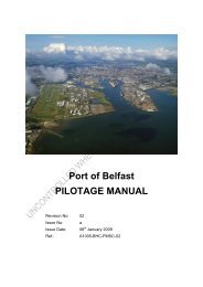
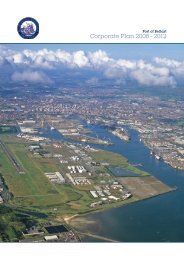
2. Introduction<br />
2.1 Background<br />
The Board of <strong>Harbour</strong> Commissioners of the Port of <strong>Belfast</strong> implemented a Port<br />
Control System in 1994. The Operations Centre is located at the Port Operations<br />
Building.<br />
Radar scanners are located at Black Head and Kinnegar, which together provide<br />
coverage of the navigable areas, docks and anchorages within <strong>Belfast</strong> <strong>Harbour</strong>‟s<br />
Area of Responsibility (<strong>Belfast</strong> AOR).<br />
There are closed circuit television (CCTV) cameras located at:<br />
<br />
<br />
<br />
Victoria Channel / River Lagan<br />
Victoria Channel (Turning Circle to Barnetts Dock)<br />
Musgrave Channel<br />
The <strong>Belfast</strong> AOR includes all waters within the <strong>Belfast</strong> Dock and extends to a line<br />
drawn between Grey Point and Carrickfergus Castle. A channel, dredged to 9.1<br />
metres extends from the Fairway Buoy to the entrance of <strong>Belfast</strong> Docks.<br />
Environmentally sensitive areas include:<br />
<br />
<br />
<br />
<br />
<br />
<br />
<strong>Belfast</strong> Lough Ramsar (Wetlands)<br />
<strong>Belfast</strong> Lough Special Protected Area<br />
Island Magee Area of Special Scientific Interest<br />
Blue Flag Beaches and Environmental Agency Bathing waters<br />
Earth Science Conservation Review Sites<br />
Country Park<br />
Date: 18.08.2008 Page: 2-1<br />
Doc: MSMS-<strong>VTS</strong> <strong>Manual</strong> 1.11.doc