Transportation Plan - Town of Garner
Transportation Plan - Town of Garner
Transportation Plan - Town of Garner
You also want an ePaper? Increase the reach of your titles
YUMPU automatically turns print PDFs into web optimized ePapers that Google loves.
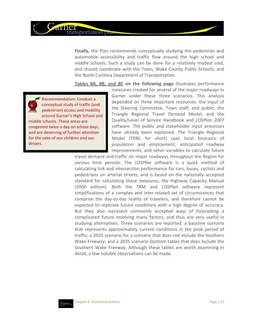
Recommendation: Conduct a<br />
conceptual study <strong>of</strong> traffic (and<br />
pedestrian) access and mobility<br />
around <strong>Garner</strong>’s High School and<br />
middle schools. These areas are<br />
congested twice a day on school days,<br />
and are deserving <strong>of</strong> further attention<br />
for the sake <strong>of</strong> our children and our<br />
drivers.<br />
Finally, the <strong>Plan</strong> recommends conceptually studying the pedestrian and<br />
automobile accessibility and traffic flow around the high school and<br />
middle schools. Such a study can be done for a relatively modest cost,<br />
and should coordinate with the <strong>Town</strong>, Wake County Public Schools, and<br />
the North Carolina Department <strong>of</strong> <strong>Transportation</strong>.<br />
Tables 8A, 8B, and 8C on the following page illustrates performance<br />
measures created for several <strong>of</strong> the major roadways in<br />
<strong>Garner</strong> under these three scenarios. This analysis<br />
depended on three important resources: the input <strong>of</strong><br />
the Steering Committee, <strong>Town</strong> staff, and public; the<br />
Triangle Regional Travel Demand Model; and the<br />
Quality/Level <strong>of</strong> Service Handbook and LOS<strong>Plan</strong> 2007<br />
s<strong>of</strong>tware. The public and stakeholder input processes<br />
have already been explained. The Triangle Regional<br />
Model (TRM, for short) uses local forecasts <strong>of</strong><br />
population and employment, anticipated roadway<br />
improvements, and other variables to calculate future<br />
travel demand and traffic on major roadways throughout the Region for<br />
various time periods. The LOS<strong>Plan</strong> s<strong>of</strong>tware is a quick method <strong>of</strong><br />
calculating link and intersection performance for cars, buses, cyclists and<br />
pedestrians on arterial streets, and is based on the nationally accepted<br />
standard for calculating these measures, the Highway Capacity Manual<br />
(2000 edition). Both the TRM and LOS<strong>Plan</strong> s<strong>of</strong>tware represent<br />
simplifications <strong>of</strong> a complex and inter‐related set <strong>of</strong> circumstances that<br />
comprise the day‐to‐day reality <strong>of</strong> travelers, and therefore cannot be<br />
expected to replicate future conditions with a high degree <strong>of</strong> accuracy.<br />
But they also represent commonly accepted ways <strong>of</strong> forecasting a<br />
complicated future involving many factors, and thus are very useful in<br />
studying alternatives. Three scenarios are reported: a baseline scenario<br />
that represents approximately current conditions in the peak period <strong>of</strong><br />
traffic; a 2035 scenario for a scenario that does not include the Southern<br />
Wake Freeway; and a 2035 scenario (bottom table) that does include the<br />
Southern Wake Freeway. Although these tables are worth examining in<br />
detail, a few notable observations can be made.<br />
Chapter 4: Recommendations Page | 57


