Allegheny River Headwaters Watershed Conservation Plan
Allegheny River Headwaters Watershed Conservation Plan
Allegheny River Headwaters Watershed Conservation Plan

You also want an ePaper? Increase the reach of your titles
YUMPU automatically turns print PDFs into web optimized ePapers that Google loves.
<strong>Allegheny</strong> <strong>River</strong> <strong>Headwaters</strong> <strong>Conservation</strong> <strong>Plan</strong><br />
Chapter 1. Project Area Characteristics<br />
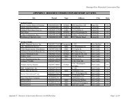
Figure 1-9. Methods of Transportation<br />
1990<br />
2000<br />
15%<br />
12%<br />
73%<br />
0%<br />
8%<br />
3%<br />
1%<br />
78%<br />
0%<br />
6%<br />
3%<br />
1%<br />
Drove<br />
Walked/Bicycled<br />
Other<br />
Carpooled<br />
Worked at Home<br />
Public Transportation<br />
Drove<br />
Walked/Bicycled<br />
Other<br />
Carpooled<br />
Worked at Home<br />
Public Transportation<br />
Methods of Transportation<br />
The most popular method of transportation among residents is the automobile. Within the project<br />
area, 78 percent of the employed population drives to work. Approximately 12 percent carpool, six<br />
percent walk or bicycle to work, and three percent work from home, leaving less than one percent that<br />
utilize public transportation. Figure 1-9 compares transportation methods used in 1990 to those used in<br />
2000.<br />
Public transportation services are provided throughout the area by the Area Transportation Authority<br />
of North Central Pennsylvania (ATA), which provides limited fixed routes and/or call-a-bus service.<br />
More information on ATA routes and services can be found on their website: www.rideata.net. Fullington<br />
Trailways (FT) also offers one daily round-trip service between Pittsburgh, PA and Buffalo, NY via<br />
Route 219. More information on FT can be found at: www.fullingtontours.com.<br />
Roadways that crisscross the region are categorized as principal arterial, minor arterial, collector, or<br />
local roads. There are no interstates or freeways located within the project area.<br />
Principal arterial roadways retain a high degree of thru-traffic mobility and serve major centers of<br />
urban facilitation and traffic generation. They provide high speed, high volume networks between major<br />
urban centers. U.S. Route 219 and U.S. Route 6 are the only principal arteries traversing the region.<br />
U.S. Route 219 is a spur of Route 19 traversing south from West Seneca, New York to Rich<br />
Creek, Virginia crossing through Pennsylvania, Maryland, and West Virginia. Within the project<br />
area, U.S. Route 219 skirts the western portion of the watershed following Tunungwant Creek from<br />
the New York State line through Bradford and Lewis Run.<br />
U.S. Route 6 was designated as a Pennsylvania Heritage Corridor in January 2005 by DCNR<br />
under the Heritage Areas Program. Route 6 crosses through 11 counties in northern Pennsylvania. It<br />
begins in Pike County, and travels west to the project area. It passes through the project area<br />
boroughs of Coudersport, Roulette, Port Allegany, Smethport, and Mount Jewett within McKean and<br />
1-15