Allegheny River Headwaters Watershed Conservation Plan
Allegheny River Headwaters Watershed Conservation Plan
Allegheny River Headwaters Watershed Conservation Plan

You also want an ePaper? Increase the reach of your titles
YUMPU automatically turns print PDFs into web optimized ePapers that Google loves.
<strong>Allegheny</strong> <strong>River</strong> <strong>Headwaters</strong> <strong>Conservation</strong> <strong>Plan</strong><br />
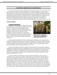
Chapter 2. Land Resources<br />
prominent ridge former. Most of the soils are frigid Inceptisols, derived from acidic glacial drift that are<br />
stony, acidic, low in fertility, and often steep (Woods et al., 1999).<br />
The natural vegetation throughout the ecoregion is primarily northern hardwood tree species, such as<br />
sugar maple, yellow birch, beech and hemlock with some intermixed bogs, swamps, and marshes.<br />
Appalachian Oak Forests, primarily containing white and red oaks, also occur. The soils, climate, and<br />
ruggedness make the area well suited to trees and poorly suited for agriculture (Woods et al., 1999).<br />
Rock Types<br />
Within the <strong>Allegheny</strong> <strong>River</strong> headwaters region, there are five formations of rocks—Rock Units 7, 13,<br />
14, 15, and 17. Unit 13 comprises shale and siltstone along major waterways, such as the <strong>Allegheny</strong><br />
<strong>River</strong>, Oswayo Creek, and Tunungwant Creek. Adjacent to it is Unit 7, which contains red sedimentary<br />
rocks, such as sandstone, siltstone, shale, and conglomerate. The only exception is along Tunungwant<br />
Creek, where Unit 15—comprised of shale or siltstone with minor amounts of sandstone—splits Unit 7<br />
and Unit 13. Unit 14—comprised of sandstone with minor amounts of shale and siltstone—is adjacent to<br />
Unit 7. Within the watershed, Unit 17 is the least common rock formation, and occurs furthest away from<br />
the tributaries. It occurs in patches that are surrounded by Rock Unit 14. Rock Unit 17 is composed of<br />
mixed sandstone and conglomerate with coal, shale, and siltstone (Berg, Sevon, & Abel, 1984).<br />
Stratification<br />
Sedimentary rocks cover 75 percent of the earth’s surface. They form from weathered, eroded rocks<br />
or dissolved materials that precipitate out of solution. The sequence, or layering, of sedimentary rocks is<br />
known as stratification. The changes in the sequence reflect changing conditions during deposition.<br />
Pennsylvanian-aged rocks are the youngest in the project area, and they underlie the highest<br />
elevations in the southern and western portions of McKean County. Belonging to the <strong>Allegheny</strong> and<br />
Pottsville groups, they contain a primarily cyclic sequence of shale, siltstone, and sandstone, forming<br />
soils within the Cookport-Hazleton association. Some coal is also found within the <strong>Allegheny</strong> formation<br />
(Churchill, 1987).<br />
Within the project area, the second-oldest rock is from the Mississippian age. Belonging to the<br />
Shenango and Oswayo formations, these rocks are cyclic sequences of shale, siltstone, and sandstone<br />
located primarily on valley sides (Churchill, 1987).<br />
The oldest rocks within the project area are from the Devonian age and include the Catskill,<br />
Venango, and Chadakoin formations. Rocks in the Catskill formation consist of red siltstone, shale, and<br />
sandstone found in the Buchanan-Hartleton-Leck Kill soil association. The Venango formation is<br />
comprised of gray siltstone, shale, and sandstone with some red shale from the Catskill formation. The<br />
Chadakoin formation consists of gray siltstone, sandstone, and shale. Soils in the Buchanan-Albrights soil<br />
association contain rocks from the Venango and Chadakoin formations.<br />
Soil Characteristics<br />
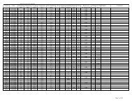
Soil Associations<br />
Soil associations are landscapes with a distinctive pattern of soils. Typically, they contain one or two<br />
major soil types and a few minor types. They are named for the major soil types in the association.<br />
Different associations may have the same soils, but they appear in different patterns or percentages. The<br />
most dominant soil in each association is identified first. Figure 2-3 displays the 13 soil associations<br />
located within the project area.<br />
2-3