Allegheny River Headwaters Watershed Conservation Plan
Allegheny River Headwaters Watershed Conservation Plan
Allegheny River Headwaters Watershed Conservation Plan

Create successful ePaper yourself
Turn your PDF publications into a flip-book with our unique Google optimized e-Paper software.
<strong>Allegheny</strong> <strong>River</strong> <strong>Headwaters</strong> <strong>Conservation</strong> <strong>Plan</strong><br />
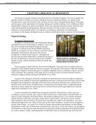
Chapter 2. Land Resources<br />
disturbance of earth materials is regulated by DEP through the Erosion and Sediment Pollution Control<br />
Program, administered by county conservation districts. Any earth moving activities, such as timber<br />
harvesting, construction activities, agricultural plowing and tilling, etc., over 5,000 square feet must have<br />
an erosion and sedimentation (E&S) control plan on site. Disturbances of less than 5,000 square feet are<br />
required to minimize the potential for accelerated erosion and sedimentation through the implementation<br />
and maintenance of best management practices (BMPs). Contact your county conservation district for<br />
more information regarding E&S concerns (Pennsylvania Code, 2000).<br />
Groundwater Recharge Areas<br />
Recharge areas occur where precipitation is capable of infiltrating the ground to the saturated zone—<br />
an area where all pore spaces and fractures are filled with water. Parking lots, sidewalks, roofs, and streets<br />
are examples of impervious surfaces that block water infiltration and suppress groundwater recharge.<br />
When a watershed is covered by 10–25 percent impervious cover, it is deemed impacted. <strong>Watershed</strong>s are<br />
considered damaged if 25 percent or more consists of impervious surfaces (Center for <strong>Watershed</strong><br />
Protection, 1999).<br />
Impervious surfaces increase the volume of stormwater by 16 percent when compared to natural<br />
forest habitats, impacting dry and wet weather stream flows, the shape and size of a stream channel, water<br />
quality, and habitats for plants and animals. The increased volume of stormwater leads to frequent<br />
flooding and increased severity of flood events. Due to the higher volume of stormwater, the velocity of<br />
the flow increases and leads to eroded streambanks, which deepens, widens, and straightens the stream’s<br />
channel. Sediment that is washed into the stream is carried and deposited downstream, smothering<br />
habitat, decreasing the depth of the stream, and ultimately changing the path of the waterway (Center for<br />
<strong>Watershed</strong> Protection, 1999).<br />
As the amount of impervious surface of a watershed increases, the quantity and diversity of aquatic<br />
life decreases. Limiting the amount of impervious surfaces and installing best management practices, such<br />
as porous pavement, rain barrels, and swales, can increase groundwater recharge. It is important to protect<br />
open spaces and limit the amount of impervious surfaces to allow water to infiltrate the ground to<br />
recharge groundwater. During dry conditions and droughts, the amount of water in streams, lakes, and<br />
ponds is supplied by groundwater. If groundwater supplies are insufficient due to impervious surfaces, the<br />
impacts of dry conditions will be intensified (Center for <strong>Watershed</strong> Protection, 1999).<br />
Fish and Wildlife Habitat<br />
Habitats are the natural environments upon which animals and plants depend. Healthy habitats are<br />
important to maintaining a diversity of biological resources. Interferences and changes to habitats affect<br />
the plants and animals that depend on them. Habitats where rare, threatened, and endangered species<br />
reside are critical. Important habitats in the watershed include forested and riparian areas, floodplains, and<br />
wetlands.<br />
Riparian Corridors<br />
Riparian corridors are lands located next to a body of water. When densely vegetated, they serve as a<br />
buffer against polluted runoff and provide habitat corridors for many species of wildlife. The Water and<br />
Biological Resources chapters of this plan provide specific information about riparian corridors and their<br />
benefits.<br />
Floodplains<br />
Floodplains are land areas that lie adjacent to waterbodies, such as the <strong>Allegheny</strong> <strong>River</strong> and its<br />
tributaries, which absorb the occasional overflow of water beyond the banks of the stream. Floodplains<br />
are delineated by the frequency of flooding events that cover them with water. Floodplains often contain<br />
rich sediments, as occasional flooding deposits nutrient rich soils from floodwaters. Floodplains are also<br />
2-16