Allegheny River Headwaters Watershed Conservation Plan
Allegheny River Headwaters Watershed Conservation Plan
Allegheny River Headwaters Watershed Conservation Plan

You also want an ePaper? Increase the reach of your titles
YUMPU automatically turns print PDFs into web optimized ePapers that Google loves.
<strong>Allegheny</strong> <strong>River</strong> <strong>Headwaters</strong> <strong>Conservation</strong> <strong>Plan</strong><br />
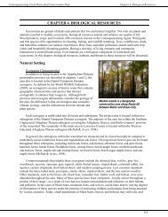
Chapter 3. Water Resources<br />
Cold Water Fishery (HQ-CWF). The tributaries that join <strong>Allegheny</strong> Portage Creek are CWF, except for<br />
Brown Hollow and Fair Run, which are HQ-CWF.<br />
Potato Creek<br />
Potato Creek starts in southern McKean County in<br />
Norwich Township, and flows in a northern direction<br />
through Smethport to Coryville, where it joins the<br />
<strong>Allegheny</strong> <strong>River</strong>. The mainstem of Potato Creek is a TSF<br />
from its source to Cole Creek. From Cole Creek to the<br />
mouth, it is designated as a Warm Water Fishery (WWF).<br />
The tributaries that join Potato Creek vary between CWF<br />
and HQ-CWF except for the South Branch of Cole Creek,<br />
which is designated as an Exceptional Value (EV)<br />
waterway. Table 3-1 identifies the HQ-CWF streams within<br />
the Potato Creek subwatershed.<br />
Oswayo Creek<br />
Oswayo Creek starts in Genesee Township, and flows<br />
in a western direction through Oswayo Borough and<br />
Shinglehouse Borough, and joins the <strong>Allegheny</strong> <strong>River</strong> south<br />
of Portville, New York. Oswayo Creek is designated as a<br />
CWF, except for the segment from Brizzee Hollow to Clara<br />
Creek, which is designated as a HQ-CWF. The tributaries that join Oswayo Creek vary between CWF and<br />
HQ-CWF, except for South Branch Oswayo Creek, which is designated as an EV waterway. There are<br />
seven waterways within the Oswayo Creek subwatershed that have been designated as HQ-CWF; they<br />
include Brizzee Hollow, Bradley Run, Elevenmile Creek, Cow Run, Butter Creek, Janders Run, and<br />
Taylor Brook.<br />
Tunungwant Creek<br />
Tunungwant Creek begins in Bradford, where the east and west branches join to form the mainstem,<br />
which flows in a northern direction and joins the <strong>Allegheny</strong> <strong>River</strong> near <strong>River</strong>side Junction, New York.<br />
The mainstem is designated as a WWF, as is the Kendall Creek tributary. The tributaries that join<br />
Tunungwant Creek vary between CWF and HQ-CWF, except for Railroad Run and Minard Run, which<br />
are designated as EV waterways. The HQ-CWF waterways that flow into Tunungwant Creek include East<br />
Branch Tunungwant Creek—from source to<br />
State Route 4002 bridge, West Branch<br />
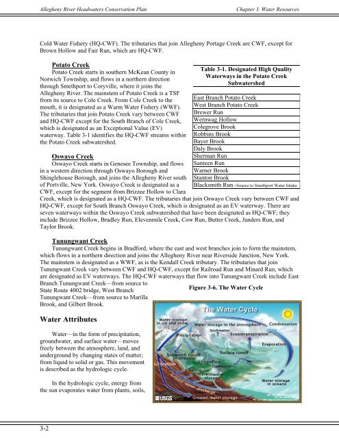
Figure 3-6. The Water Cycle<br />
Tunungwant Creek—from source to Marilla<br />
Brook, and Gilbert Brook.<br />
Water Attributes<br />
Water—in the form of precipitation,<br />
groundwater, and surface water—moves<br />
freely between the atmosphere, land, and<br />
underground by changing states of matter;<br />
from liquid to solid or gas. This movement<br />
is described as the hydrologic cycle.<br />
In the hydrologic cycle, energy from<br />
the sun evaporates water from plants, soils,<br />
Table 3-1. Designated High Quality<br />
Waterways in the Potato Creek<br />
Subwatershed<br />
East Branch Potato Creek<br />
West Branch Potato Creek<br />
Brewer Run<br />
Wernwag Hollow<br />
Colegrove Brook<br />
Robbins Brook<br />
Bayer Brook<br />
Daly Brook<br />
Sherman Run<br />
Santeen Run<br />
Warner Brook<br />
Stanton Brook<br />
Blacksmith Run -Source to Smethport Water Intake<br />
3-2