4.8.1 Getting started - WindSim
4.8.1 Getting started - WindSim
4.8.1 Getting started - WindSim

Create successful ePaper yourself
Turn your PDF publications into a flip-book with our unique Google optimized e-Paper software.
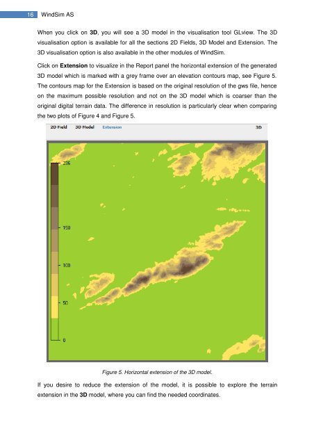
16 <strong>WindSim</strong> ASWhen you click on 3D, you will see a 3D model in the visualisation tool GLview. The 3Dvisualisation option is available for all the sections 2D Fields, 3D Model and Extension. The3D visualisation option is also available in the other modules of <strong>WindSim</strong>.Click on Extension to visualize in the Report panel the horizontal extension of the generated3D model which is marked with a grey frame over an elevation contours map, see Figure 5.The contours map for the Extension is based on the original resolution of the gws file, henceon the maximum possible resolution and not on the 3D model which is coarser than theoriginal digital terrain data. The difference in resolution is particularly clear when comparingthe two plots of Figure 4 and Figure 5.Figure 5. Horizontal extension of the 3D model.If you desire to reduce the extension of the model, it is possible to explore the terrainextension in the 3D model, where you can find the needed coordinates.