Proceedings of the Workshop - United Nations Office for Outer ...
Proceedings of the Workshop - United Nations Office for Outer ...
Proceedings of the Workshop - United Nations Office for Outer ...
- No tags were found...
Create successful ePaper yourself
Turn your PDF publications into a flip-book with our unique Google optimized e-Paper software.
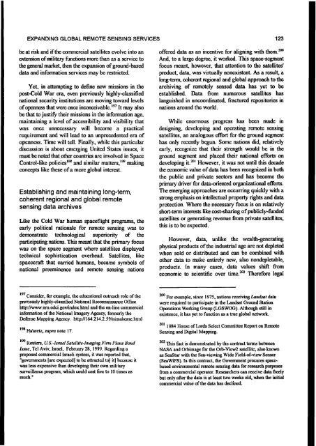
EXPANDING GLOBAL REMOTE SENSING SERVICES 123be at risk and if <strong>the</strong> commercial satellites evolve into anextension <strong>of</strong> military functions more than as a service to<strong>the</strong> general market, <strong>the</strong>n <strong>the</strong> expansion <strong>of</strong> ground-baseddata and in<strong>for</strong>mation services may be restricted.Yet, in attempting to define new missions in <strong>the</strong>post-Cold War era, even previously highly-classifiednational security institutions are moving toward levels<strong>of</strong> openness that were once inconceivable.197 It may alsobe that to justify <strong>the</strong>ir missions in <strong>the</strong> in<strong>for</strong>mation age,maintaining a level <strong>of</strong> accessibility and visibility thatwas once unnecessary will become a practicalrequirement and will lead to an unprecedented era <strong>of</strong>openness. Time will tell. Finally, while this particulardiscussion is about emerging <strong>United</strong> States issues, itmust be noted that o<strong>the</strong>r countries are involved in SpaceControl-like policies198 and similar matters,199 makingconcepts like <strong>the</strong>se <strong>of</strong> a more global interest.Establishing and maintaining long-term,coherent regional and global remotesensing data archivesLike <strong>the</strong> Cold War human spaceflight programs, <strong>the</strong>early political rationale <strong>for</strong> remote sensing was todemonstrate technological superiority <strong>of</strong> <strong>the</strong>participating nations. This meant that <strong>the</strong> primary focuswas on <strong>the</strong> space segment where satellites displayedtechnical sophistication overhead. Satellites, likespacecraft that carried humans, became symbols <strong>of</strong>national preeminence and remote sensing nations<strong>of</strong>fered data as an incentive <strong>for</strong> aligning with <strong>the</strong>m.200And, to a large degree, it worked. This space-segmentfocus meant, however, that attention to <strong>the</strong> satellites'product, data, was virtually nonexistent. As a result, along-term, coherent regional and global approach to <strong>the</strong>archiving <strong>of</strong> remotely sensed data has yet to beestablished. Data from numerous satellites haslanguished in uncoordinated, fractured repositories innations around <strong>the</strong> world.While enormous progress has been made indesigning, developing and operating remote sensingsatellites, an analogous ef<strong>for</strong>t <strong>for</strong> <strong>the</strong> ground segmenthas only recently begun. Some nations did, relativelyearly, recognize that <strong>the</strong>ir strength would be in <strong>the</strong>ground segment and placed <strong>the</strong>ir national ef<strong>for</strong>ts ondeveloping it.201 However, it was not until this decade<strong>the</strong> economic value <strong>of</strong> data has been recognized in both<strong>the</strong> public and private sectors and has become <strong>the</strong>primary driver <strong>for</strong> data-oriented organizational ef<strong>for</strong>ts.The emerging approaches are occurring quickly with astrong emphasis on intellectual property rights and dataprotection. Where <strong>the</strong> necessary focus is on relativelyshort-term interests like cost-sharing <strong>of</strong> publicly-fundedsatellites or generating revenue from private satellites,this is to be expected.However, data, unlike <strong>the</strong> wealth-generatingphysical products <strong>of</strong> <strong>the</strong> industrial age are not depletedwhen sold or distributed and can be combined witho<strong>the</strong>r data to make entirely new, also nondepletable,products. In many cases, data values shift fromeconomic to scientific over time.202 There<strong>for</strong>e legal197 Consider, <strong>for</strong> example, <strong>the</strong> educational outreach role <strong>of</strong> <strong>the</strong>previously highly-classified National Reconnaissance <strong>Office</strong>http://www.nro.odci.gov/index.html and <strong>the</strong> on-line commercialin<strong>for</strong>mation <strong>of</strong> <strong>the</strong> National Imagery Agency, <strong>for</strong>merly <strong>the</strong>Defense Mapping Agency. http./ / 164.214.2.59/nimahome.html198 Ha'aretz, supra note 17.199 Reuters, U.S.-Israel Satellite-Imaging Firm Plans BondIssue, Tel Aviv, Israel, February 28, 1999. Regarding aproposed commercial Israeli system, it was reported that,"governments [are expected] to be attracted to[ it] because itwas less expensive than developing <strong>the</strong>ir own militarysurveillance program, which could cost five to 10 times asmuch."200 For example, since 1975, nations receiving Landsat datawere required to participate in <strong>the</strong> Landsat Ground StationOperations Working Group (LGSWOG). Although still inexistence, it has yet to function as a true global network.201 1984 House <strong>of</strong> Lords Select Committee Report on RemoteSensing and Digital Mapping.202 This fact is demonstrated by <strong>the</strong> contract terms betweenNASA and Orbimage <strong>for</strong> <strong>the</strong> Orb-View2 satellite, also knownas SeaStar with <strong>the</strong> Sea-viewing Wide Field-<strong>of</strong>-view Sensor(SeaWiFS). In this contract, <strong>the</strong> Government procures spacebasedenvironmental remote sensing data <strong>for</strong> research purposesfrom a commercial operator. Researchers can receive data freelybut only after <strong>the</strong> data is at least two weeks old, when <strong>the</strong> initialcommercial value <strong>of</strong> <strong>the</strong> data has declined.


